01
MethodologyHow they did it
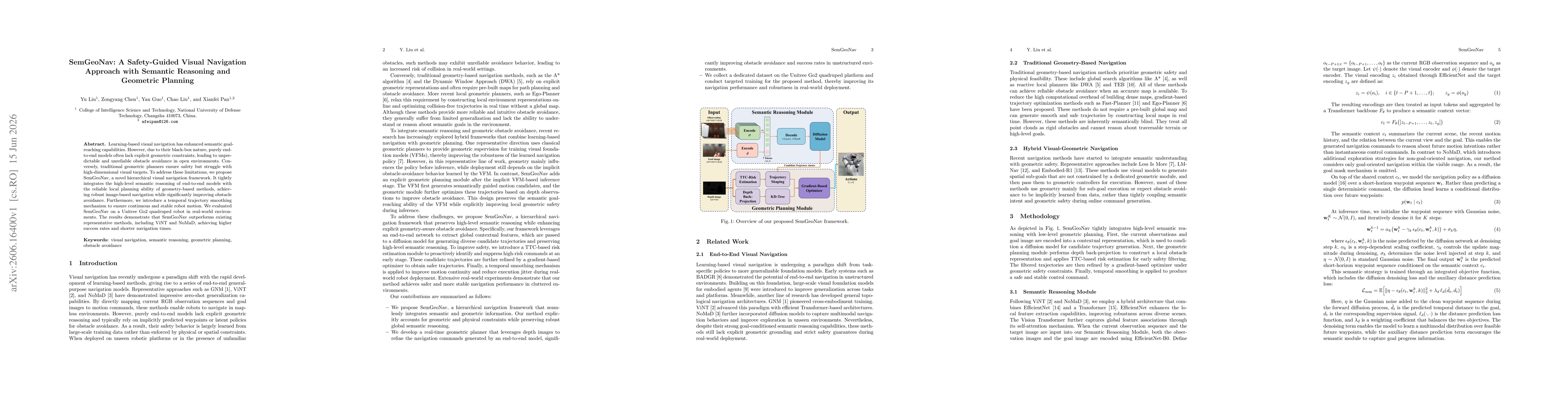
SemGeoNav presents a hierarchical navigation framework that fuses end-to-end semantic reasoning with a real-time geometric planner. It uses an end-to-end network to extract global contextual features and generate diverse candidate trajectories via a diffusion model, followed by a TTC-based risk estimation to suppress high-risk commands, and a gradient-based optimizer to refine trajectories, ending with temporal smoothing for motion continuity. A real-time geometric planner refines depth-based observations to ensure obstacle avoidance, enabling explicit geometric constraints while preserving semantic goal guidance.
Discussion 0