01
MethodologyHow they did it
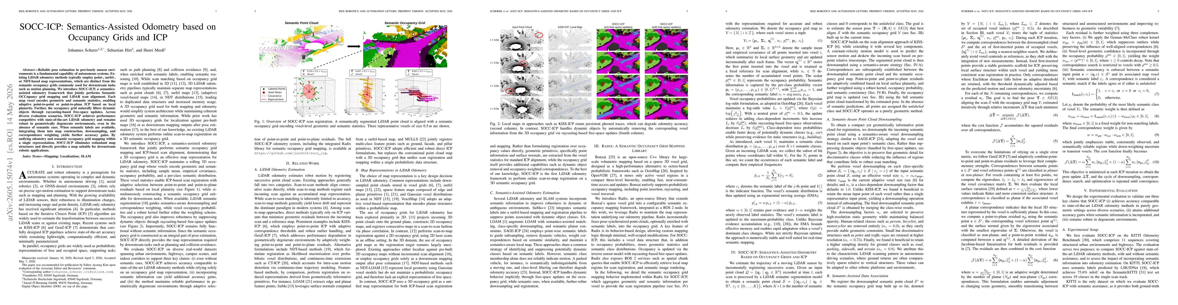
SOCC-ICP jointly performs Semantic Occupancy Grid mapping and LiDAR scan registration by maintaining a 3D occupancy grid where each voxel stores geometric and semantic statistics (mean, covariance, occupancy probability, and per-class semantic distribution). It adaptively selects between point-to-point and point-to-plane ICP residuals based on local planarity, uses semantic labels to guide downsampling and correspondence weighting, and employs raycasting-based free-space updates to filter dynamic objects, all within a single probabilistic voxel grid map actionable for downstream tasks.
Discussion 0