Publication
Metrics
AI Quick Summary
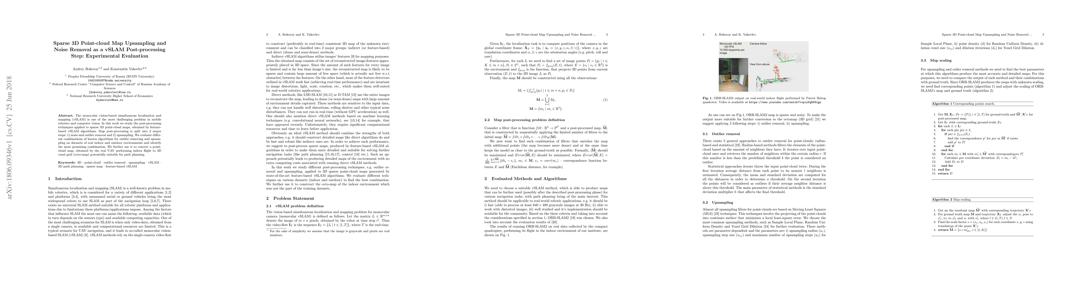
This paper investigates post-processing techniques for sparse 3D point-cloud maps from monocular vSLAM, focusing on noise and outlier removal followed by upsampling. The study evaluates various combinations of algorithms on real datasets and identifies the most effective method for converting UAV-generated maps into 3D voxel grids for path planning.
Paper Preview
Abstract
The monocular vision-based simultaneous localization and mapping (vSLAM) is one of the most challenging problem in mobile robotics and computer vision. In this work we study the post-processing techniques applied to sparse 3D point-cloud maps, obtained by feature-based vSLAM algorithms. Map post-processing is split into 2 major steps: 1) noise and outlier removal and 2) upsampling. We evaluate different combinations of known algorithms for outlier removing and upsampling on datasets of real indoor and outdoor environments and identify the most promising combination. We further use it to convert a point-cloud map, obtained by the real UAV performing indoor flight to 3D voxel grid (octo-map) potentially suitable for path planning.
AI Key Findings
Get AI-generated insights about this paper's methodology, results, significance, and more — seven facets brought into focus.
Impact
Paper Details
PDF Preview
Key Terms
Citation Network
Current paper (gray), citations (green), references (blue)
Display is limited for performance on very large graphs.
Discussion 0