Spatial-Temporal Extreme Modeling for Point-to-Area Random Effects (PARE)
Publication
Metrics
AI Quick Summary
The paper proposes a spatial-temporal extreme modeling approach called Point-to-Area Random Effects (PARE) to understand extreme rainfall and flooding at larger spatial scales. It highlights the importance of converting point-location rainfall data to inform community-level flood risk modeling and policy changes.
Paper Preview
Abstract
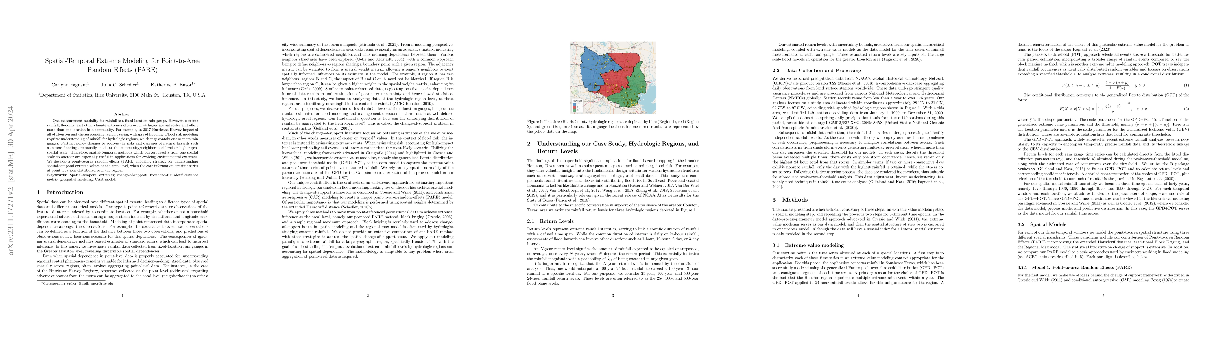
One measurement modality for rainfall is a fixed location rain gauge. However, extreme rainfall, flooding, and other climate extremes often occur at larger spatial scales and affect more than one location in a community. For example, in 2017 Hurricane Harvey impacted all of Houston and the surrounding region causing widespread flooding. Flood risk modeling requires understanding of rainfall for hydrologic regions, which may contain one or more rain gauges. Further, policy changes to address the risks and damages of natural hazards such as severe flooding are usually made at the community/neighborhood level or higher geo-spatial scale. Therefore, spatial-temporal methods which convert results from one spatial scale to another are especially useful in applications for evolving environmental extremes. We develop a point-to-area random effects (PARE) modeling strategy for understanding spatial-temporal extreme values at the areal level, when the core information are time series at point locations distributed over the region.
AI Key Findings
Get AI-generated insights about this paper's methodology, results, significance, and more — seven facets brought into focus.
Impact
Paper Details
Authors
PDF Preview
Key Terms
Citation Network
Current paper (gray), citations (green), references (blue)
Display is limited for performance on very large graphs.
Discussion 0