01
MethodologyHow they did it
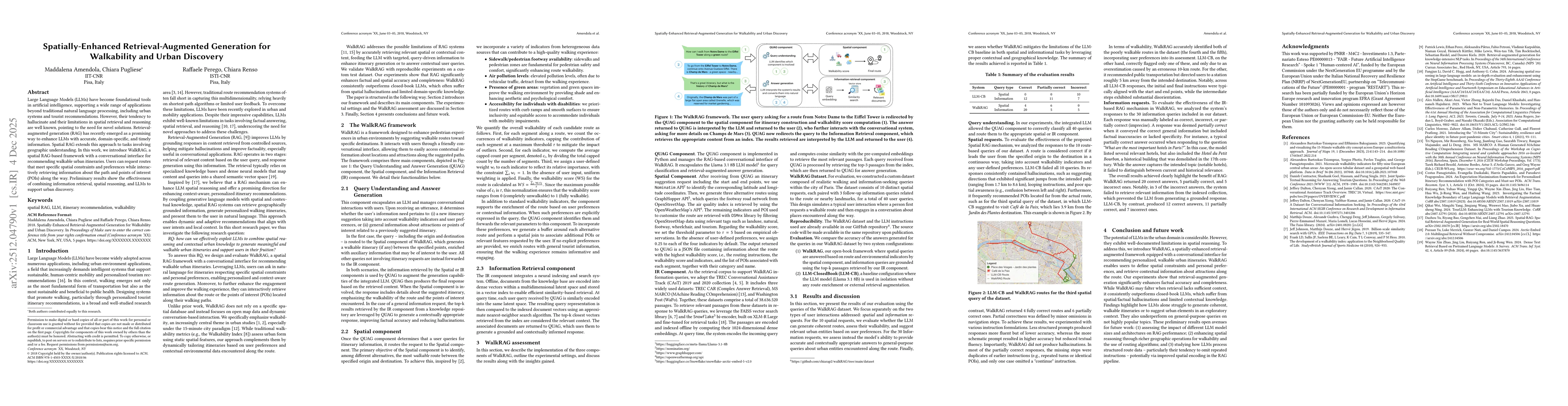
The paper introduces WalkRAG, a spatially-enhanced retrieval-augmented generation (RAG) framework that combines information retrieval, spatial reasoning, and large language models (LLMs) to recommend walkable urban itineraries. It uses a conversational interface to interact with users, integrating a query understanding and answer generation (QUAG) component, a spatial component for route planning with walkability indicators, and an information retrieval (IR) component for contextual information retrieval.
Discussion 0