Spatialyze: A Geospatial Video Analytics System with Spatial-Aware Optimizations
Publication
Metrics
AI Quick Summary
Spatialyze is a framework for querying geospatial videos, enabling users to construct workflows using a 3-step declarative language. It optimizes execution by leveraging metadata and real-world object behavior, achieving up to 5.3x faster performance with 97.1% accuracy.
Paper Preview
Abstract
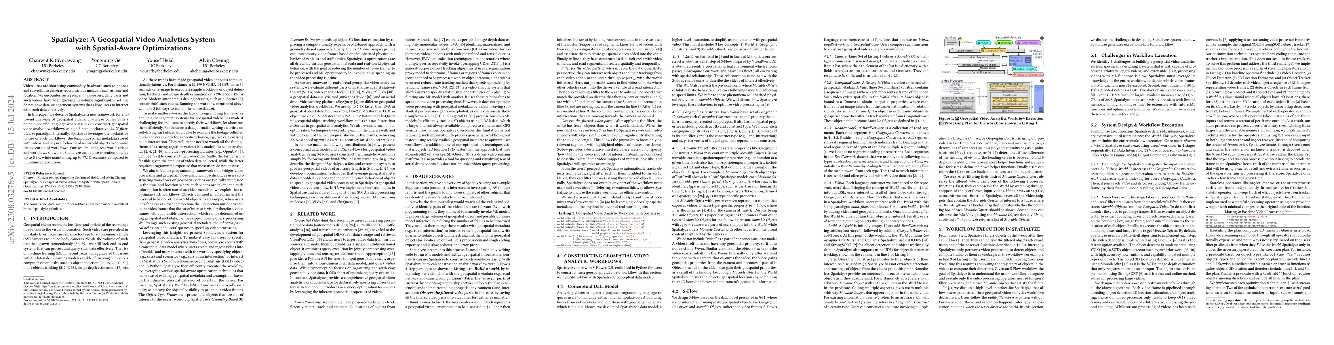
Videos that are shot using commodity hardware such as phones and surveillance cameras record various metadata such as time and location. We encounter such geospatial videos on a daily basis and such videos have been growing in volume significantly. Yet, we do not have data management systems that allow users to interact with such data effectively. In this paper, we describe Spatialyze, a new framework for end-to-end querying of geospatial videos. Spatialyze comes with a domain-specific language where users can construct geospatial video analytic workflows using a 3-step, declarative, build-filter-observe paradigm. Internally, Spatialyze leverages the declarative nature of such workflows, the temporal-spatial metadata stored with videos, and physical behavior of real-world objects to optimize the execution of workflows. Our results using real-world videos and workflows show that Spatialyze can reduce execution time by up to 5.3x, while maintaining up to 97.1% accuracy compared to unoptimized execution.
AI Key Findings
Get AI-generated insights about this paper's methodology, results, significance, and more — seven facets brought into focus.
Impact
Paper Details
Authors
PDF Preview
Key Terms
Citation Network
Current paper (gray), citations (green), references (blue)
Display is limited for performance on very large graphs.
Discussion 0