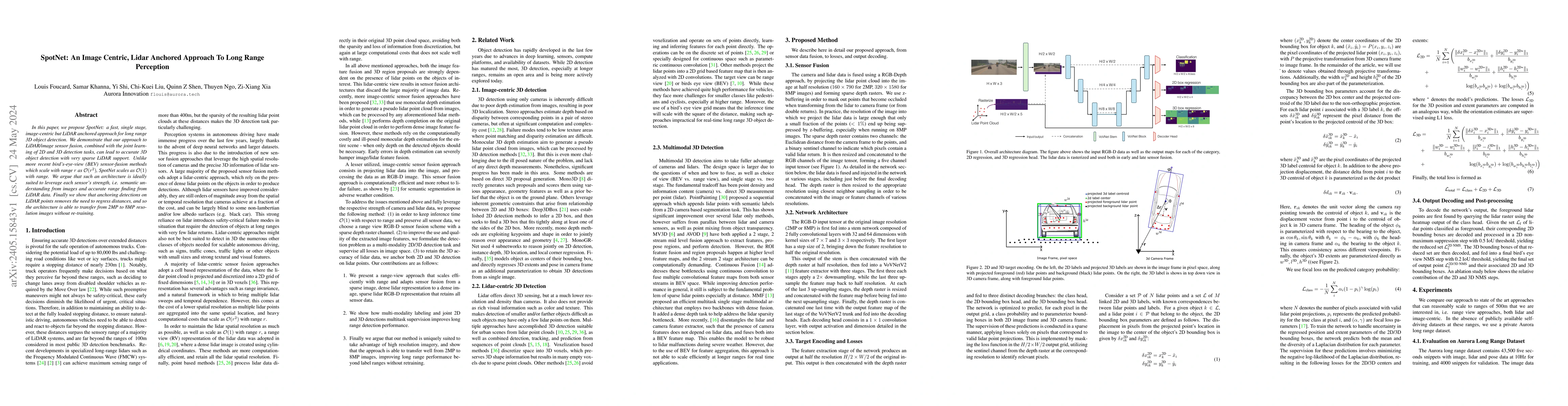
SpotNet: An Image Centric, Lidar Anchored Approach To Long Range Perception
Publication
Metrics
AI Quick Summary
SpotNet is a fast, single-stage method for long-range 3D object detection that fuses image and LiDAR data, scaling efficiently as $O(1)$ with range, leveraging image semantics and LiDAR accuracy without needing distance regression. It can transfer between different image resolutions without retraining.
Paper Preview
Abstract
In this paper, we propose SpotNet: a fast, single stage, image-centric but LiDAR anchored approach for long range 3D object detection. We demonstrate that our approach to LiDAR/image sensor fusion, combined with the joint learning of 2D and 3D detection tasks, can lead to accurate 3D object detection with very sparse LiDAR support. Unlike more recent bird's-eye-view (BEV) sensor-fusion methods which scale with range $r$ as $O(r^2)$, SpotNet scales as $O(1)$ with range. We argue that such an architecture is ideally suited to leverage each sensor's strength, i.e. semantic understanding from images and accurate range finding from LiDAR data. Finally we show that anchoring detections on LiDAR points removes the need to regress distances, and so the architecture is able to transfer from 2MP to 8MP resolution images without re-training.
AI Key Findings
Get AI-generated insights about this paper's methodology, results, significance, and more — seven facets brought into focus.
Impact
Paper Details
Authors
PDF Preview
Key Terms
Citation Network
Current paper (gray), citations (green), references (blue)
Display is limited for performance on very large graphs.
Discussion 0