Temporal and Spatial Elements in Interactive Epidemiological Maps
Publication
Metrics
AI Quick Summary
This paper explores the integration of temporal and spatial elements in interactive epidemiological maps, emphasizing their importance for disease surveillance, especially in remote regions. It highlights challenges in combining dynamic data sources with spatial visualization and proposes tools for distributed data collection, simulation, and analysis to enhance public health communication.
Paper Preview
Abstract
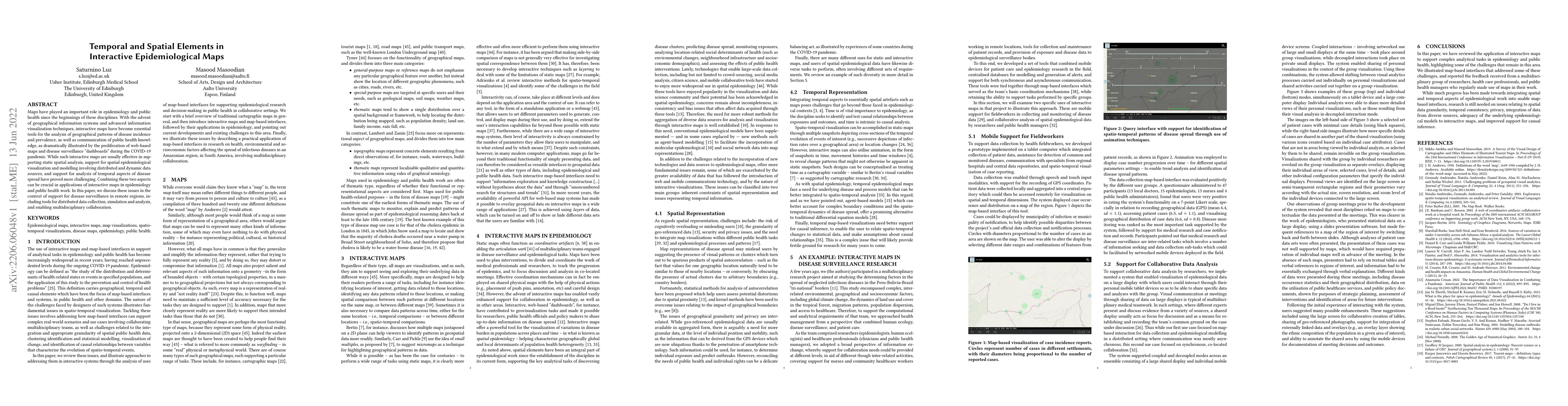
Maps have played an important role in epidemiology and public health since the beginnings of these disciplines. With the advent of geographical information systems and advanced information visualization techniques, interactive maps have become essential tools for the analysis of geographical patterns of disease incidence and prevalence, as well as communication of public health knowledge, as dramatically illustrated by the proliferation of web-based maps and disease surveillance ``dashboards'' during the COVID-19 pandemic. While such interactive maps are usually effective in supporting static spatial analysis, support for spatial epidemiological visualization and modelling involving distributed and dynamic data sources, and support for analysis of temporal aspects of disease spread have proved more challenging. Combining these two aspects can be crucial in applications of interactive maps in epidemiology and public health work. In this paper, we discuss these issues in the context of support for disease surveillance in remote regions, including tools for distributed data collection, simulation and analysis, and enabling multidisciplinary collaboration.
AI Key Findings
Get AI-generated insights about this paper's methodology, results, significance, and more — seven facets brought into focus.
Impact
Paper Details
Authors
PDF Preview
Key Terms
Citation Network
Current paper (gray), citations (green), references (blue)
Display is limited for performance on very large graphs.
Discussion 0