Terrain-Based UAV Deployment: Providing Coverage for Outdoor Users
Publication
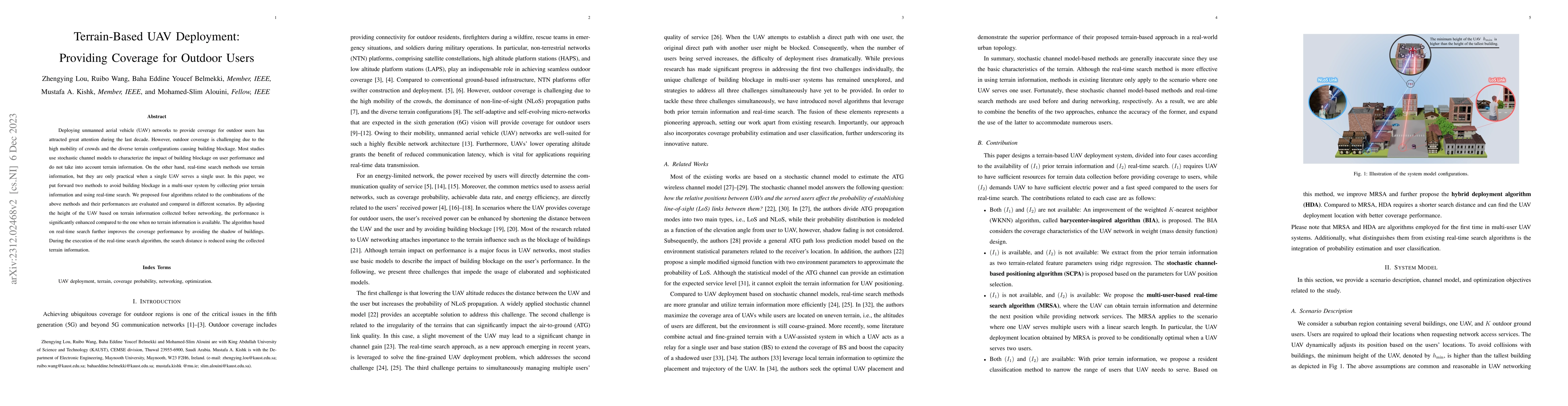
Metrics
AI Quick Summary
This paper proposes two methods to enhance UAV network coverage for outdoor users by integrating terrain information to avoid building blockage. The evaluated algorithms show significant performance improvements over traditional methods, especially when combining terrain-based height adjustment and real-time search to optimize UAV positioning.
Paper Preview
Abstract
Deploying unmanned aerial vehicle (UAV) networks to provide coverage for outdoor users has attracted great attention during the last decade. However, outdoor coverage is challenging due to the high mobility of crowds and the diverse terrain configurations causing building blockage. Most studies use stochastic channel models to characterize the impact of building blockage on user performance and do not take into account terrain information. On the other hand, real-time search methods use terrain information, but they are only practical when a single UAV serves a single user.In this paper, we put forward two methods to avoid building blockage in a multi-user system by collecting prior terrain information and using real-time search.We proposed four algorithms related to the combinations of the above methods and their performances are evaluated and compared in different scenarios.By adjusting the height of the UAV based on terrain information collected before networking, the performance is significantly enhanced compared to the one when no terrain information is available.The algorithm based on real-time search further improves the coverage performance by avoiding the shadow of buildings. During the execution of the real-time search algorithm, the search distance is reduced using the collected terrain information.
AI Key Findings — Failed
Key findings generation failed. Failed to start generation process
Impact
Paper Details
Authors
PDF Preview
Key Terms
Citation Network
Current paper (gray), citations (green), references (blue)
Display is limited for performance on very large graphs.
Discussion 0