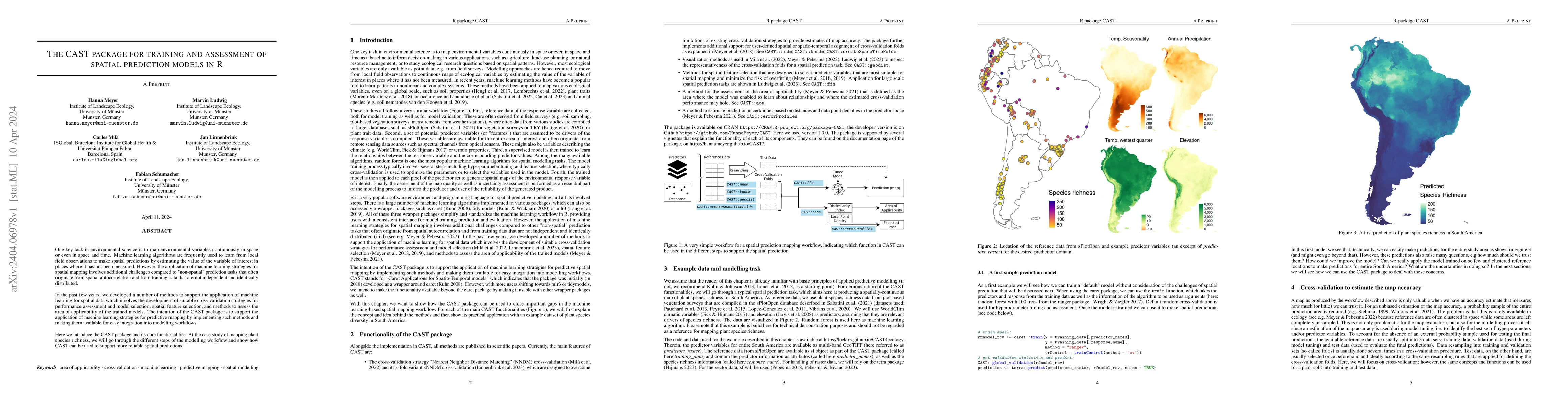
The CAST package for training and assessment of spatial prediction models in R
Publication
Metrics
AI Quick Summary
Summary: The CAST package in R facilitates the training and assessment of spatial prediction models using machine learning, addressing unique challenges like spatial autocorrelation. It provides methods for cross-validation, spatial feature selection, and applicability assessment, demonstrated through a case study on mapping plant species richness.
Paper Preview
Abstract
One key task in environmental science is to map environmental variables continuously in space or even in space and time. Machine learning algorithms are frequently used to learn from local field observations to make spatial predictions by estimating the value of the variable of interest in places where it has not been measured. However, the application of machine learning strategies for spatial mapping involves additional challenges compared to "non-spatial" prediction tasks that often originate from spatial autocorrelation and from training data that are not independent and identically distributed. In the past few years, we developed a number of methods to support the application of machine learning for spatial data which involves the development of suitable cross-validation strategies for performance assessment and model selection, spatial feature selection, and methods to assess the area of applicability of the trained models. The intention of the CAST package is to support the application of machine learning strategies for predictive mapping by implementing such methods and making them available for easy integration into modelling workflows. Here we introduce the CAST package and its core functionalities. At the case study of mapping plant species richness, we will go through the different steps of the modelling workflow and show how CAST can be used to support more reliable spatial predictions.
AI Key Findings
Get AI-generated insights about this paper's methodology, results, significance, and more — seven facets brought into focus.
Impact
Paper Details
Authors
PDF Preview
Key Terms
Citation Network
Current paper (gray), citations (green), references (blue)
Display is limited for performance on very large graphs.
Discussion 0