Publication
Metrics
AI Quick Summary
This paper introduces a novel coordinate system for spaceborne synthetic aperture radar (SAR) developed for the Seasat-A satellite's SAR ground processor. It details mathematical expressions for azimuth FM rate, isodoppler lines, and antenna attitude, and presents a method for transforming SAR images using these parameters, concluding with a report on the map accuracy of the resulting images.
Paper Preview
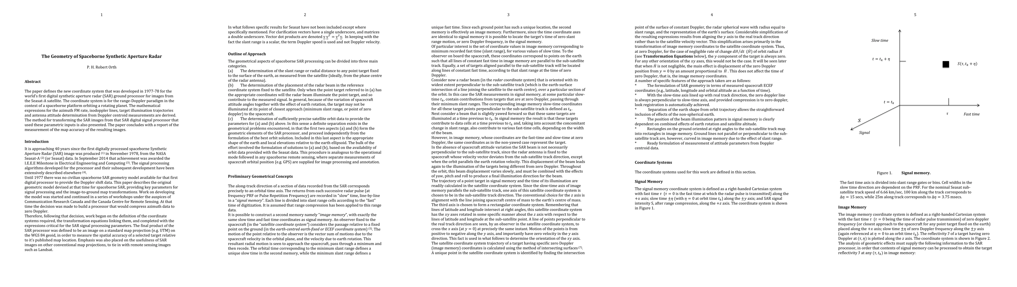
Abstract
The paper defines a new coordinate system that was developed in 1977-78 for the world's first digital synthetic aperture radar (SAR) ground processor for images from the Seasat-A satellite. The coordinate system is for the range-Doppler paradigm in the context of a spaceborne platform orbiting a rotating planet. The mathematical expressions for the azimuth FM rate, isodoppler lines, target illumination trajectories and antenna attitude determination from Doppler centroid measurements are derived. The method for transforming the SAR images from that SAR digital signal processor that used these parametric inputs is also presented. The paper concludes with a report of the measurement of the map accuracy of the resulting images.
AI Key Findings
Get AI-generated insights about this paper's methodology, results, significance, and more — seven facets brought into focus.
Impact
Paper Details
PDF Preview
Key Terms
Citation Network
Current paper (gray), citations (green), references (blue)
Display is limited for performance on very large graphs.
Discussion 0