Publication
Published:
Jun 03, 2011
Updated:
Jun 01, 2025
Categories:
physics.geo-ph
Metrics
Citations:
5
Source:
ArXiv
Paper Preview
Abstract
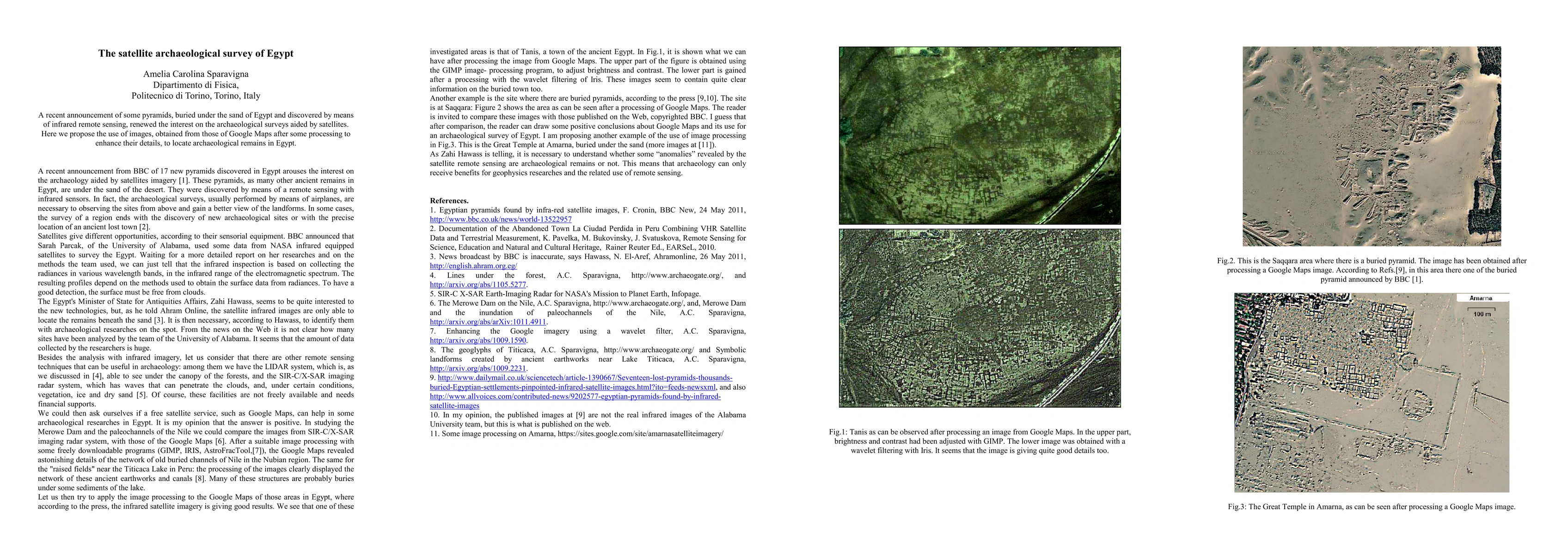
A recent announcement of some pyramids, buried under the sand of Egypt and discovered by means of infrared remote sensing, renewed the interest on the archaeological surveys aided by satellites. Here we propose the use of images, obtained from those of Google Maps after some processing to enhance their details, to locate archaeological remains in Egypt.
AI Key Findings
Get AI-generated insights about this paper's methodology, results, significance, and more — seven facets brought into focus.
Impact
5
Citations
5
References
Paper Details
Paper ID:
1105.6315
License:
http://arxiv.org/licenses/nonexclusive-distrib/1.0/
Comments:
Satellite, Google Maps, Archaeology, More references and images
Categories:
physics.geo-ph
PDF Preview
Key Terms
remote sensing
(0.330)
aided
(0.315)
remote
(0.283)
surveys
(0.280)
details
(0.257)
discovered
(0.255)
sensing
(0.253)
enhance
(0.245)
Citation Network
Current paper (gray), citations (green), references (blue)
Display is limited for performance on very large graphs.
Current Paper
Citations
References
Click to view
Discussion 0