The spatial scan statistic: A new method for spatial aggregation of categorical raster maps
Publication
Metrics
AI Quick Summary
This paper introduces the spatial scan statistic method for aggregating categorical raster maps, contrasting it with majority rule and nearest neighbor techniques. The spatial scan statistic preserves rare classes better than the majority rule, making it suitable for analyses where heterogeneity and rare information are crucial.
Paper Preview
Abstract
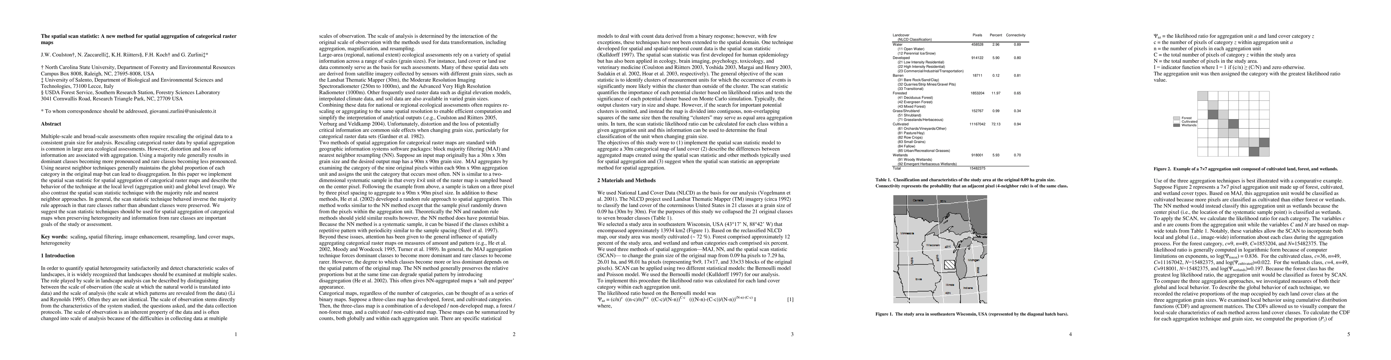
Multiple-scale and broad-scale assessments often require rescaling the original data to a consistent grain size for analysis. Rescaling categorical raster data by spatial aggregation is common in large area ecological assessments. However, distortion and loss of information are associated with aggregation. Using a majority rule generally results in dominant classes becoming more pronounced and rare classes becoming less pronounced. Using nearest neighbor techniques generally maintains the global proportion of each category in the original map but can lead to disaggregation. In this paper we implement the spatial scan statistic for spatial aggregation of categorical raster maps and describe the behavior of the technique at the local level (aggregation unit) and global level (map). We also contrast the spatial scan statistic technique with the majority rule and nearest neighbor approaches. In general, the scan statistic technique behaved inverse the majority rule approach in that rare classes rather than abundant classes were preserved. We suggest the scan statistic techniques should be used for spatial aggregation of categorical maps when preserving heterogeneity and information from rare classes are important goals of the study or assessment.
AI Key Findings
Get AI-generated insights about this paper's methodology, results, significance, and more — seven facets brought into focus.
Impact
Paper Details
PDF Preview
Key Terms
Citation Network
Current paper (gray), citations (green), references (blue)
Display is limited for performance on very large graphs.
Discussion 0