TopView: Vectorising road users in a bird's eye view from uncalibrated street-level imagery with deep learning
Publication
Metrics
AI Quick Summary
This paper presents a deep learning approach to vectorise road users in bird's eye view from uncalibrated street-level imagery, utilising the vanishing point for projection and 3D bounding information. The framework enables applications like navigation and social distancing analysis, showing high accuracy in geolocating users across various cameras.
Paper Preview
Abstract
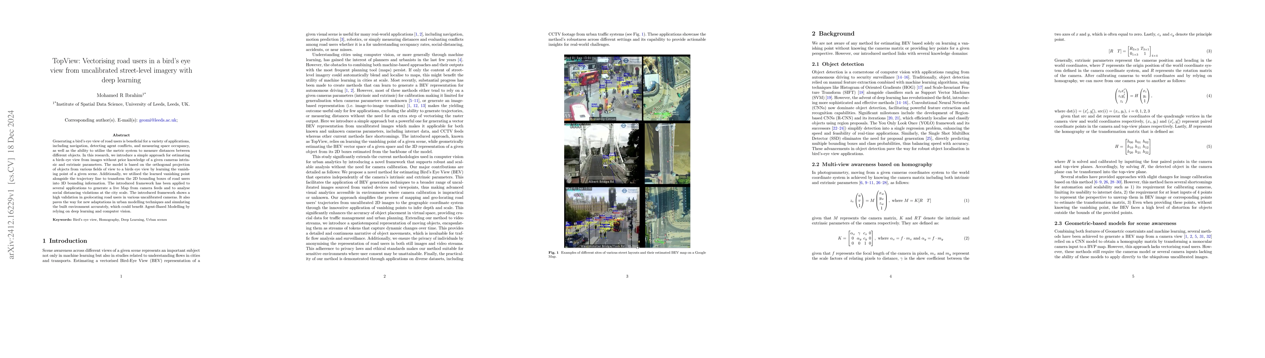
Generating a bird's eye view of road users is beneficial for a variety of applications, including navigation, detecting agent conflicts, and measuring space occupancy, as well as the ability to utilise the metric system to measure distances between different objects. In this research, we introduce a simple approach for estimating a bird's eye view from images without prior knowledge of a given camera's intrinsic and extrinsic parameters. The model is based on the orthogonal projection of objects from various fields of view to a bird's eye view by learning the vanishing point of a given scene. Additionally, we utilised the learned vanishing point alongside the trajectory line to transform the 2D bounding boxes of road users into 3D bounding information. The introduced framework has been applied to several applications to generate a live Map from camera feeds and to analyse social distancing violations at the city scale. The introduced framework shows a high validation in geolocating road users in various uncalibrated cameras. It also paves the way for new adaptations in urban modelling techniques and simulating the built environment accurately, which could benefit Agent-Based Modelling by relying on deep learning and computer vision.
AI Key Findings
Get AI-generated insights about this paper's methodology, results, significance, and more — seven facets brought into focus.
Impact
Authors
PDF Preview
Citation Network
Current paper (gray), citations (green), references (blue)
Display is limited for performance on very large graphs.
Discussion 0