01
MethodologyHow they did it
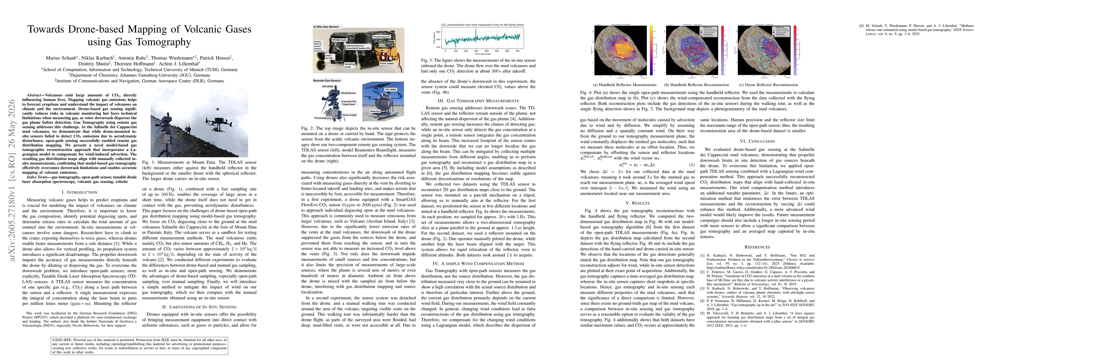
The study combines open-path Tunable Diode Laser Absorption Spectroscopy (TDLAS) sensing with a novel model-based gas tomography that incorporates a Lagrangian wind advection model to compensate for wind-induced plume movement. Measurements were collected using two setups: (i) a handheld reflector for ground-level slices and (ii) a reflector mounted on a drone to capture higher-altitude, multi-angle measurements. A simple wind compensation technique offsets the sensor and reflector positions by wind velocity over a chosen time step to reconstruct two-dimensional gas distribution maps via tomography.
Discussion 0