Towards Targeted Change Detection with Heterogeneous Remote Sensing Images for Forest Mortality Mapping
Publication
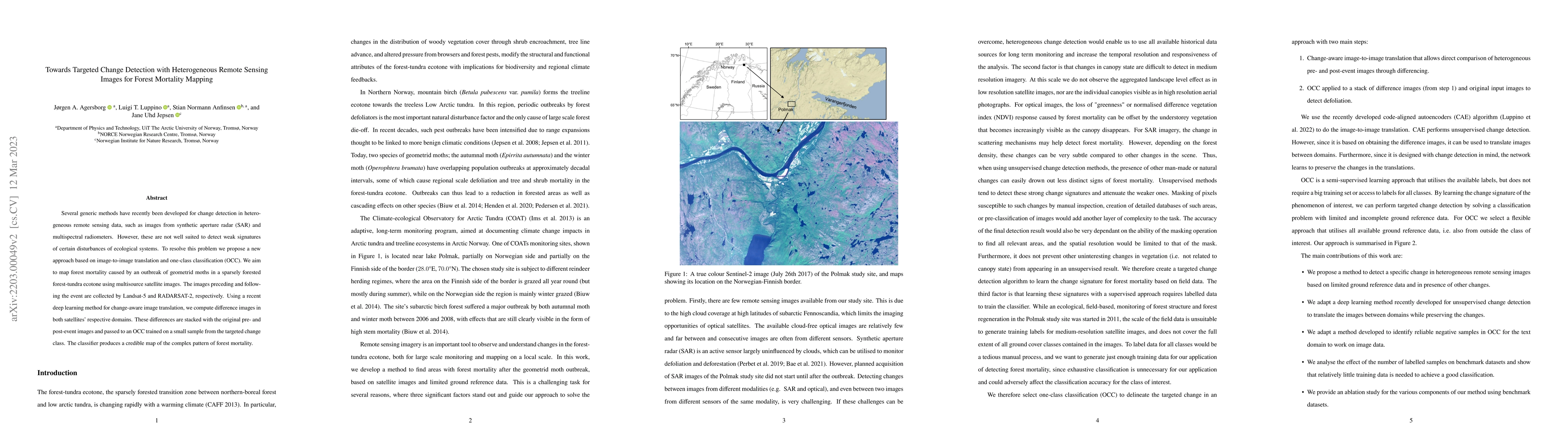
Metrics
AI Quick Summary
This paper proposes a new deep learning method combining image-to-image translation and one-class classification for detecting forest mortality in a forest-tundra ecotone using Landsat-5 and RADARSAT-2 images. The approach successfully maps the subtle changes caused by geometrid moth outbreaks.
Paper Preview
Abstract
Several generic methods have recently been developed for change detection in heterogeneous remote sensing data, such as images from synthetic aperture radar (SAR) and multispectral radiometers. However, these are not well suited to detect weak signatures of certain disturbances of ecological systems. To resolve this problem we propose a new approach based on image-to-image translation and one-class classification (OCC). We aim to map forest mortality caused by an outbreak of geometrid moths in a sparsely forested forest-tundra ecotone using multisource satellite images. The images preceding and following the event are collected by Landsat-5 and RADARSAT-2, respectively. Using a recent deep learning method for change-aware image translation, we compute difference images in both satellites' respective domains. These differences are stacked with the original pre- and post-event images and passed to an OCC trained on a small sample from the targeted change class. The classifier produces a credible map of the complex pattern of forest mortality.
AI Key Findings
Get AI-generated insights about this paper's methodology, results, significance, and more — seven facets brought into focus.
Impact
Paper Details
Authors
PDF Preview
Key Terms
Citation Network
Current paper (gray), citations (green), references (blue)
Display is limited for performance on very large graphs.
Discussion 0