01
MethodologyHow they did it
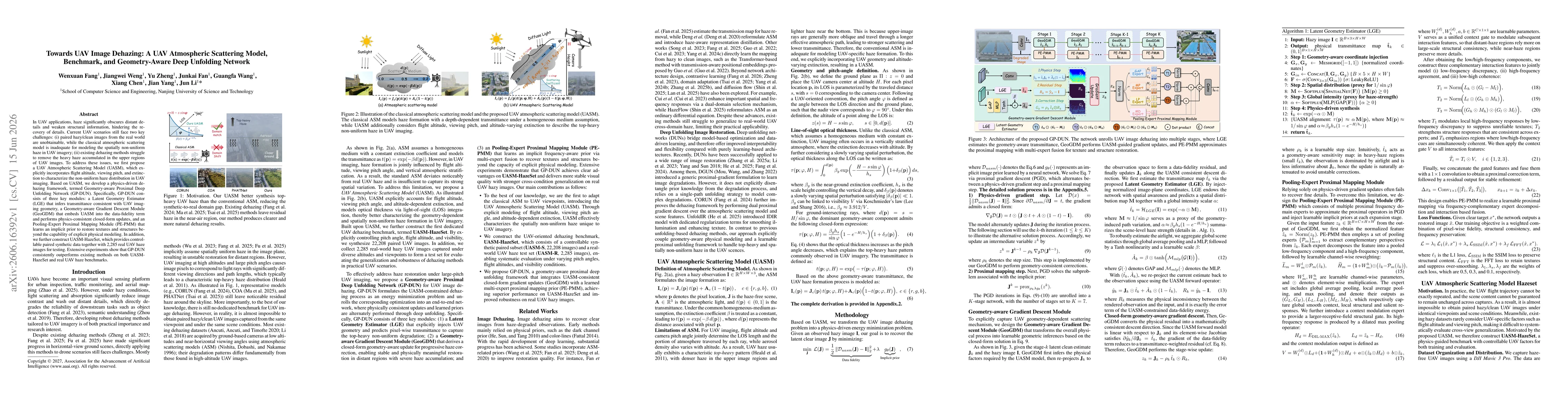
GP-DUN is a physics-guided, geometry-aware deep unfolding network for UAV image dehazing. It unrolls an energy minimization problem constrained by the proposed UAV Atmospheric Scattering Model (UASM), and comprises three modules: Latent Geometry Estimator (LGE) for UAV-consistent transmittance prediction, Geometry-aware Gradient Descent Module (GeoGDM) for physics-consistent, closed-form updates, and Pooling-Expert Proximal Mapping Module (PE-PMM) for learned priors. A dedicated UASM-HazeSet provides controllable synthetic data and real UAV haze images for evaluation. The framework integrates UASM into updates and uses multi-expert fusion to restore textures and structures beyond explicit modeling.
Discussion 0