Travel time estimation for ambulances using Bayesian data augmentation
Publication
Metrics
AI Quick Summary
This paper proposes a Bayesian model for estimating ambulance travel times using GPS data, employing Bayesian data augmentation to infer paths and travel times. The method outperforms simpler alternatives and provides more realistic probability-of-coverage maps, demonstrating robustness to GPS data errors.
Paper Preview
Abstract
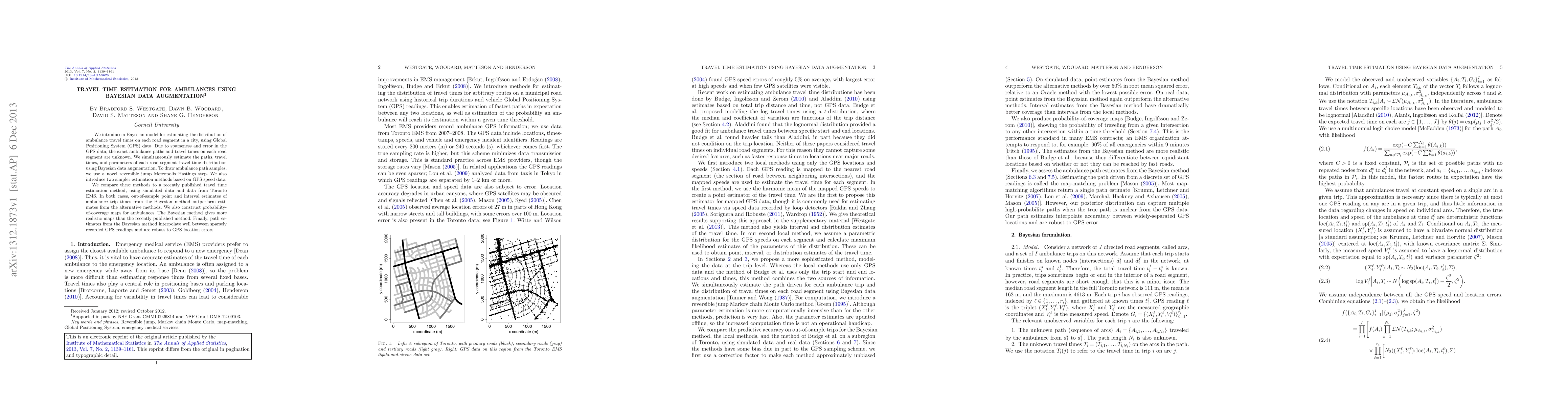
We introduce a Bayesian model for estimating the distribution of ambulance travel times on each road segment in a city, using Global Positioning System (GPS) data. Due to sparseness and error in the GPS data, the exact ambulance paths and travel times on each road segment are unknown. We simultaneously estimate the paths, travel times, and parameters of each road segment travel time distribution using Bayesian data augmentation. To draw ambulance path samples, we use a novel reversible jump Metropolis-Hastings step. We also introduce two simpler estimation methods based on GPS speed data. We compare these methods to a recently published travel time estimation method, using simulated data and data from Toronto EMS. In both cases, out-of-sample point and interval estimates of ambulance trip times from the Bayesian method outperform estimates from the alternative methods. We also construct probability-of-coverage maps for ambulances. The Bayesian method gives more realistic maps than the recently published method. Finally, path estimates from the Bayesian method interpolate well between sparsely recorded GPS readings and are robust to GPS location errors.
AI Key Findings
Get AI-generated insights about this paper's methodology, results, significance, and more — seven facets brought into focus.
Impact
Paper Details
PDF Preview
Key Terms
Citation Network
Current paper (gray), citations (green), references (blue)
Display is limited for performance on very large graphs.
Discussion 0