01
MethodologyHow they did it
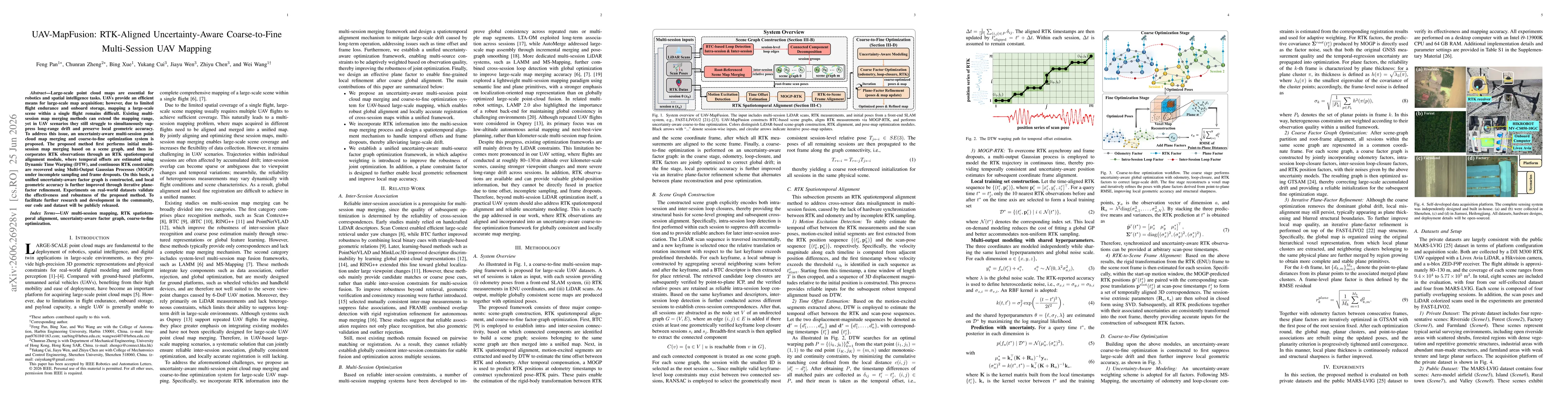
The approach integrates three components: (1) scene-graph construction for initial multi-session map merging using BTC-based connectivity to create a unified scene graph, (2) RTK spatiotemporal alignment that uses DTW to estimate time offsets between RTK observations and odometry and a Multi-Output Gaussian Process (MOGP) to recover continuous RTK constraints, enabling synchronized pose–RTK pairs, and (3) a unified uncertainty-aware factor graph that fuses odometry, loop closures, and RTK constraints with plane-factor refinement to improve local geometric accuracy in a coarse-to-fine optimization regime.
Discussion 0