UdeerLID+: Integrating LiDAR, Image, and Relative Depth with Semi-Supervised
Publication
Metrics
AI Quick Summary
The paper proposes a semi-supervised framework, UdeerLID+, that integrates LiDAR, visual images, and relative depth maps for road segmentation in autonomous driving. Despite challenges due to the lack of large-scale labeled datasets, the framework demonstrates superior performance validated on KITTI datasets.
Paper Preview
Abstract
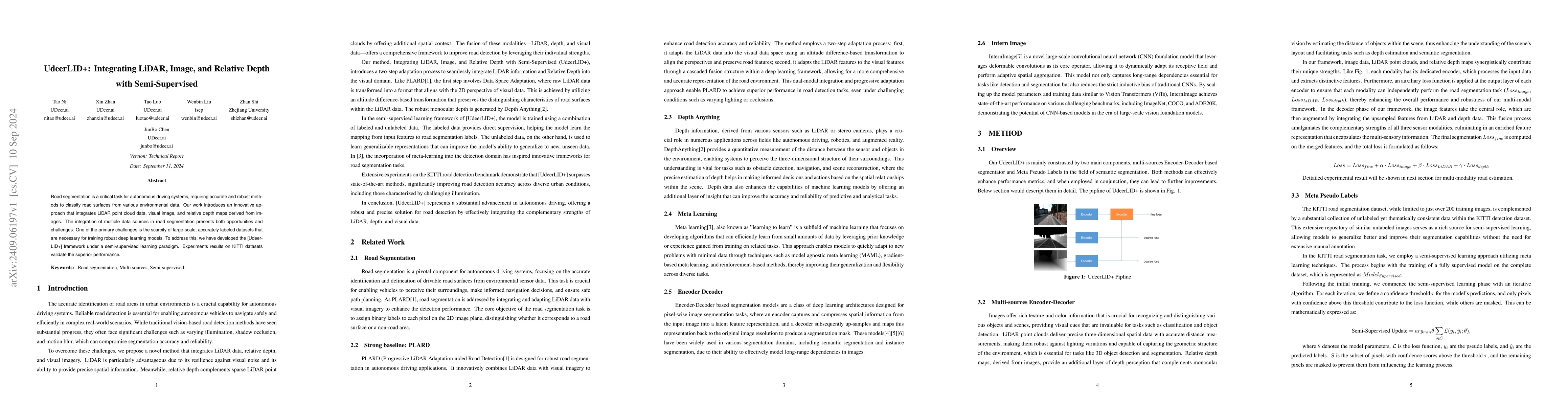
Road segmentation is a critical task for autonomous driving systems, requiring accurate and robust methods to classify road surfaces from various environmental data. Our work introduces an innovative approach that integrates LiDAR point cloud data, visual image, and relative depth maps derived from images. The integration of multiple data sources in road segmentation presents both opportunities and challenges. One of the primary challenges is the scarcity of large-scale, accurately labeled datasets that are necessary for training robust deep learning models. To address this, we have developed the [UdeerLID+] framework under a semi-supervised learning paradigm. Experiments results on KITTI datasets validate the superior performance.
AI Key Findings
Get AI-generated insights about this paper's methodology, results, significance, and more — seven facets brought into focus.
Impact
Authors
PDF Preview
Citation Network
Current paper (gray), citations (green), references (blue)
Display is limited for performance on very large graphs.
Discussion 0