Publication
Metrics
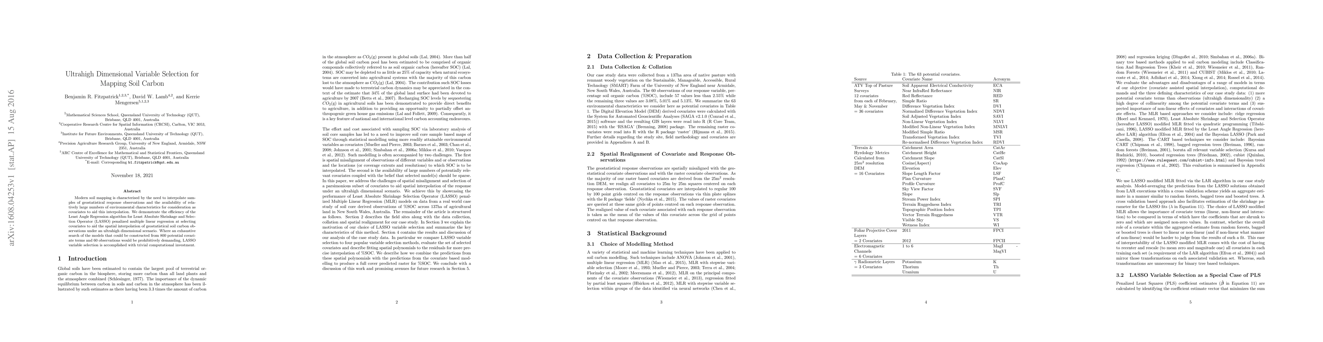
AI Quick Summary
This paper demonstrates the effectiveness of the LASSO algorithm for selecting relevant covariates from 800 potential variables to aid in the spatial interpolation of soil carbon observations, even with only 60 observations, showcasing its efficiency in ultrahigh dimensional variable selection scenarios.
Paper Preview
Abstract
Modern soil mapping is characterised by the need to interpolate samples of geostatistical response observations and the availability of relatively large numbers of environmental characteristics for consideration as covariates to aid this interpolation. We demonstrate the efficiency of the Least Angle Regression algorithm for Least Absolute Shrinkage and Selection Operator (LASSO) penalized multiple linear regression at selecting covariates to aid the spatial interpolation of geostatistical soil carbon observations under an ultrahigh dimensional scenario. Where an exhaustive search of the models that could be constructed from 800 potential covariate terms and 60 observations would be prohibitively demanding, LASSO variable selection is accomplished with trivial computational investment.
AI Key Findings
Get AI-generated insights about this paper's methodology, results, significance, and more — seven facets brought into focus.
Impact
Paper Details
PDF Preview
Key Terms
Citation Network
Current paper (gray), citations (green), references (blue)
Display is limited for performance on very large graphs.
Discussion 0