Uncertainty estimation in satellite precipitation interpolation with machine learning
Publication
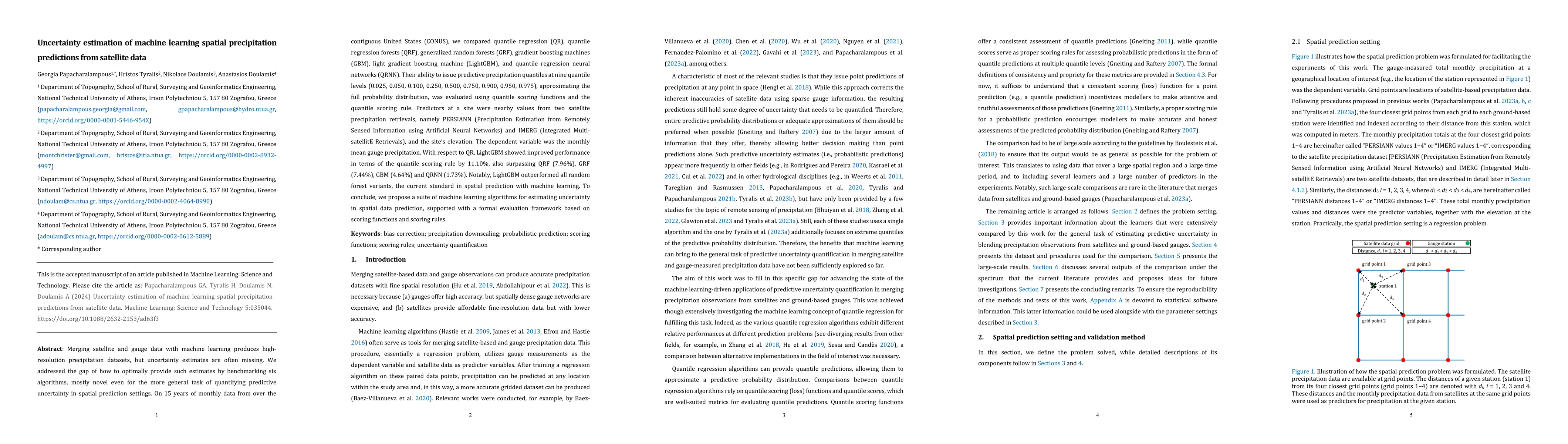
Metrics
AI Quick Summary
This paper benchmarks six machine learning algorithms for estimating uncertainty in satellite precipitation interpolation, finding that LightGBM outperforms others in predicting precipitation quantiles. Satellite data (PERSIANN and IMERG) were identified as the most informative predictors.
Paper Preview
Abstract
Merging satellite and gauge data with machine learning produces high-resolution precipitation datasets, but uncertainty estimates are often missing. We address this gap by benchmarking six algorithms, mostly novel for this task, for quantifying predictive uncertainty in spatial interpolation. On 15 years of monthly data over the contiguous United States (CONUS), we compared quantile regression (QR), quantile regression forests (QRF), generalized random forests (GRF), gradient boosting machines (GBM), light gradient boosting machines (LightGBM), and quantile regression neural networks (QRNN). Their ability to issue predictive precipitation quantiles at nine quantile levels (0.025, 0.050, 0.100, 0.250, 0.500, 0.750, 0.900, 0.950, 0.975), approximating the full probability distribution, was evaluated using quantile scoring functions and the quantile scoring rule. Feature importance analysis revealed satellite precipitation (PERSIANN (Precipitation Estimation from Remotely Sensed Information using Artificial Neural Networks) and IMERG (Integrated Multi-satellitE Retrievals) datasets) as the most informative predictor, followed by gauge elevation and distance to satellite grid points. Compared to QR, LightGBM showed improved performance with respect to the quantile scoring rule by 11.10%, followed by QRF (7.96%), GRF (7.44%), GBM (4.64%) and QRNN (1.73%). Notably, LightGBM outperformed all random forest variants, the current standard in spatial interpolation with machine learning. To conclude, we propose a suite of machine learning algorithms for estimating uncertainty in interpolating spatial data, supported with a formal evaluation framework based on scoring functions and scoring rules.
AI Key Findings
Get AI-generated insights about this paper's methodology, results, significance, and more — seven facets brought into focus.
Impact
Paper Details
PDF Preview
Key Terms
Citation Network
Current paper (gray), citations (green), references (blue)
Display is limited for performance on very large graphs.
Discussion 0