Publication
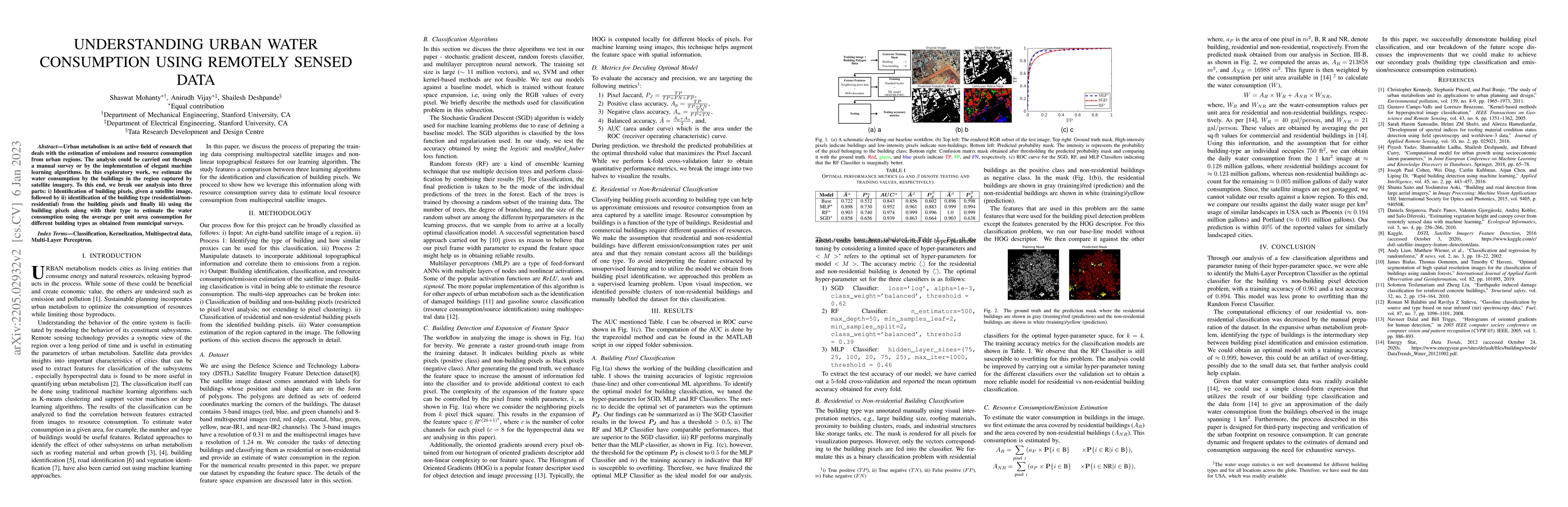
Metrics
AI Quick Summary
This research estimates urban water consumption using satellite imagery and machine learning, focusing on identifying building pixels, classifying building types, and calculating water usage based on average per unit area consumption for different building types derived from municipal surveys.
Paper Preview
Abstract
Urban metabolism is an active field of research that deals with the estimation of emissions and resource consumption from urban regions. The analysis could be carried out through a manual surveyor by the implementation of elegant machine learning algorithms. In this exploratory work, we estimate the water consumption by the buildings in the region captured by satellite imagery. To this end, we break our analysis into three parts: i) Identification of building pixels, given a satellite image, followed by ii) identification of the building type (residential/non-residential) from the building pixels, and finally iii) using the building pixels along with their type to estimate the water consumption using the average per unit area consumption for different building types as obtained from municipal surveys.
AI Key Findings
Get AI-generated insights about this paper's methodology, results, significance, and more — seven facets brought into focus.
Impact
Paper Details
Authors
PDF Preview
Key Terms
Citation Network
Current paper (gray), citations (green), references (blue)
Display is limited for performance on very large graphs.
Discussion 0