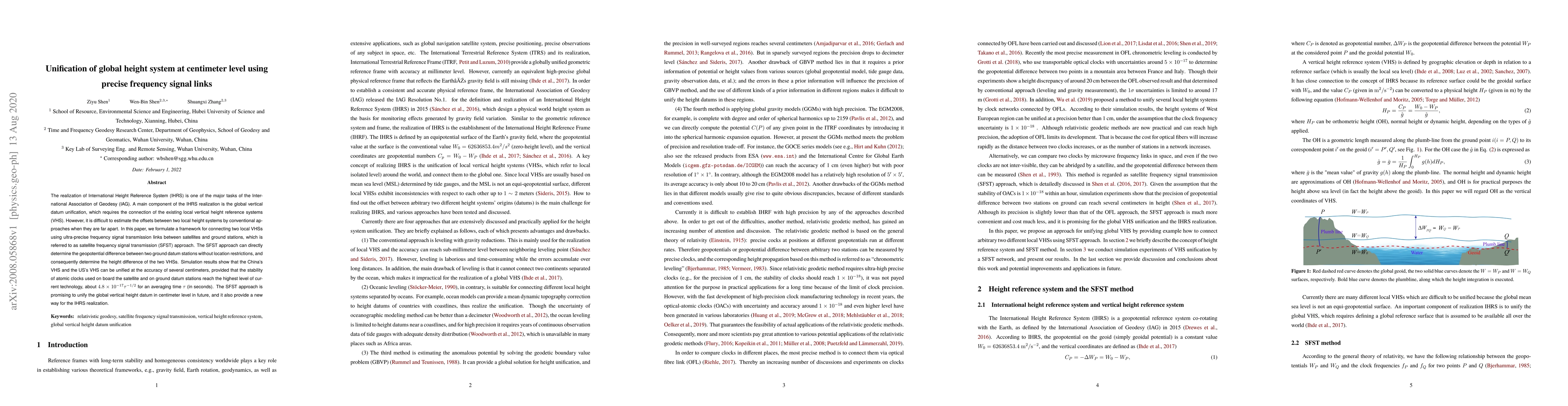
Unification of global height system at centimeter level using precise frequency signal links
Publication
Metrics
AI Quick Summary
Researchers propose a new method to unify global height systems at centimeter accuracy using satellite frequency signal transmission links, which can directly determine geopotential differences between ground stations.
Paper Preview
Abstract
The realization of International Height Reference System (IHRS) is one of the major tasks of the International Association of Geodesy (IAG). A main component of the IHRS realization is the global vertical datum unification, which requires the connection of the existing local vertical height reference systems (VHS). However, it is difficult to estimate the offsets between two local height systems by conventional approaches when they are far apart. In this paper, we formulate a framework for connecting two local VHSs using ultra-precise frequency signal transmission links between satellites and ground stations, which is referred to as satellite frequency signal transmission (SFST) approach. The SFST approach can directly determine the geopotential difference between two ground datum stations without location restrictions, and consequently determine the height difference of the two VHSs. Simulation results show that the China's VHS and the US's VHS can be unified at the accuracy of several centimeters, provided that the stability of atomic clocks used on board the satellite and on ground datum stations reach the highest level of current technology, about $4.8\times 10^{-17}/\sqrt{\tau}$ for an averaging time {\tau} (in seconds). The SFST approach is promising to unify the global vertical height datum in centimeter level in future, and it also provide a new way for the IHRS realization.
AI Key Findings
Get AI-generated insights about this paper's methodology, results, significance, and more — seven facets brought into focus.
Impact
Paper Details
Authors
PDF Preview
Key Terms
Citation Network
Current paper (gray), citations (green), references (blue)
Display is limited for performance on very large graphs.
Discussion 0