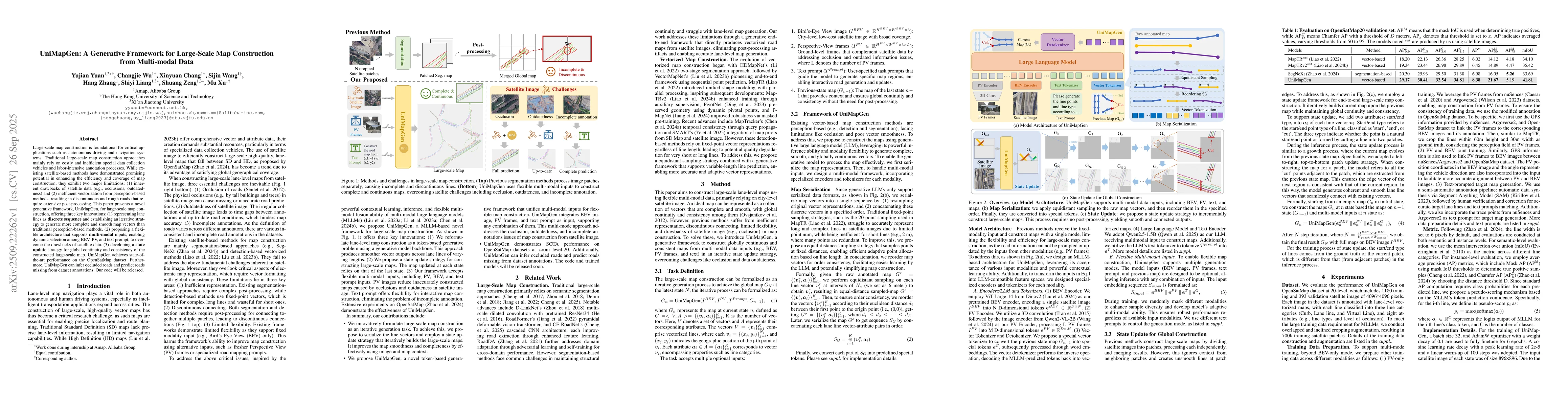
Large-scale map construction is foundational for critical applications such
as autonomous driving and navigation systems. Traditional large-scale map
construction approaches mainly rely on costly and inefficient special data
collection vehicles and labor-intensive annotation processes. While existing
satellite-based methods have demonstrated promising potential in enhancing the
efficiency and coverage of map construction, they exhibit two major
limitations: (1) inherent drawbacks of satellite data (e.g., occlusions,
outdatedness) and (2) inefficient vectorization from perception-based methods,
resulting in discontinuous and rough roads that require extensive
post-processing. This paper presents a novel generative framework, UniMapGen,
for large-scale map construction, offering three key innovations: (1)
representing lane lines as \textbf{discrete sequence} and establishing an
iterative strategy to generate more complete and smooth map vectors than
traditional perception-based methods. (2) proposing a flexible architecture
that supports \textbf{multi-modal} inputs, enabling dynamic selection among
BEV, PV, and text prompt, to overcome the drawbacks of satellite data. (3)
developing a \textbf{state update} strategy for global continuity and
consistency of the constructed large-scale map. UniMapGen achieves
state-of-the-art performance on the OpenSatMap dataset. Furthermore, UniMapGen
can infer occluded roads and predict roads missing from dataset annotations.
Our code will be released.
Discussion 0