Urban Mosaic: Visual Exploration of Streetscapes Using Large-Scale Image Data
Publication
Metrics
AI Quick Summary
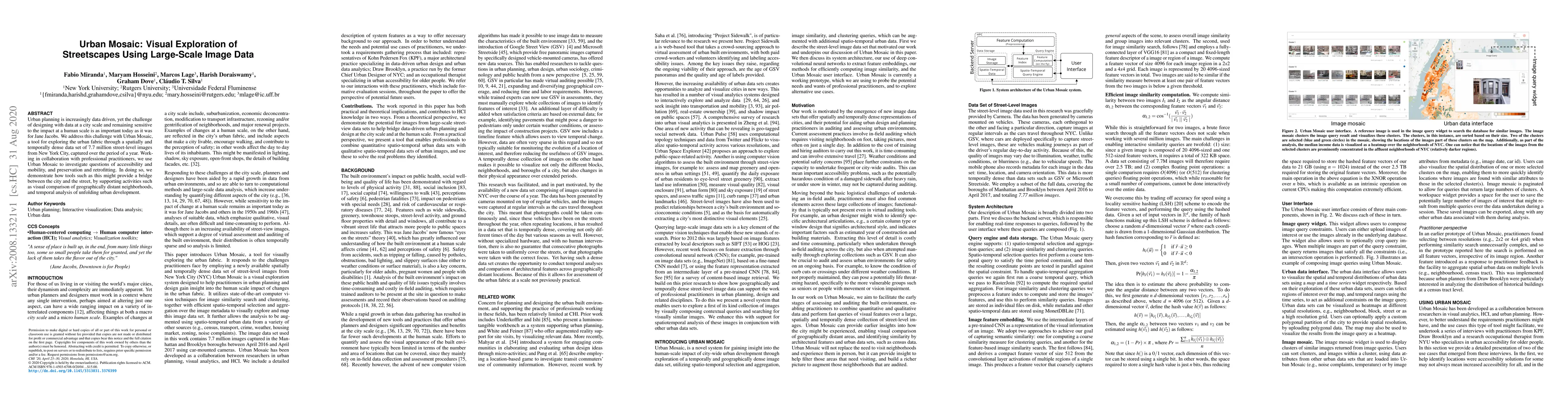
Urban Mosaic is a tool for exploring urban fabric using 7.7 million street-level images from New York City, aiding urban planning through spatial and temporal analysis of accessibility, mobility, and urban development. It bridges city-scale data with human-scale impact considerations.
Paper Preview
Abstract
Urban planning is increasingly data driven, yet the challenge of designing with data at a city scale and remaining sensitive to the impact at a human scale is as important today as it was for Jane Jacobs. We address this challenge with Urban Mosaic,a tool for exploring the urban fabric through a spatially and temporally dense data set of 7.7 million street-level images from New York City, captured over the period of a year. Working in collaboration with professional practitioners, we use Urban Mosaic to investigate questions of accessibility and mobility, and preservation and retrofitting. In doing so, we demonstrate how tools such as this might provide a bridge between the city and the street, by supporting activities such as visual comparison of geographically distant neighborhoods,and temporal analysis of unfolding urban development.
AI Key Findings
Get AI-generated insights about this paper's methodology, results, significance, and more — seven facets brought into focus.
Impact
Paper Details
Authors
PDF Preview
Key Terms
Citation Network
Current paper (gray), citations (green), references (blue)
Display is limited for performance on very large graphs.
Discussion 0