Urban Surface Reconstruction in SAR Tomography by Graph-Cuts
Publication
Metrics
Paper Preview
Abstract
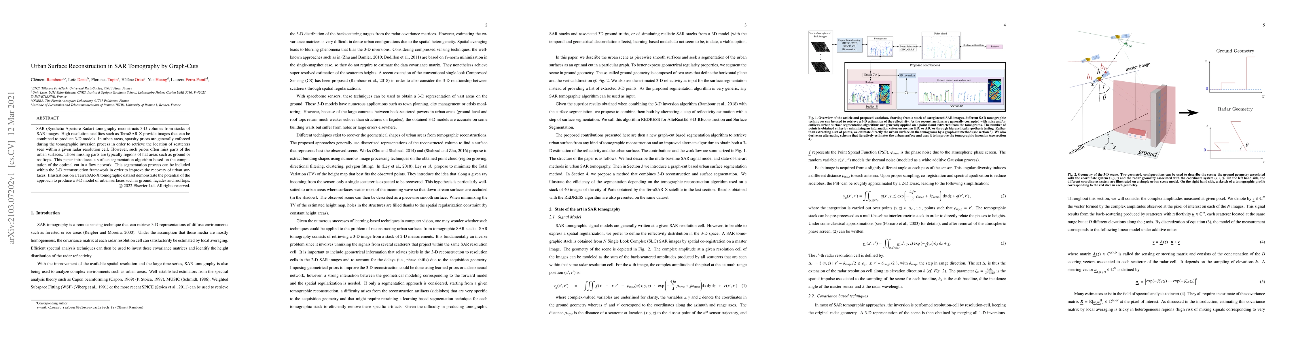
SAR (Synthetic Aperture Radar) tomography reconstructs 3-D volumes from stacks of SAR images. High-resolution satellites such as TerraSAR-X provide images that can be combined to produce 3-D models. In urban areas, sparsity priors are generally enforced during the tomographic inversion process in order to retrieve the location of scatterers seen within a given radar resolution cell. However, such priors often miss parts of the urban surfaces. Those missing parts are typically regions of flat areas such as ground or rooftops. This paper introduces a surface segmentation algorithm based on the computation of the optimal cut in a flow network. This segmentation process can be included within the 3-D reconstruction framework in order to improve the recovery of urban surfaces. Illustrations on a TerraSAR-X tomographic dataset demonstrate the potential of the approach to produce a 3-D model of urban surfaces such as ground, fa\c{c}ades and rooftops.
AI Key Findings
Get AI-generated insights about this paper's methodology, results, significance, and more — seven facets brought into focus.
Impact
Paper Details
Authors
PDF Preview
Key Terms
Citation Network
Current paper (gray), citations (green), references (blue)
Display is limited for performance on very large graphs.
Discussion 0