Using coarse GPS data to quantify city-scale transportation system resilience to extreme events
Publication
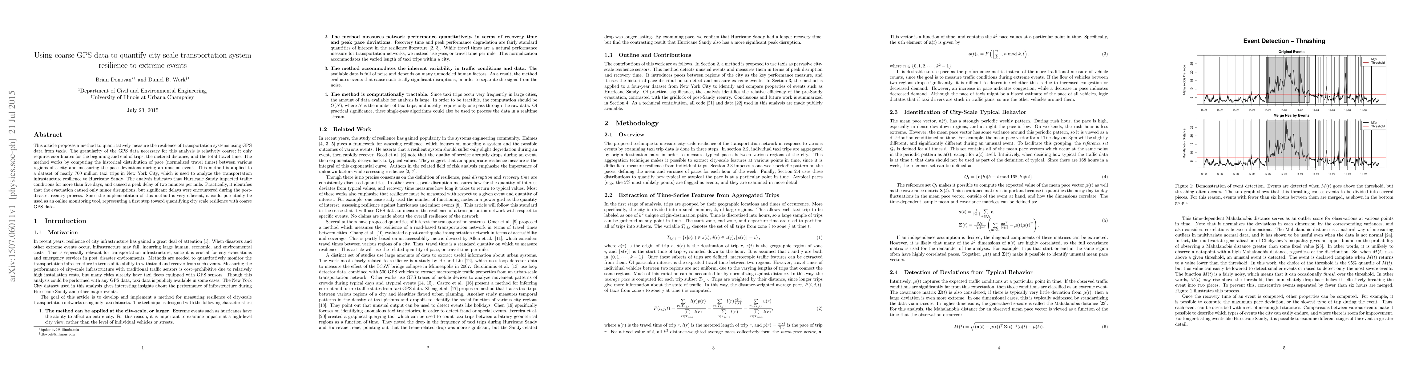
Metrics
AI Quick Summary
This paper proposes a method to measure transportation system resilience using coarse GPS data from taxis, focusing on New York City's response to Hurricane Sandy. The analysis reveals significant delays post-disaster, highlighting the potential for this method as an efficient online monitoring tool.
Paper Preview
Abstract
This article proposes a method to quantitatively measure the resilience of transportation systems using GPS data from taxis. The granularity of the GPS data necessary for this analysis is relatively coarse; it only requires coordinates for the beginning and end of trips, the metered distance, and the total travel time. The method works by computing the historical distribution of pace (normalized travel times) between various regions of a city and measuring the pace deviations during an unusual event. This method is applied to a dataset of nearly 700 million taxi trips in New York City, which is used to analyze the transportation infrastructure resilience to Hurricane Sandy. The analysis indicates that Hurricane Sandy impacted traffic conditions for more than five days, and caused a peak delay of two minutes per mile. Practically, it identifies that the evacuation caused only minor disruptions, but significant delays were encountered during the post-disaster reentry process. Since the implementation of this method is very efficient, it could potentially be used as an online monitoring tool, representing a first step toward quantifying city scale resilience with coarse GPS data.
AI Key Findings
Get AI-generated insights about this paper's methodology, results, significance, and more — seven facets brought into focus.
Impact
Paper Details
PDF Preview
Key Terms
Citation Network
Current paper (gray), citations (green), references (blue)
Display is limited for performance on very large graphs.
Discussion 0