Using NASA Satellite Data Sources and Geometric Deep Learning to Uncover Hidden Patterns in COVID-19 Clinical Severity
Publication
Metrics
Paper Preview
Abstract
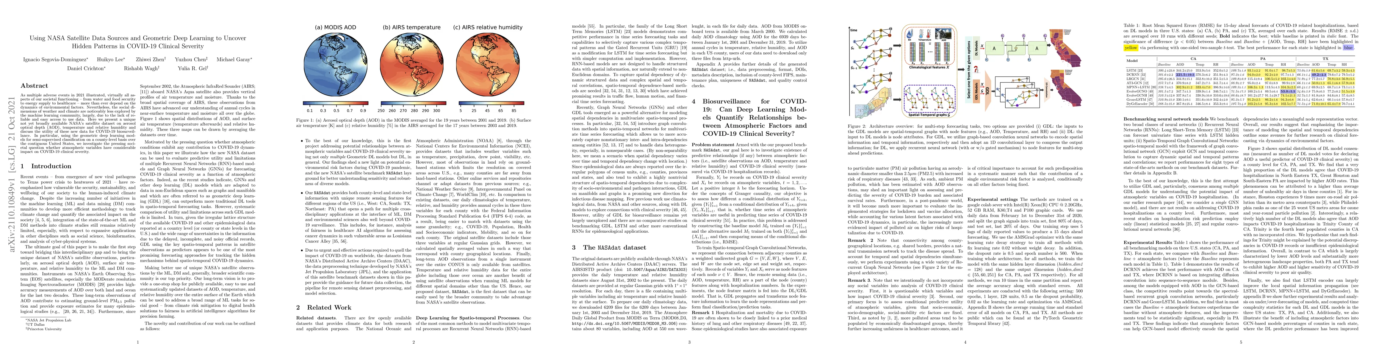
As multiple adverse events in 2021 illustrated, virtually all aspects of our societal functioning -- from water and food security to energy supply to healthcare -- more than ever depend on the dynamics of environmental factors. Nevertheless, the social dimensions of weather and climate are noticeably less explored by the machine learning community, largely, due to the lack of reliable and easy access to use data. Here we present a unique not yet broadly available NASA's satellite dataset on aerosol optical depth (AOD), temperature and relative humidity and discuss the utility of these new data for COVID-19 biosurveillance. In particular, using the geometric deep learning models for semi-supervised classification on a county-level basis over the contiguous United States, we investigate the pressing societal question whether atmospheric variables have considerable impact on COVID-19 clinical severity.
AI Key Findings
Get AI-generated insights about this paper's methodology, results, significance, and more — seven facets brought into focus.
Impact
Paper Details
Authors
PDF Preview
Key Terms
Citation Network
Current paper (gray), citations (green), references (blue)
Display is limited for performance on very large graphs.
Discussion 0