VAULT: A Mobile Mapping System for ROS 2-based Autonomous Robots
Publication
Metrics
AI Quick Summary
The VAULT prototype leverages GNSS data, visual-inertial odometry, IMU data, and the Extended Kalman Filter to generate reliable 3D odometry and create comprehensive point cloud maps.
Paper Preview
Abstract
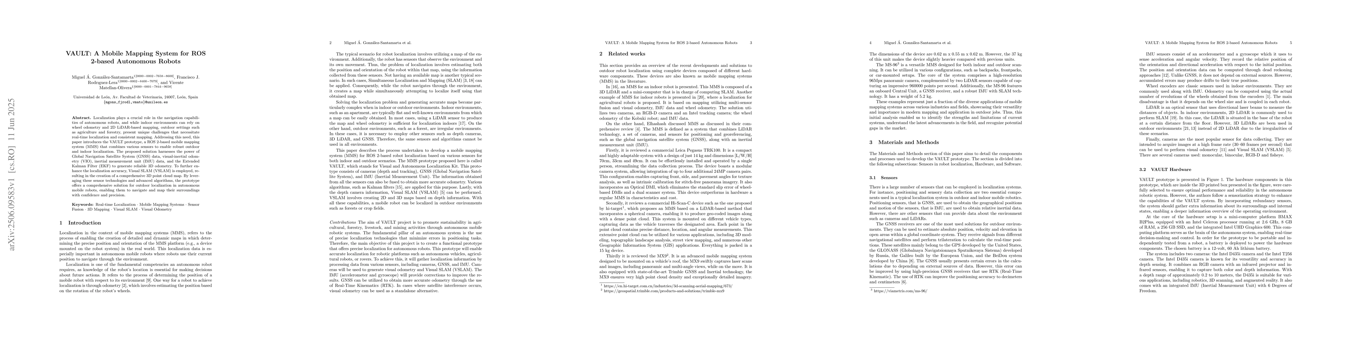
Localization plays a crucial role in the navigation capabilities of autonomous robots, and while indoor environments can rely on wheel odometry and 2D LiDAR-based mapping, outdoor settings such as agriculture and forestry, present unique challenges that necessitate real-time localization and consistent mapping. Addressing this need, this paper introduces the VAULT prototype, a ROS 2-based mobile mapping system (MMS) that combines various sensors to enable robust outdoor and indoor localization. The proposed solution harnesses the power of Global Navigation Satellite System (GNSS) data, visual-inertial odometry (VIO), inertial measurement unit (IMU) data, and the Extended Kalman Filter (EKF) to generate reliable 3D odometry. To further enhance the localization accuracy, Visual SLAM (VSLAM) is employed, resulting in the creation of a comprehensive 3D point cloud map. By leveraging these sensor technologies and advanced algorithms, the prototype offers a comprehensive solution for outdoor localization in autonomous mobile robots, enabling them to navigate and map their surroundings with confidence and precision.
AI Key Findings
Get AI-generated insights about this paper's methodology, results, significance, and more — seven facets brought into focus.
Impact
Paper Details
Authors
PDF Preview
Citation Network
Current paper (gray), citations (green), references (blue)
Display is limited for performance on very large graphs.
Discussion 0