Vector Field-based Simulation of Tree-Like Non-Stationary Geostatistical Models
Publication
Metrics
AI Quick Summary
A new geostatistical model simulates tree-like structures with directional features using a vector field-based approach, capturing non-stationarity in training images.
Paper Preview
Abstract
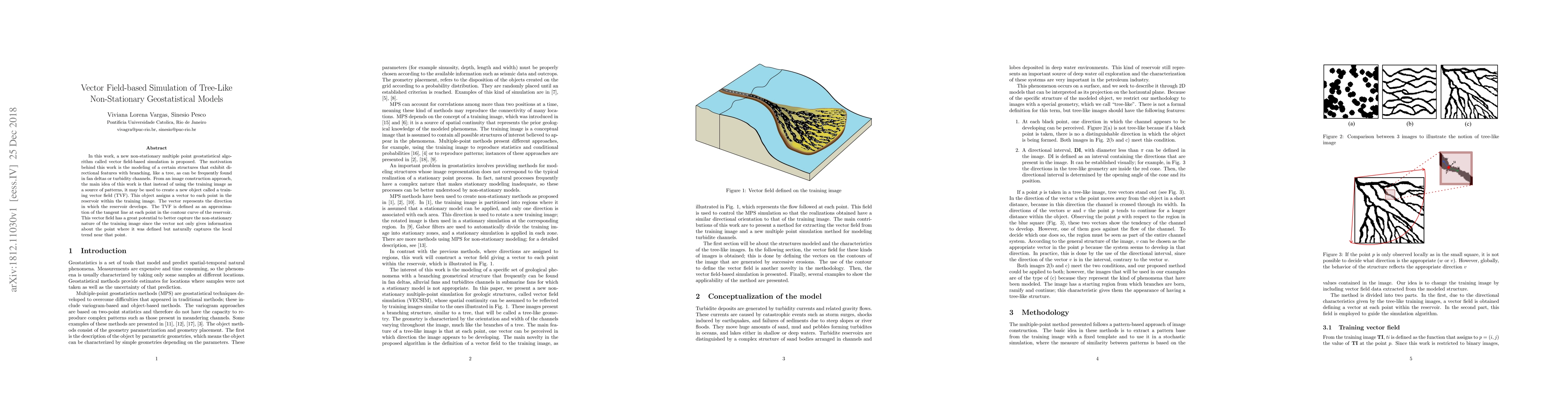
In this work, a new non-stationary multiple point geostatistical algorithm called vector field-based simulation is proposed. The motivation behind this work is the modeling of a certain structures that exhibit directional features with branching, like a tree, as can be frequently found in fan deltas or turbidity channels. From an image construction approach, the main idea of this work is that instead of using the training image as a source of patterns, it may be used to create a new object called a training vector field (TVF). This object assigns a vector to each point in the reservoir within the training image. The vector represents the direction in which the reservoir develops. The TVF is defined as an approximation of the tangent line at each point in the contour curve of the reservoir. This vector field has a great potential to better capture the non-stationary nature of the training image since the vector not only gives information about the point where it was defined but naturally captures the local trend near that point.
AI Key Findings
Get AI-generated insights about this paper's methodology, results, significance, and more — seven facets brought into focus.
Impact
Paper Details
PDF Preview
Key Terms
Citation Network
Current paper (gray), citations (green), references (blue)
Display is limited for performance on very large graphs.
Discussion 0