The study introduces a wavelet-based spatial verification method for evaluating precipitation forecasts, combining multiscale analysis with traditional verification metrics to assess forecast accuracy across different spatial scales.
WaveSim: A Wavelet-based Multi-scale Similarity Metric for Weather and Climate Fields
Publication
Metrics
Quick Answers
What methodology did the authors use?
The study introduces a wavelet-based spatial verification method for evaluating precipitation forecasts, combining multiscale analysis with traditional verification metrics to assess forecast accuracy across different spatial scales. More in Methodology →
What are the key results?
Wavelet-based verification outperforms traditional metrics in capturing scale-dependent forecast errors — The method effectively identifies systematic biases across multiple spatial resolutions More in Key Results →
Why is this work significant?
This approach enhances the evaluation of weather models by offering a more nuanced understanding of forecast errors, which is critical for improving predictive accuracy and model reliability in climate studies. More in Significance →
What are the main limitations?
Computational complexity may limit its application to large-scale datasets — Dependence on accurate reference data for validation More in Limitations →
Abstract
We introduce WaveSim, a multi-scale similarity metric for the evaluation of spatial fields in weather and climate applications. WaveSim exploits wavelet transforms to decompose input fields into scale-specific wavelet coefficients. The metric is built by multiplying three orthogonal components derived from these coefficients: Magnitude, which quantifies similarities in the energy distribution of the coefficients, i.e., the intensity of the field; Displacement, which captures spatial shift by comparing the centers of mass of normalized energy distributions; and Structure, which assesses pattern organization independent of location and amplitude. Each component yields a scale-specific similarity score ranging from 0 (no similarity) to 1 (perfect similarity), which are then combined across scales to produce an overall similarity measure. We first evaluate WaveSim using synthetic test cases, applying controlled spatial and temporal perturbations to systematically assess its sensitivity and expected behavior. We then demonstrate its applicability to physically relevant case studies of key modes of climate variability in Earth System Models. Traditional point-wise metrics lack a mechanism for attributing errors to physical scales or modes of dissimilarity. By operating in the wavelet domain and decomposing the signal along independent axes, WaveSim bypasses these limitations and provides an interpretable and diagnostically rich framework for assessing similarity in complex fields. Additionally, the WaveSim framework allows users to place emphasis on a specific scale or component, and lends itself to user-specific model intercomparison, model evaluation, and calibration and training of forecasting systems. We provide a PyTorch-ready implementation of WaveSim, along with all evaluation scripts, at: https://github.com/gabrieleaccarino/wavesim.
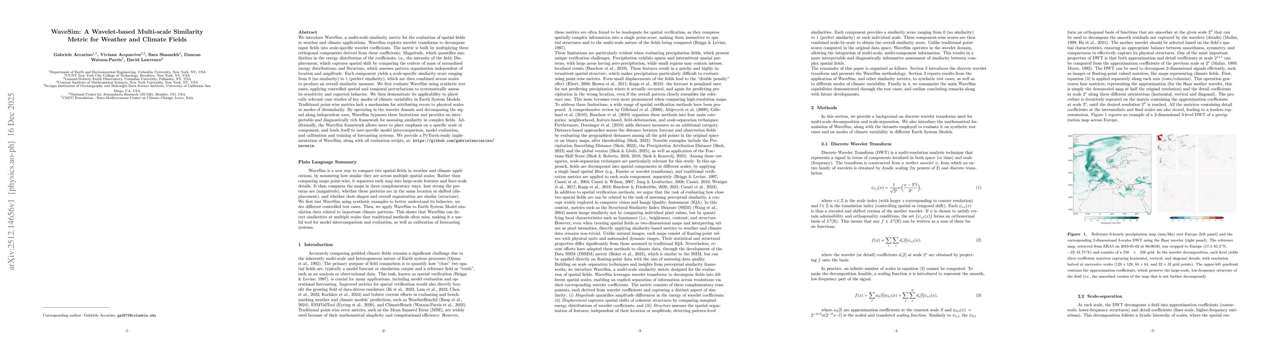
Key Findings, in focus
Seven facets of this paper, analysed and brought into focus by AI.
This approach enhances the evaluation of weather models by offering a more nuanced understanding of forecast errors, which is critical for improving predictive accuracy and model reliability in climate studies.
- Wavelet-based verification outperforms traditional metrics in capturing scale-dependent forecast errors
- The method effectively identifies systematic biases across multiple spatial resolutions
- It provides detailed insights into forecast performance at both local and regional levels
This approach enhances the evaluation of weather models by offering a more nuanced understanding of forecast errors, which is critical for improving predictive accuracy and model reliability in climate studies.
Development of a novel wavelet-based framework for spatial verification that integrates multiscale analysis with existing verification techniques
First application of wavelet decomposition in spatial forecast verification that explicitly accounts for scale-specific error characteristics in precipitation forecasts
- Computational complexity may limit its application to large-scale datasets
- Dependence on accurate reference data for validation
- Integration with machine learning for automated error detection
- Expansion to other meteorological variables beyond precipitation
Discussion 0