Publication
Metrics
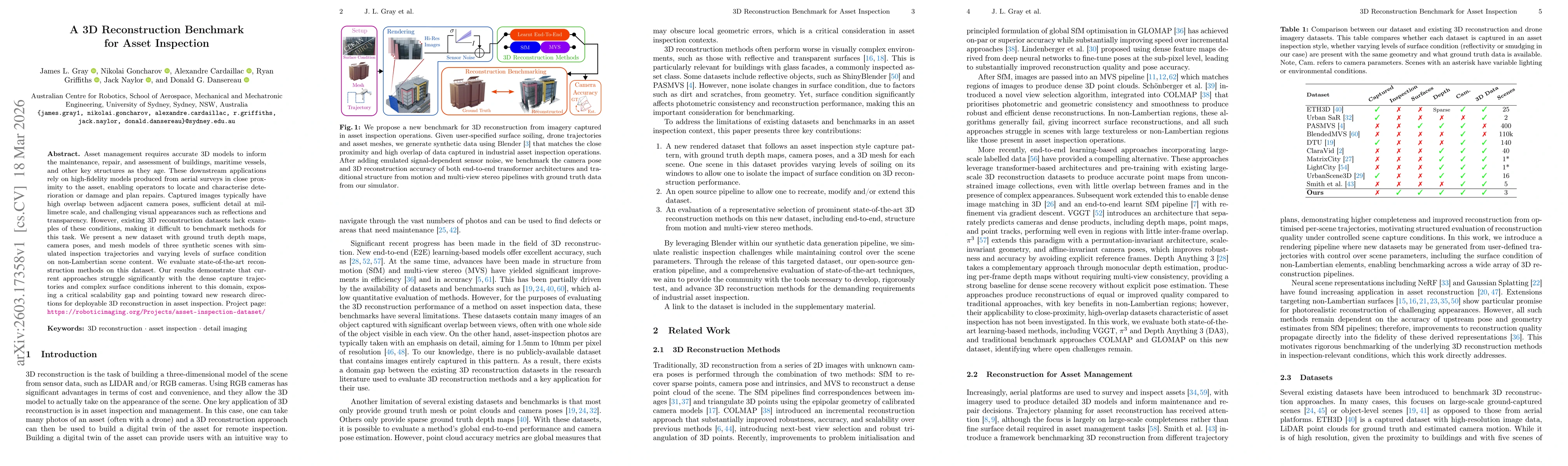
Paper Preview
Abstract
Asset management requires accurate 3D models to inform the maintenance, repair, and assessment of buildings, maritime vessels, and other key structures as they age. These downstream applications rely on high-fidelity models produced from aerial surveys in close proximity to the asset, enabling operators to locate and characterise deterioration or damage and plan repairs. Captured images typically have high overlap between adjacent camera poses, sufficient detail at millimetre scale, and challenging visual appearances such as reflections and transparency. However, existing 3D reconstruction datasets lack examples of these conditions, making it difficult to benchmark methods for this task. We present a new dataset with ground truth depth maps, camera poses, and mesh models of three synthetic scenes with simulated inspection trajectories and varying levels of surface condition on non-Lambertian scene content. We evaluate state-of-the-art reconstruction methods on this dataset. Our results demonstrate that current approaches struggle significantly with the dense capture trajectories and complex surface conditions inherent to this domain, exposing a critical scalability gap and pointing toward new research directions for deployable 3D reconstruction in asset inspection. Project page: https://roboticimaging.org/Projects/asset-inspection-dataset/
AI Key Findings
Get AI-generated insights about this paper's methodology, results, significance, and more — seven facets brought into focus.
Discussion 0