A Multi-stage Collaborative 3D GIS to Support Public Participation
Publication
Metrics
Paper Preview
Abstract
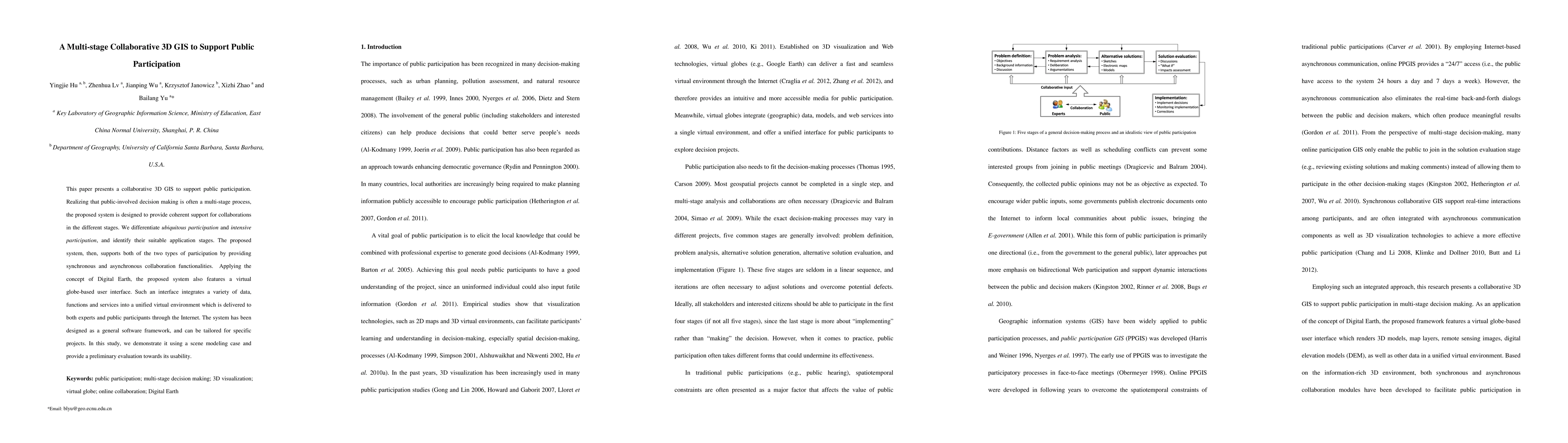
This paper presents a collaborative 3D GIS to support public participation. Realizing that public-involved decision making is often a multi-stage process, the proposed system is designed to provide coherent support for collaborations in the different stages. We differentiate ubiquitous participation and intensive participation, and identify their suitable application stages. The proposed system, then, supports both of the two types of participation by providing synchronous and asynchronous collaboration functionalities. Applying the concept of Digital Earth, the proposed system also features a virtual globe-based user interface. Such an interface integrates a variety of data, functions and services into a unified virtual environment which is delivered to both experts and public participants through the Internet. The system has been designed as a general software framework, and can be tailored for specific projects. In this study, we demonstrate it using a scene modeling case and provide a preliminary evaluation towards its usability.
AI Key Findings
Get AI-generated insights about this paper's methodology, results, significance, and more — seven facets brought into focus.
Impact
Paper Details
PDF Preview
Key Terms
Citation Network
Current paper (gray), citations (green), references (blue)
Display is limited for performance on very large graphs.
Discussion 0