ALTO: A Large-Scale Dataset for UAV Visual Place Recognition and Localization
Publication
Metrics
AI Quick Summary
The ALTO dataset offers extensive visual data from UAV flights over Ohio and Pennsylvania, including high-precision GPS-INS data, accelerometer readings, and RGB imagery for benchmarking visual place recognition and localization methods. This large-scale dataset is available for public use to advance research in UAV localization.
Paper Preview
Abstract
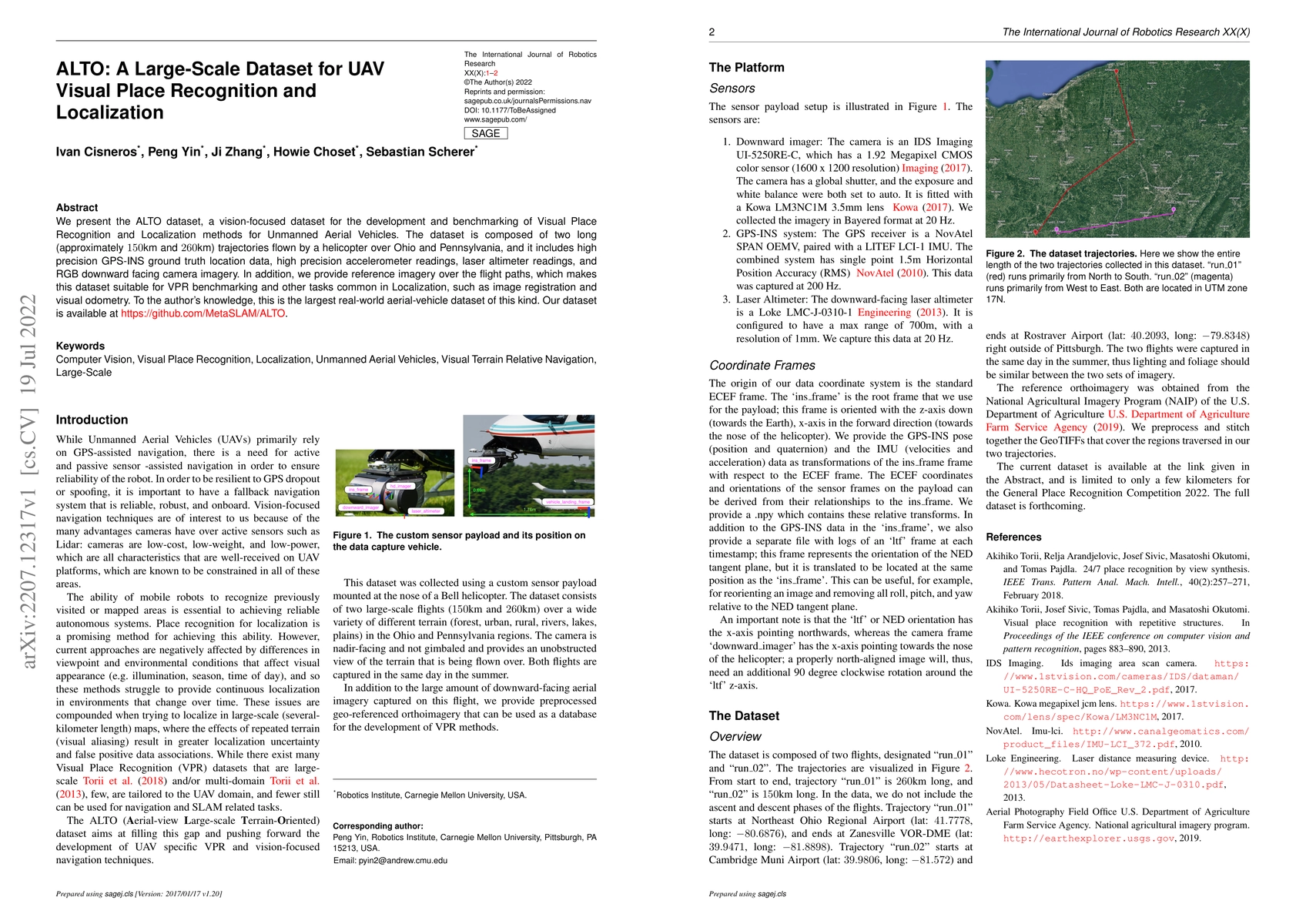
We present the ALTO dataset, a vision-focused dataset for the development and benchmarking of Visual Place Recognition and Localization methods for Unmanned Aerial Vehicles. The dataset is composed of two long (approximately 150km and 260km) trajectories flown by a helicopter over Ohio and Pennsylvania, and it includes high precision GPS-INS ground truth location data, high precision accelerometer readings, laser altimeter readings, and RGB downward facing camera imagery. In addition, we provide reference imagery over the flight paths, which makes this dataset suitable for VPR benchmarking and other tasks common in Localization, such as image registration and visual odometry. To the author's knowledge, this is the largest real-world aerial-vehicle dataset of this kind. Our dataset is available at https://github.com/MetaSLAM/ALTO.
AI Key Findings
Get AI-generated insights about this paper's methodology, results, significance, and more — seven facets brought into focus.
Impact
Paper Details
Authors
PDF Preview
Key Terms
Citation Network
Current paper (gray), citations (green), references (blue)
Display is limited for performance on very large graphs.
Discussion 0