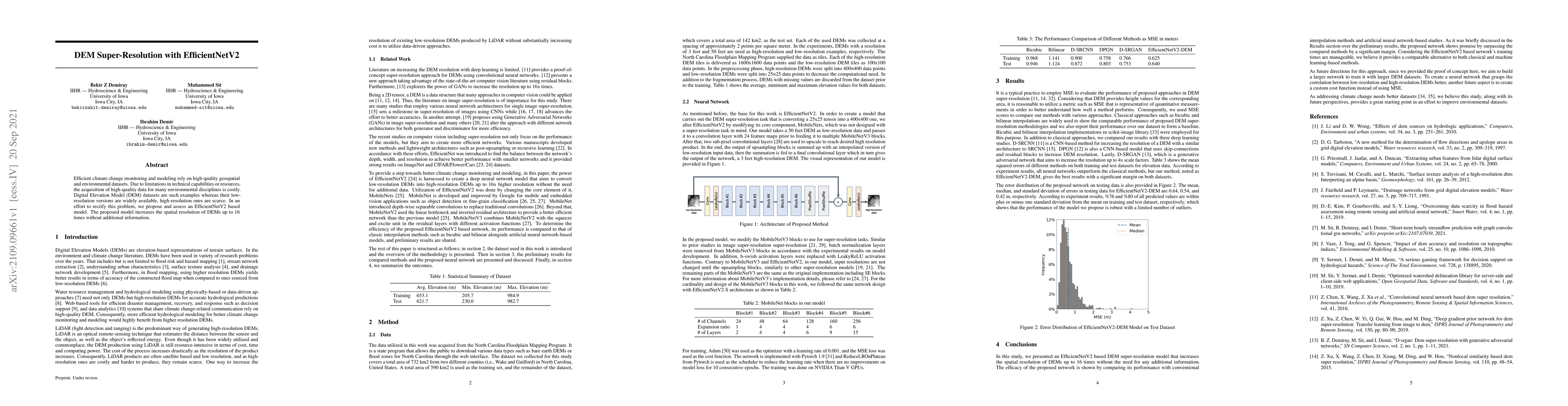
Publication
Metrics
AI Quick Summary
This paper proposes an EfficientNetV2-based model for super-resolving Digital Elevation Models (DEMs) up to 16 times, addressing the scarcity of high-resolution DEM datasets essential for climate change monitoring and modeling. The method enhances DEM resolution without requiring additional data inputs.
Paper Preview
Abstract
Efficient climate change monitoring and modeling rely on high-quality geospatial and environmental datasets. Due to limitations in technical capabilities or resources, the acquisition of high-quality data for many environmental disciplines is costly. Digital Elevation Model (DEM) datasets are such examples whereas their low-resolution versions are widely available, high-resolution ones are scarce. In an effort to rectify this problem, we propose and assess an EfficientNetV2 based model. The proposed model increases the spatial resolution of DEMs up to 16times without additional information.
AI Key Findings
Get AI-generated insights about this paper's methodology, results, significance, and more — seven facets brought into focus.
Impact
Paper Details
Authors
PDF Preview
Key Terms
Citation Network
Current paper (gray), citations (green), references (blue)
Display is limited for performance on very large graphs.
Discussion 0