01
MethodologyHow they did it
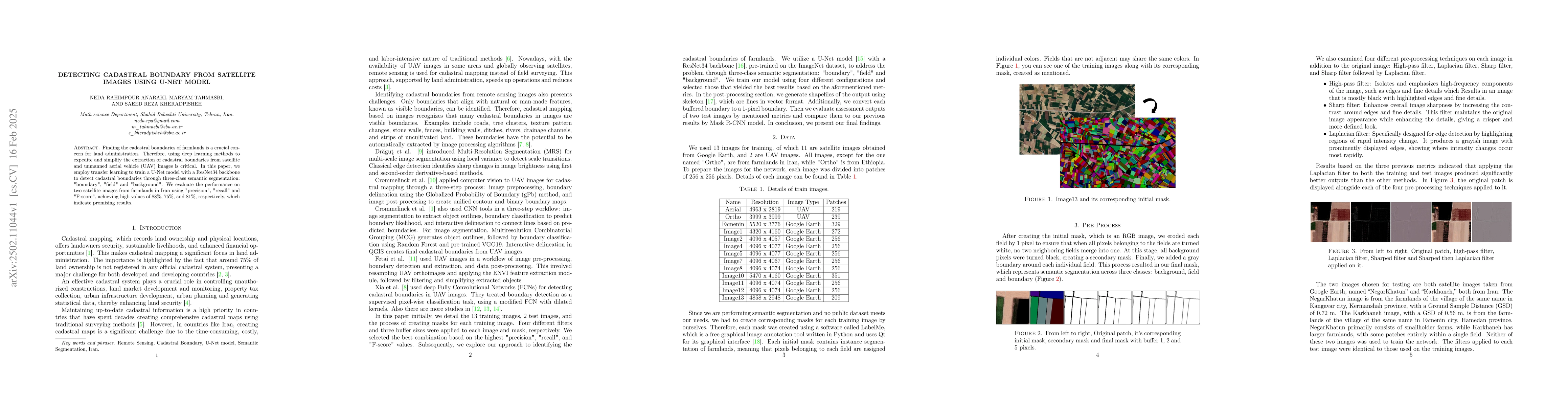
The research employs transfer learning to train a U-Net model with a ResNet34 backbone for three-class semantic segmentation (boundary, field, and background) of cadastral boundaries in satellite images. The study uses four pre-processing techniques (High-pass filter, Laplacian filter, Sharp filter, and Sharp filter followed by Laplacian filter) and evaluates the model on two satellite images from Iranian farmlands.
Discussion 0