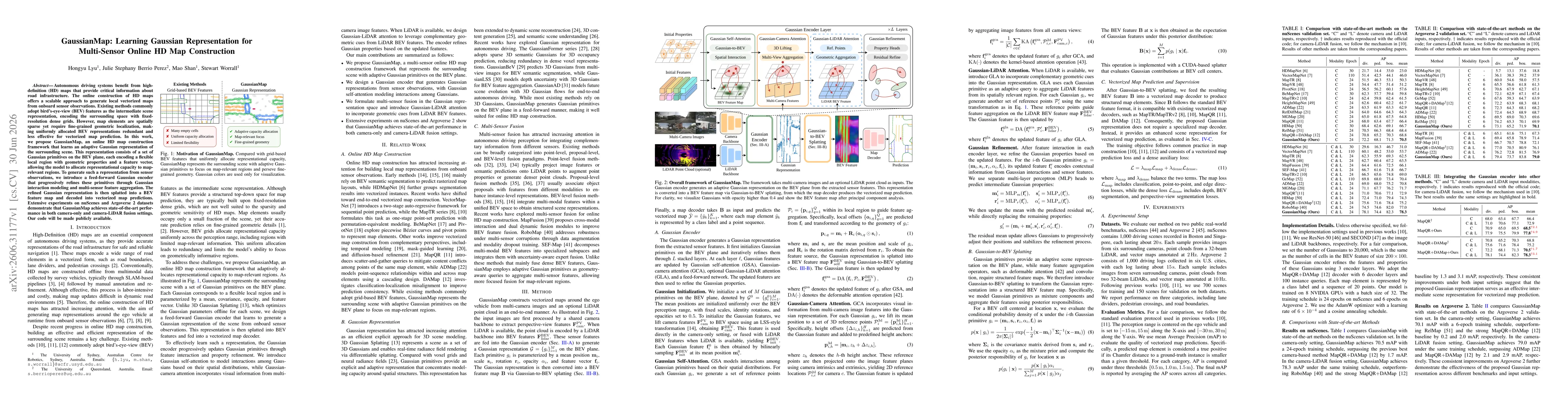
Autonomous driving systems benefit from high-definition (HD) maps that provide critical information about road infrastructure. The online construction of HD maps offers a scalable approach to generate local vectorized maps from onboard sensor observations. Existing methods commonly adopt bird's-eye-view (BEV) features as the intermediate scene representation, encoding the surrounding space with fixed-resolution dense grids. However, map elements are spatially sparse yet require fine-grained geometric localization, making uniformly allocated BEV representations redundant and less effective for vectorized map prediction. In this work, we propose GaussianMap, an online HD map construction framework that learns an adaptive Gaussian representation of the surrounding scene. This representation consists of a set of Gaussian primitives on the BEV plane, each encoding a flexible local region with geometric properties and a feature vector, allowing the model to allocate representational capacity to map-relevant regions. To generate such a representation from sensor observations, we introduce a feed-forward Gaussian encoder that progressively refines these primitives through Gaussian interaction modeling and multi-sensor feature aggregation. The refined Gaussian representation is then splatted into a BEV feature map and decoded into vectorized map predictions. Extensive experiments on nuScenes and Argoverse 2 datasets demonstrate that GaussianMap achieves state-of-the-art performance in both camera-only and camera-LiDAR fusion settings. Our code will be made publicly available.
Discussion 0