ArxivLens

Publication

Published: May 13, 2025
Categories: cs.CV, cs.AI, cs.LG

Metrics

Source: ArXiv

AI Quick Summary

A new dataset, MESSI, has been created to study drone-based semantic segmentation in urban environments. The dataset consists of 2525 images taken from various altitudes and locations, allowing for a comprehensive analysis of the impact of depth on object recognition.

Quick Answers

What is "MESSI: A Multi-Elevation Semantic Segmentation Image Dataset of an Urban Environment" about?

A new dataset, MESSI, has been created to study drone-based semantic segmentation in urban environments. The dataset consists of 2525 images taken from various altitudes and locations, allowing for a comprehensive analysis of the impact of depth on object recognition.

What methodology did the authors use?

The MESSI dataset was created by capturing 2525 images from various altitudes using a drone over dense urban environments. The images are annotated with location, orientation, and camera intrinsic parameters, enabling applications like semantic segmentation, localization, navigation, and tracking. More in Methodology →

What are the key results?

MESSI contains images from multiple urban regions and altitudes, providing a diverse dataset for evaluating semantic segmentation algorithms. — The paper demonstrates the use of several neural network models for semantic segmentation on the MESSI dataset, showcasing relevant statistics. More in Key Results →

Why is this work significant?

MESSI is significant as it serves as a public benchmark for evaluating semantic segmentation using drone-captured images in urban environments, aiding advancements in computer vision, AI, and robotics. More in Significance →

What are the main limitations?

The dataset is limited to urban environments, potentially restricting its applicability to other scenarios. — The paper does not explore the performance of MESSI with other segmentation models beyond the mentioned neural networks. More in Limitations →

Paper Preview

Abstract

This paper presents a Multi-Elevation Semantic Segmentation Image (MESSI) dataset comprising 2525 images taken by a drone flying over dense urban environments. MESSI is unique in two main features. First, it contains images from various altitudes, allowing us to investigate the effect of depth on semantic segmentation. Second, it includes images taken from several different urban regions (at different altitudes). This is important since the variety covers the visual richness captured by a drone's 3D flight, performing horizontal and vertical maneuvers. MESSI contains images annotated with location, orientation, and the camera's intrinsic parameters and can be used to train a deep neural network for semantic segmentation or other applications of interest (e.g., localization, navigation, and tracking). This paper describes the dataset and provides annotation details. It also explains how semantic segmentation was performed using several neural network models and shows several relevant statistics. MESSI will be published in the public domain to serve as an evaluation benchmark for semantic segmentation using images captured by a drone or similar vehicle flying over a dense urban environment.
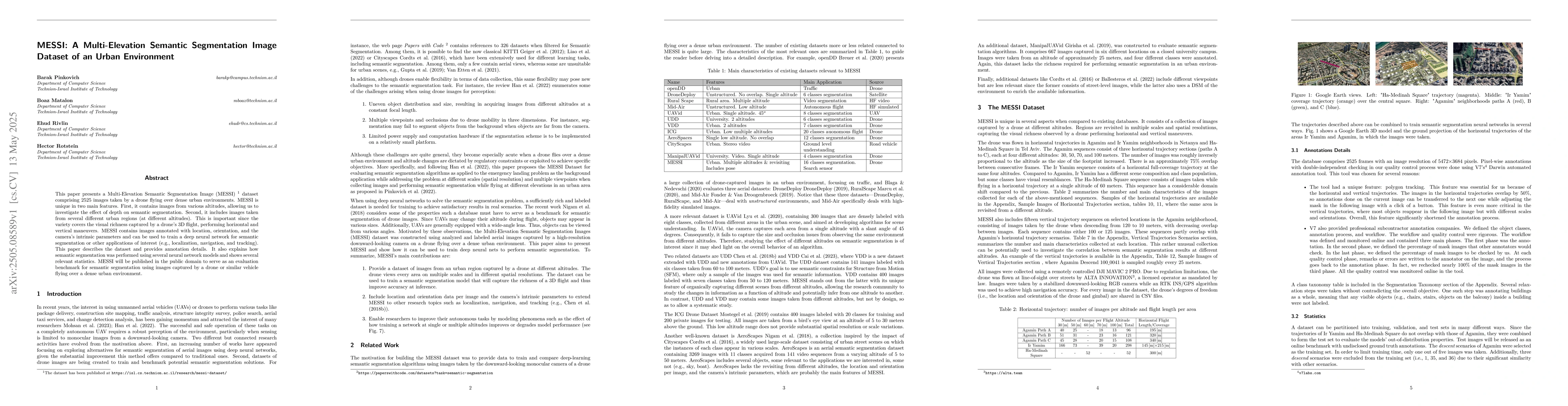
Key Findings, in focus

Seven facets of this paper, analysed and brought into focus by AI.

AI-generated · verify against source Generated Jun 08, 2025
In focus · one-line synthesis

MESSI is significant as it serves as a public benchmark for evaluating semantic segmentation using drone-captured images in urban environments, aiding advancements in computer vision, AI, and robotics.

01
MethodologyHow they did it

The MESSI dataset was created by capturing 2525 images from various altitudes using a drone over dense urban environments. The images are annotated with location, orientation, and camera intrinsic parameters, enabling applications like semantic segmentation, localization, navigation, and tracking.

02
ResultsWhat they found
  • MESSI contains images from multiple urban regions and altitudes, providing a diverse dataset for evaluating semantic segmentation algorithms.
  • The paper demonstrates the use of several neural network models for semantic segmentation on the MESSI dataset, showcasing relevant statistics.
03
SignificanceWhy it matters

MESSI is significant as it serves as a public benchmark for evaluating semantic segmentation using drone-captured images in urban environments, aiding advancements in computer vision, AI, and robotics.

04
Technical ContributionsWhat's new technically

The main technical contribution is the creation and annotation of the MESSI dataset, which facilitates research in multi-elevation semantic segmentation for urban environments.

05
NoveltyWhat sets it apart

MESSI's novelty lies in its multi-elevation and multi-region urban coverage, offering a unique resource for drone-based semantic segmentation research.

06
LimitationsWhat to be cautious about
  • The dataset is limited to urban environments, potentially restricting its applicability to other scenarios.
  • The paper does not explore the performance of MESSI with other segmentation models beyond the mentioned neural networks.
07
Future WorkWhere it goes next
  • Further research could investigate the use of MESSI for other tasks like object detection and tracking.
  • Expanding the dataset to include various weather conditions and times of day would enhance its robustness.

Impact

24
References

Paper Details

Paper ID: 2505.08589
Categories:
cs.CV cs.AI cs.LG cs.RO

How to Cite This Paper

Reference manager: RIS EndNote

Citation Network

Current paper (gray), citations (green), references (blue)

Display is limited for performance on very large graphs.

Current Paper
Citations
References
Click to view


Discussion 0

This website uses cookies to ensure you get the best experience. Learn more