ArxivLens

Publication

Published: Sep 06, 2025
Categories: cs.CV

Metrics

Source: ArXiv

Quick Answers

What methodology did the authors use?

The paper proposes a multi-camera LiDAR-visual-inertial odometry framework called Multi-LVI-SAM, which integrates data from multiple fisheye cameras, LiDAR, and inertial sensors using a factor graph. It introduces a panoramic visual feature model to unify multi-camera observations into a single representation and employs an extrinsic compensation method to address triangulation inconsistencies. More in Methodology →

What are the key results?

The panoramic visual feature model enhances multi-camera constraint quality and consistency, leading to higher accuracy and robustness compared to existing systems. — The extrinsic compensation method significantly reduces triangulation and optimization errors, improving pose estimation accuracy. More in Key Results →

Why is this work significant?

This research advances multi-sensor fusion for robust and high-precision localization in complex environments, enabling reliable navigation in scenarios with poor visual features or sensor failures. More in Significance →

What are the main limitations?

Performance degrades in sequences with rapid orientation changes or severe device shaking. — The method relies on LiDAR for depth information, which can be problematic in environments with insufficient LiDAR planar constraints. More in Limitations →

Paper Preview

Abstract

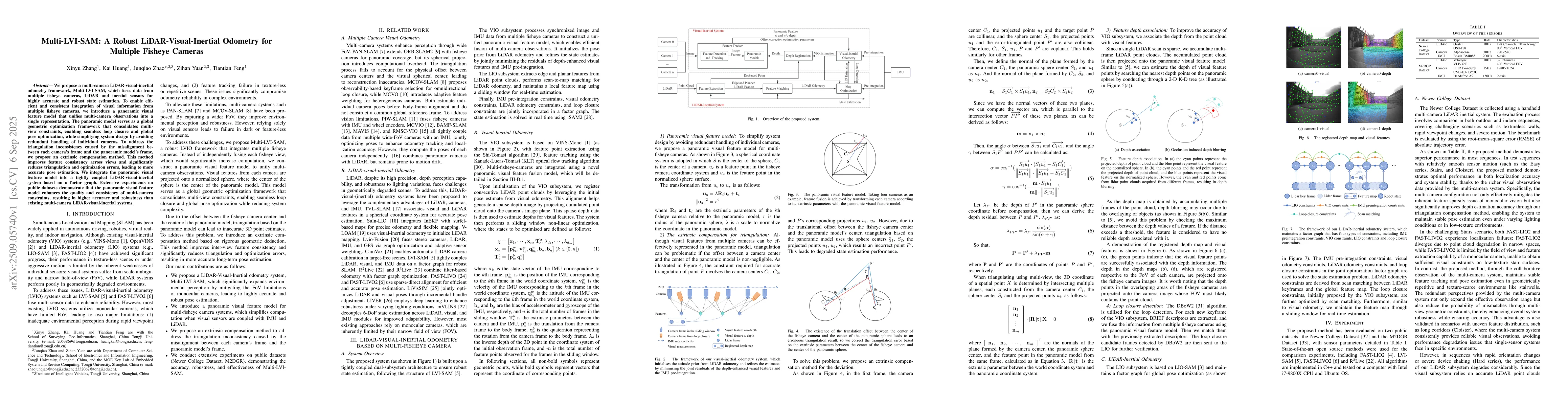
We propose a multi-camera LiDAR-visual-inertial odometry framework, Multi-LVI-SAM, which fuses data from multiple fisheye cameras, LiDAR and inertial sensors for highly accurate and robust state estimation. To enable efficient and consistent integration of visual information from multiple fisheye cameras, we introduce a panoramic visual feature model that unifies multi-camera observations into a single representation. The panoramic model serves as a global geometric optimization framework that consolidates multi-view constraints, enabling seamless loop closure and global pose optimization, while simplifying system design by avoiding redundant handling of individual cameras. To address the triangulation inconsistency caused by the misalignment between each camera's frame and the panoramic model's frame, we propose an extrinsic compensation method. This method improves feature consistency across views and significantly reduces triangulation and optimization errors, leading to more accurate pose estimation. We integrate the panoramic visual feature model into a tightly coupled LiDAR-visual-inertial system based on a factor graph. Extensive experiments on public datasets demonstrate that the panoramic visual feature model enhances the quality and consistency of multi-camera constraints, resulting in higher accuracy and robustness than existing multi-camera LiDAR-visual-inertial systems.
Key Findings, in focus

Seven facets of this paper, analysed and brought into focus by AI.

AI-generated · verify against source Generated Nov 19, 2025
In focus · one-line synthesis

This research advances multi-sensor fusion for robust and high-precision localization in complex environments, enabling reliable navigation in scenarios with poor visual features or sensor failures.

01
MethodologyHow they did it

The paper proposes a multi-camera LiDAR-visual-inertial odometry framework called Multi-LVI-SAM, which integrates data from multiple fisheye cameras, LiDAR, and inertial sensors using a factor graph. It introduces a panoramic visual feature model to unify multi-camera observations into a single representation and employs an extrinsic compensation method to address triangulation inconsistencies.

02
ResultsWhat they found
  • The panoramic visual feature model enhances multi-camera constraint quality and consistency, leading to higher accuracy and robustness compared to existing systems.
  • The extrinsic compensation method significantly reduces triangulation and optimization errors, improving pose estimation accuracy.
  • The proposed method outperforms state-of-the-art methods on public datasets like NewerCollege and M2DGR in most sequences, especially in challenging scenarios like textureless walls and narrow spaces.
03
SignificanceWhy it matters

This research advances multi-sensor fusion for robust and high-precision localization in complex environments, enabling reliable navigation in scenarios with poor visual features or sensor failures.

04
Technical ContributionsWhat's new technically

Development of a tightly coupled multi-sensor fusion framework with a panoramic visual feature model and extrinsic compensation algorithm for accurate LiDAR-visual-inertial odometry.

05
NoveltyWhat sets it apart

The novelty lies in the panoramic visual feature model that unifies multi-fisheye camera observations into a globally consistent representation, combined with an extrinsic compensation method to resolve triangulation inconsistencies caused by sensor misalignment.

06
LimitationsWhat to be cautious about
  • Performance degrades in sequences with rapid orientation changes or severe device shaking.
  • The method relies on LiDAR for depth information, which can be problematic in environments with insufficient LiDAR planar constraints.
  • The computational overhead increases with more cameras, though it remains efficient compared to single-camera systems.
07
Future WorkWhere it goes next
  • Enhancing system robustness in dark environments by leveraging overlapping observations from neighboring cameras.
  • Improving the handling of dynamic objects and scale uncertainty in monocular systems.
  • Exploring more efficient multi-camera feature fusion mechanisms for real-time applications.

Paper Details

Paper ID: 2509.05740
Categories:
cs.CV

How to Cite This Paper

Reference manager: RIS EndNote


Discussion 0

This website uses cookies to ensure you get the best experience. Learn more