Offline map matching involves aligning historical trajectories of mobile
objects, which may have positional errors, with digital maps. This is essential
for applications in intelligent transportation systems (ITS), such as route
analysis and traffic pattern mining. Existing methods have two main
limitations: (i) they assume a uniform Localization Error Distribution (LED)
across urban areas, neglecting environmental factors that lead to suboptimal
path search ranges, and (ii) they struggle to efficiently handle local
non-shortest paths and detours. To address these issues, we propose a novel
offline map matching method for sparse trajectories, called LNSP, which
integrates LED modeling and non-shortest path detection. Key innovations
include: (i) leveraging public transit trajectories with fixed routes to model
LED in finer detail across different city regions, optimizing path search
ranges, and (ii) scoring paths using sub-region dependency LED and a sliding
window, which reduces global map matching errors. Experimental results using
real-world bus and taxi trajectory datasets demonstrate that the LNSP algorithm
significantly outperforms existing methods in both efficiency and matching
accuracy.
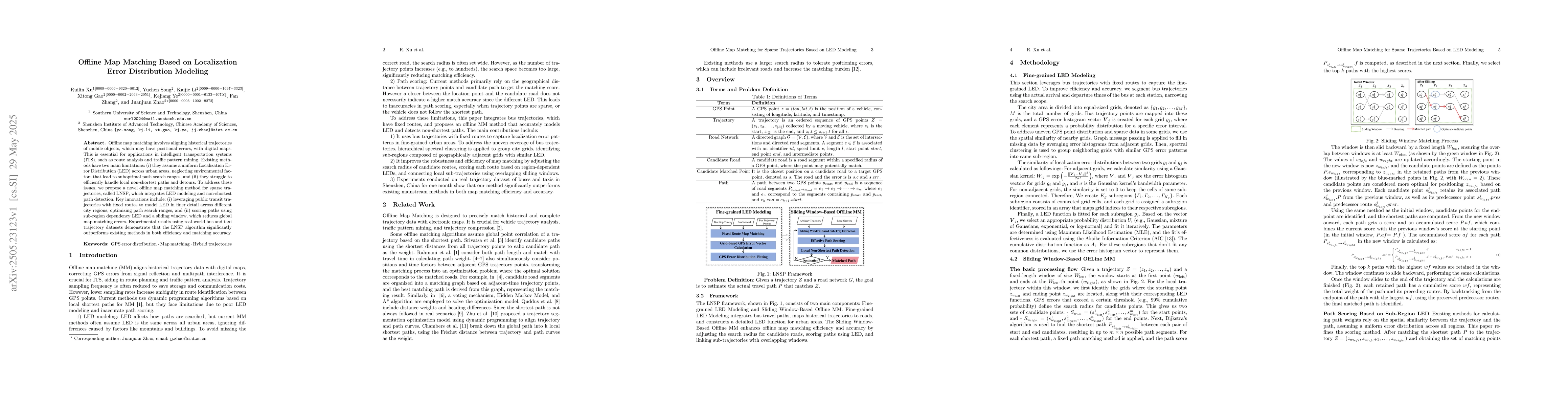
Discussion 0