Publication
Metrics
AI Quick Summary
This paper analyzes existing satellite image recognition models, compares deep learning methods, and identifies challenges in the field. The findings aim to inform the development of a fire recognition model and its integration with a macroeconomic forecasting cognitive model using fuzzy cognitive maps.
Paper Preview
Abstract
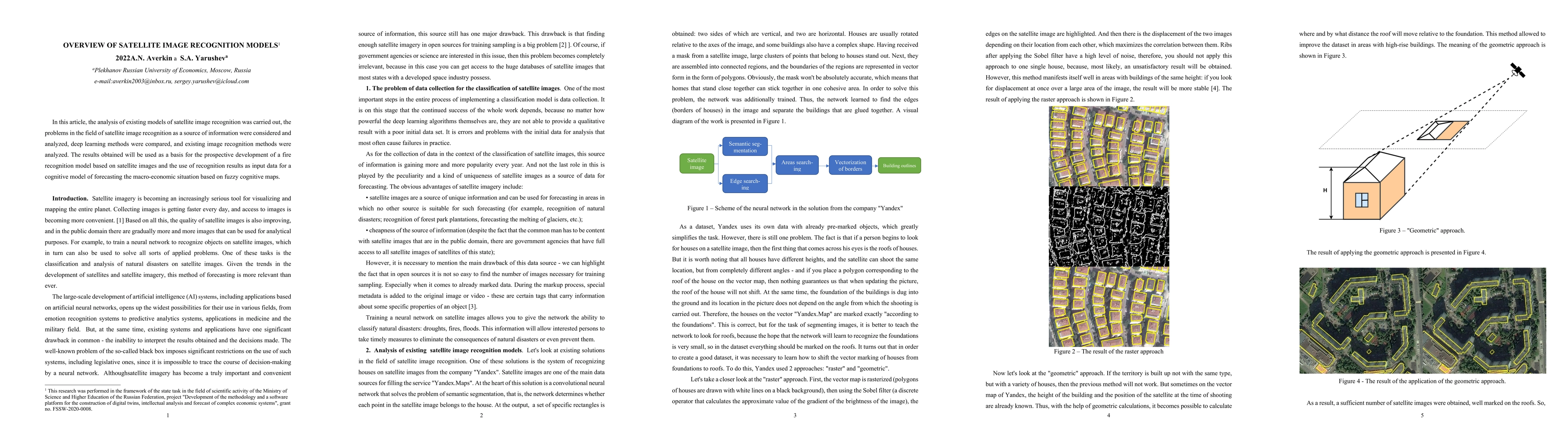
In this article, the analysis of existing models of satellite image recognition was carried out, the problems in the field of satellite image recognition as a source of information were considered and analyzed, deep learning methods were compared, and existing image recognition methods were analyzed. The results obtained will be used as a basis for the prospective development of a fire recognition model based on satellite images and the use of recognition results as input data for a cognitive model of forecasting the macro-economic situation based on fuzzy cognitive maps.
AI Key Findings
Get AI-generated insights about this paper's methodology, results, significance, and more — seven facets brought into focus.
Impact
Paper Details
Authors
PDF Preview
Key Terms
Citation Network
Current paper (gray), citations (green), references (blue)
Display is limited for performance on very large graphs.
Discussion 0