PyGALAX: An Open-Source Python Toolkit for Advanced Explainable Geospatial Machine Learning
Publication
Metrics
Paper Preview
Abstract
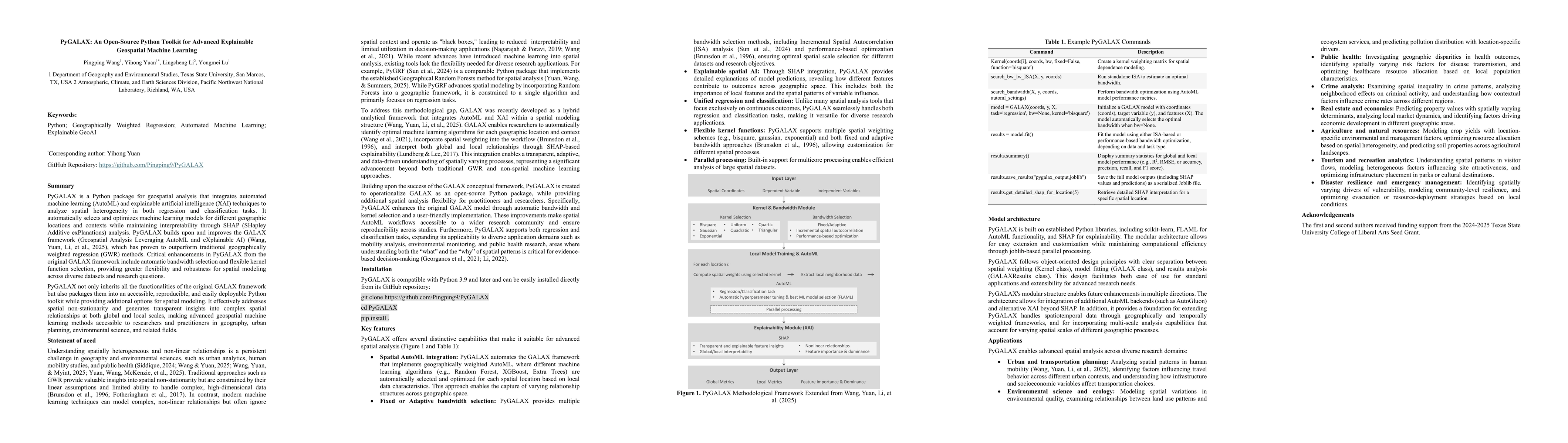
PyGALAX is a Python package for geospatial analysis that integrates automated machine learning (AutoML) and explainable artificial intelligence (XAI) techniques to analyze spatial heterogeneity in both regression and classification tasks. It automatically selects and optimizes machine learning models for different geographic locations and contexts while maintaining interpretability through SHAP (SHapley Additive exPlanations) analysis. PyGALAX builds upon and improves the GALAX framework (Geospatial Analysis Leveraging AutoML and eXplainable AI), which has proven to outperform traditional geographically weighted regression (GWR) methods. Critical enhancements in PyGALAX from the original GALAX framework include automatic bandwidth selection and flexible kernel function selection, providing greater flexibility and robustness for spatial modeling across diverse datasets and research questions. PyGALAX not only inherits all the functionalities of the original GALAX framework but also packages them into an accessible, reproducible, and easily deployable Python toolkit while providing additional options for spatial modeling. It effectively addresses spatial non-stationarity and generates transparent insights into complex spatial relationships at both global and local scales, making advanced geospatial machine learning methods accessible to researchers and practitioners in geography, urban planning, environmental science, and related fields.
AI Key Findings
Get AI-generated insights about this paper's methodology, results, significance, and more — seven facets brought into focus.
Discussion 0