Academic Profile
Statistics
Similar Authors
Papers on arXiv
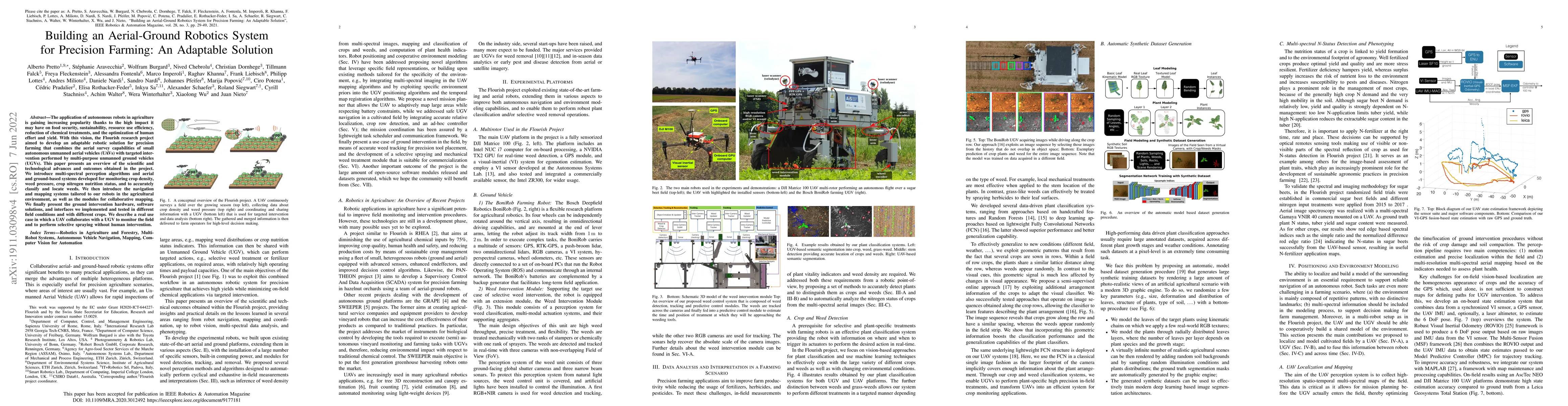
The application of autonomous robots in agriculture is gaining increasing popularity thanks to the high impact it may have on food security, sustainability, resource use efficiency, reduction of che...
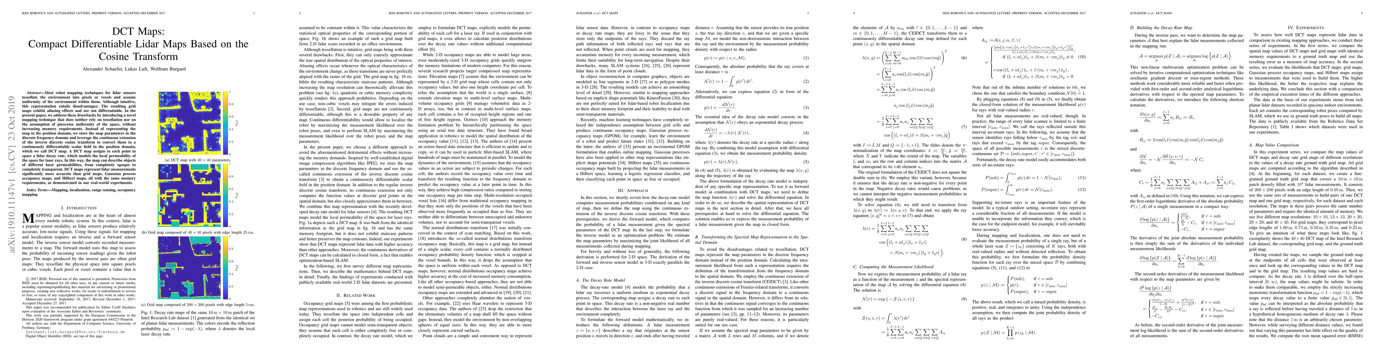
Most robot mapping techniques for lidar sensors tessellate the environment into pixels or voxels and assume uniformity of the environment within them. Although intuitive, this representation entails...
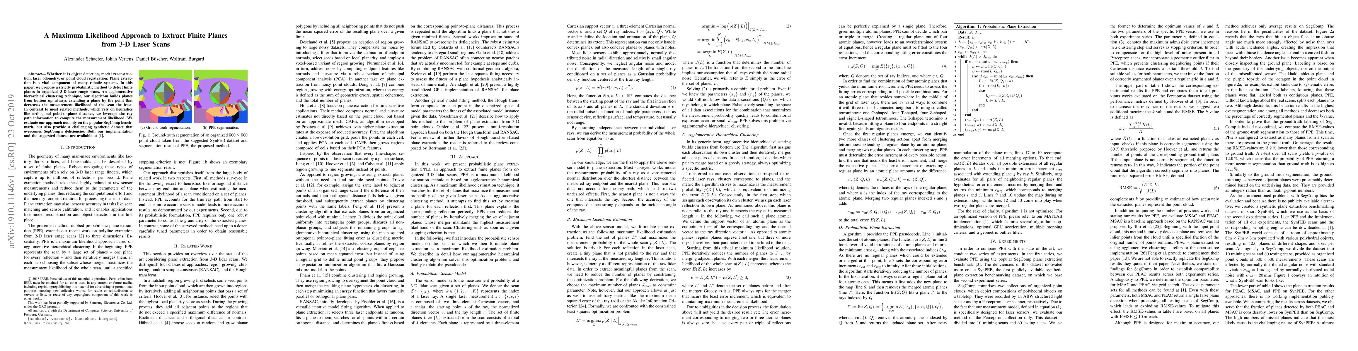
Whether it is object detection, model reconstruction, laser odometry, or point cloud registration: Plane extraction is a vital component of many robotic systems. In this paper, we propose a strictly...
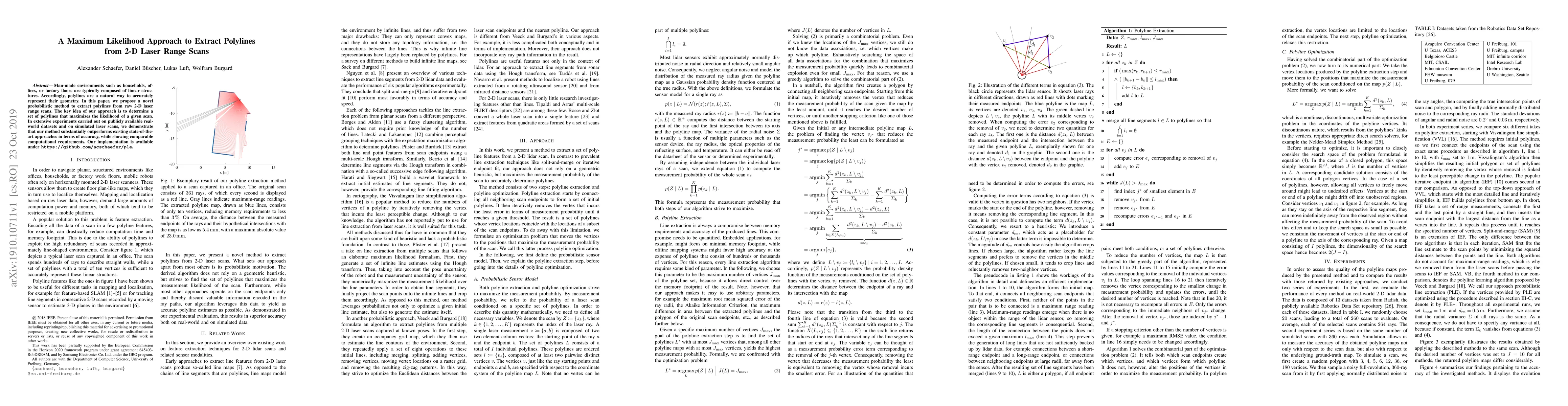
Man-made environments such as households, offices, or factory floors are typically composed of linear structures. Accordingly, polylines are a natural way to accurately represent their geometry. In ...
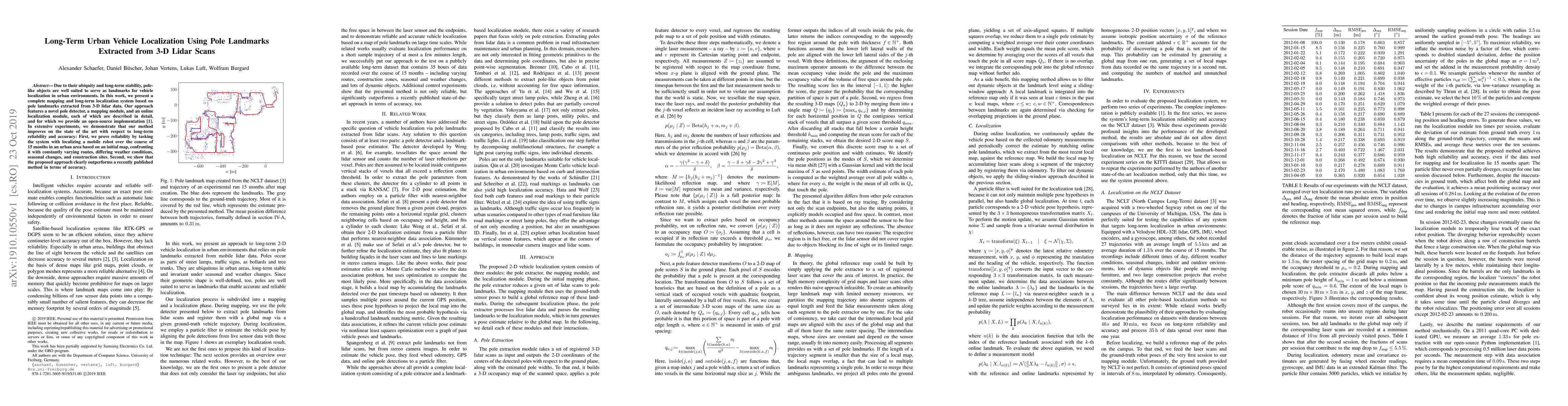
Due to their ubiquity and long-term stability, pole-like objects are well suited to serve as landmarks for vehicle localization in urban environments. In this work, we present a complete mapping and...
A popular class of lidar-based grid mapping algorithms computes for each map cell the probability that it reflects an incident laser beam. These algorithms typically determine the map as the set of ...
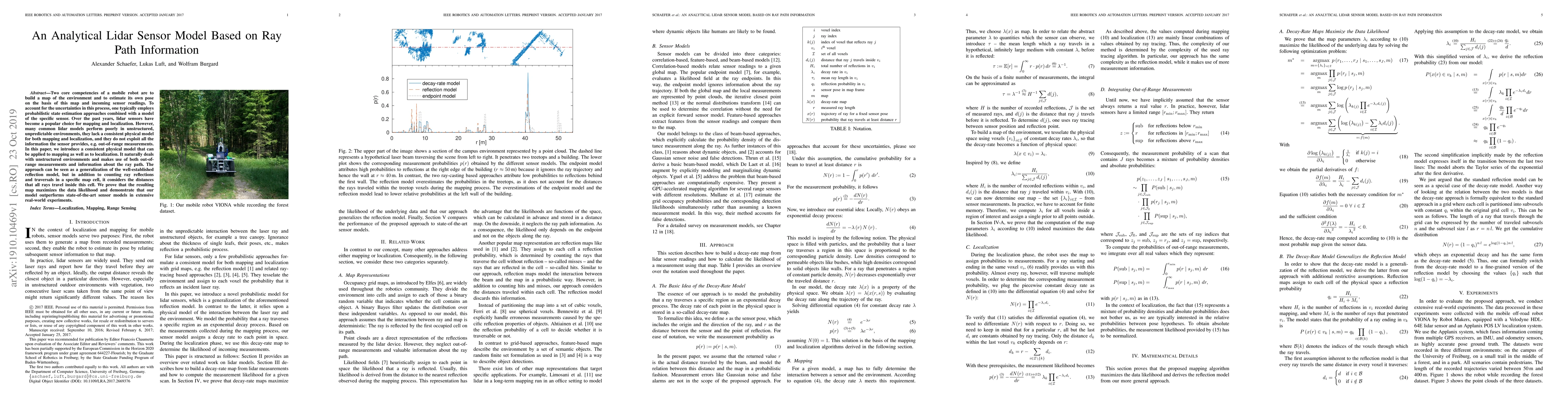
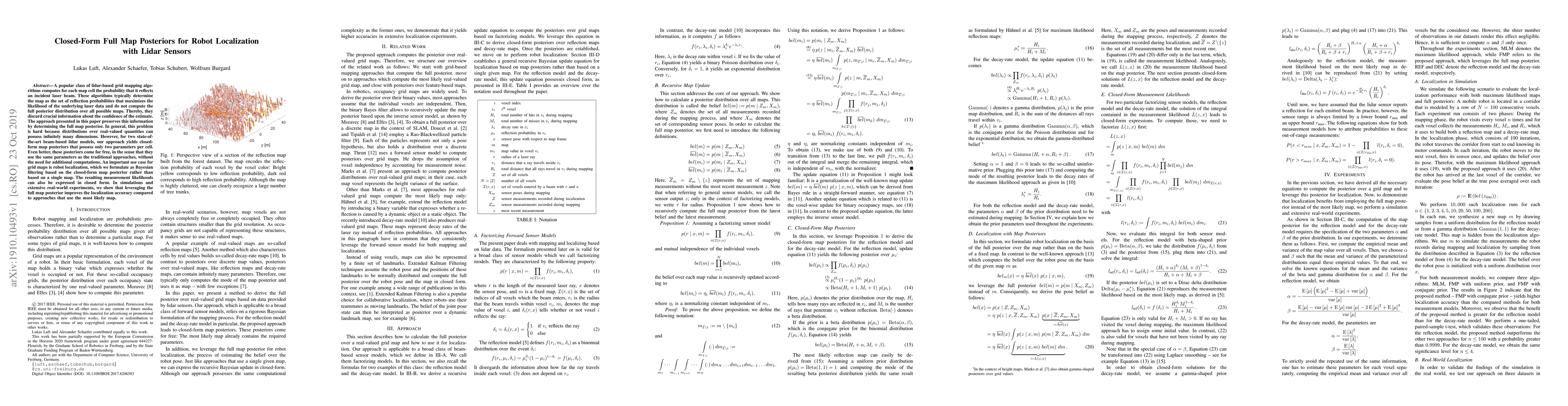
Two core competencies of a mobile robot are to build a map of the environment and to estimate its own pose on the basis of this map and incoming sensor readings. To account for the uncertainties in ...
Generating high-quality code remains a challenge for Large Language Models (LLMs). For the evolution of reasoning models on this task, reward models are a necessary intermediate step. These models jud...