Academic Profile
Statistics
Similar Authors
Papers on arXiv
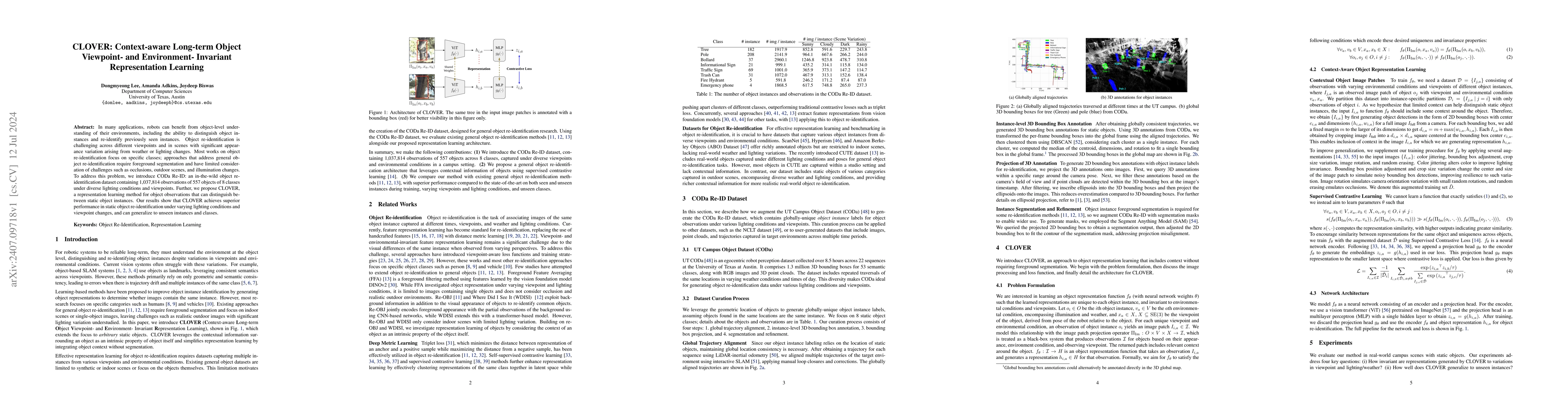
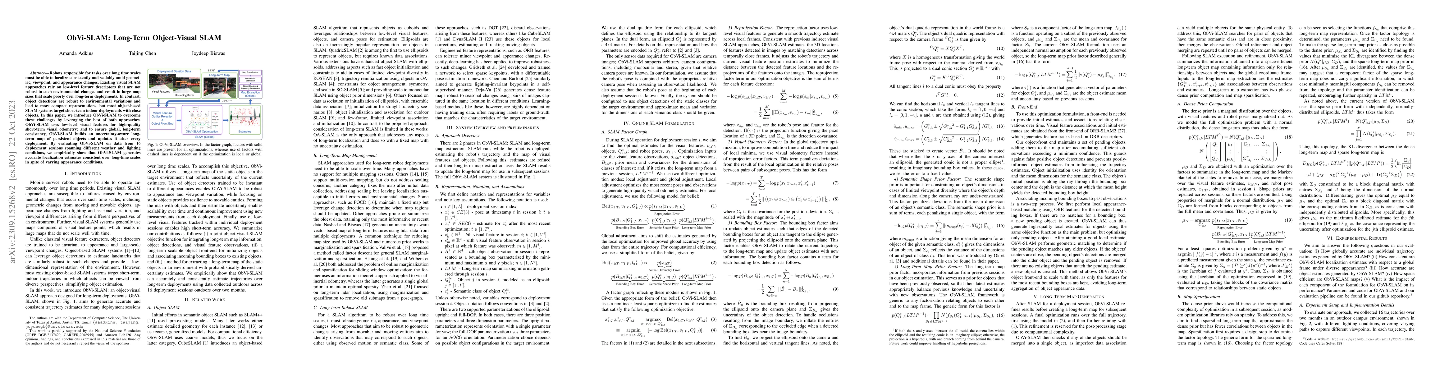
In many applications, robots can benefit from object-level understanding of their environments, including the ability to distinguish object instances and re-identify previously seen instances. Object ...
Robots responsible for tasks over long time scales must be able to localize consistently and scalably amid geometric, viewpoint, and appearance changes. Existing visual SLAM approaches rely on low-l...
Robots deployed in settings such as warehouses and parking lots must cope with frequent and substantial changes when localizing in their environments. While many previous localization and mapping al...
Robust cross-view 3-DoF localization in GPS-denied, off-road environments remains challenging due to (1) perceptual ambiguities from repetitive vegetation and unstructured terrain, and (2) seasonal sh...
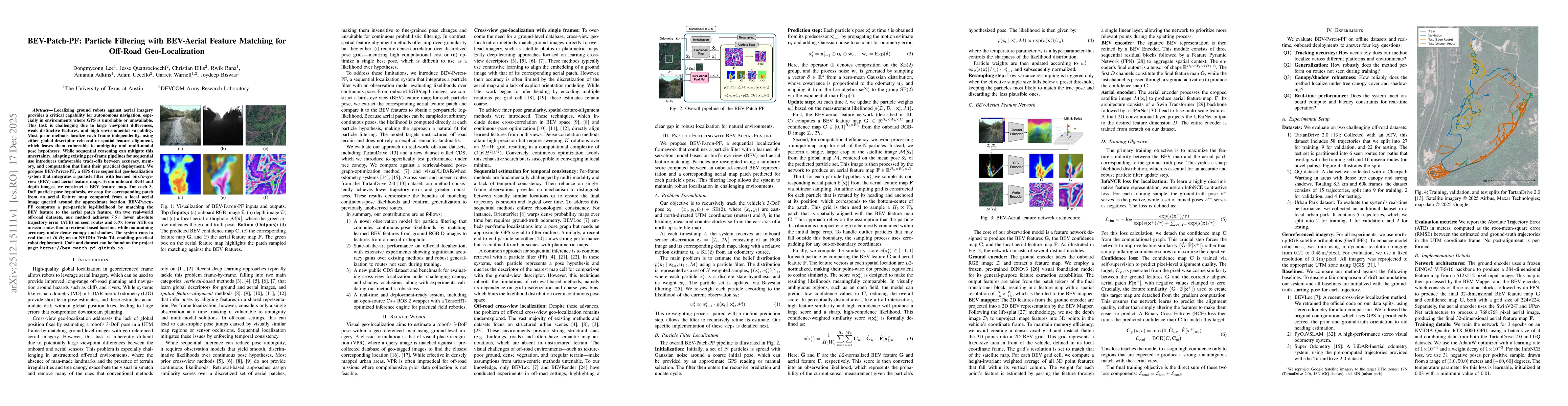
We propose BEV-Patch-PF, a GPS-free sequential geo-localization system that integrates a particle filter with learned bird's-eye-view (BEV) and aerial feature maps. From onboard RGB and depth images, ...
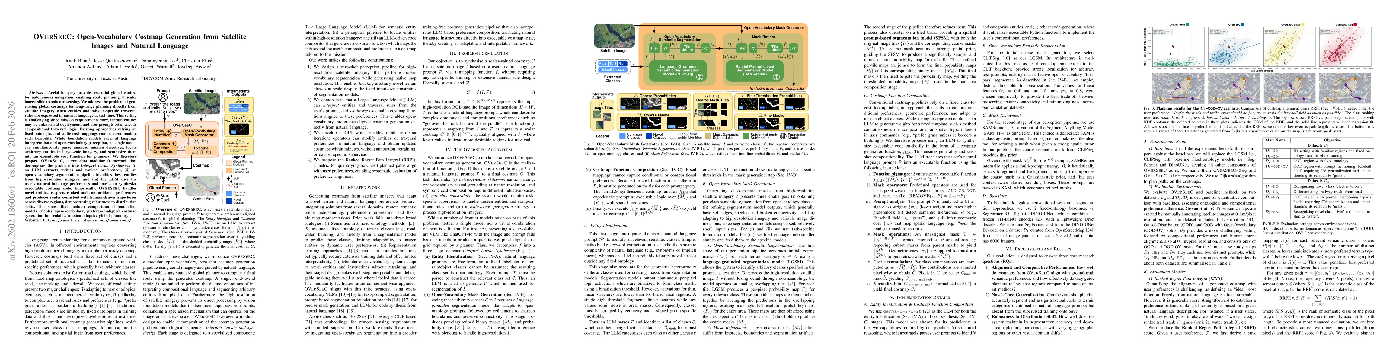
Aerial imagery provides essential global context for autonomous navigation, enabling route planning at scales inaccessible to onboard sensing. We address the problem of generating global costmaps for ...
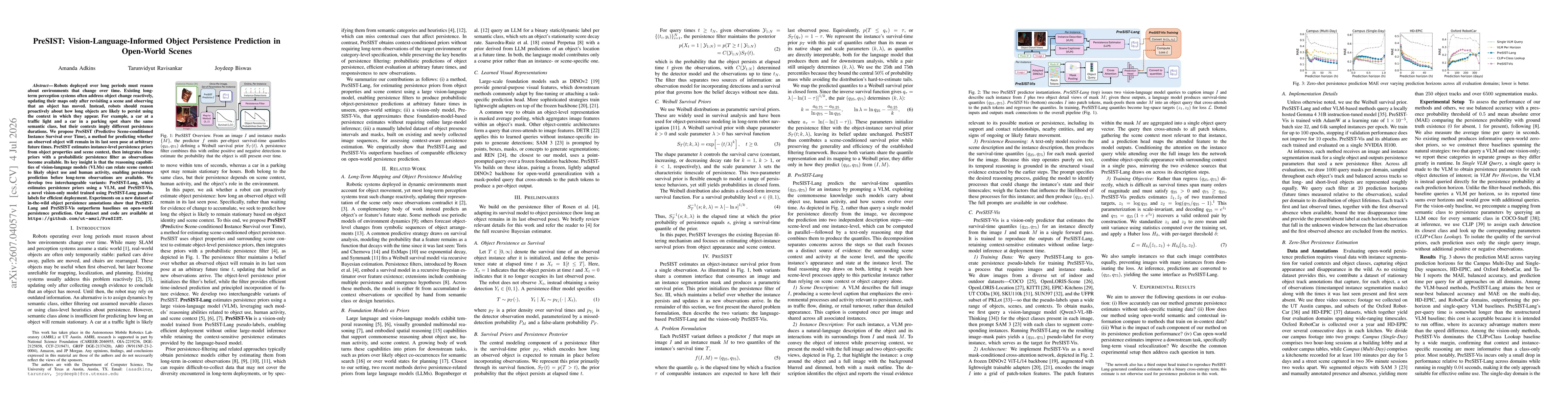
Robots deployed over long periods must reason about environments that change over time. Existing long-term perception systems often address object change reactively, updating their maps only after rev...