Academic Profile
Statistics
Similar Authors
Papers on arXiv
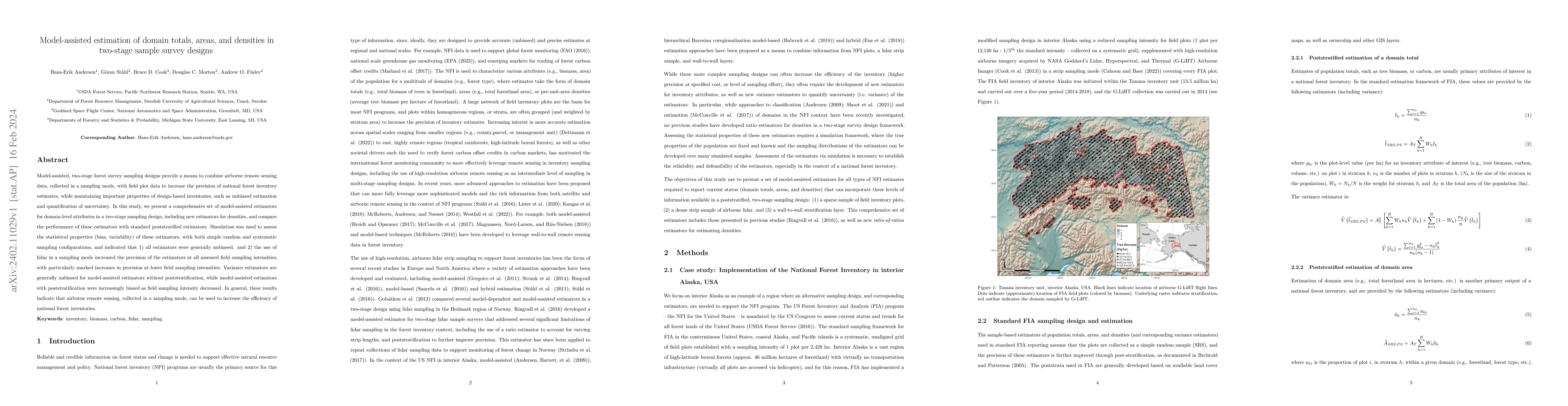
Model-assisted, two-stage forest survey sampling designs provide a means to combine airborne remote sensing data, collected in a sampling mode, with field plot data to increase the precision of nati...
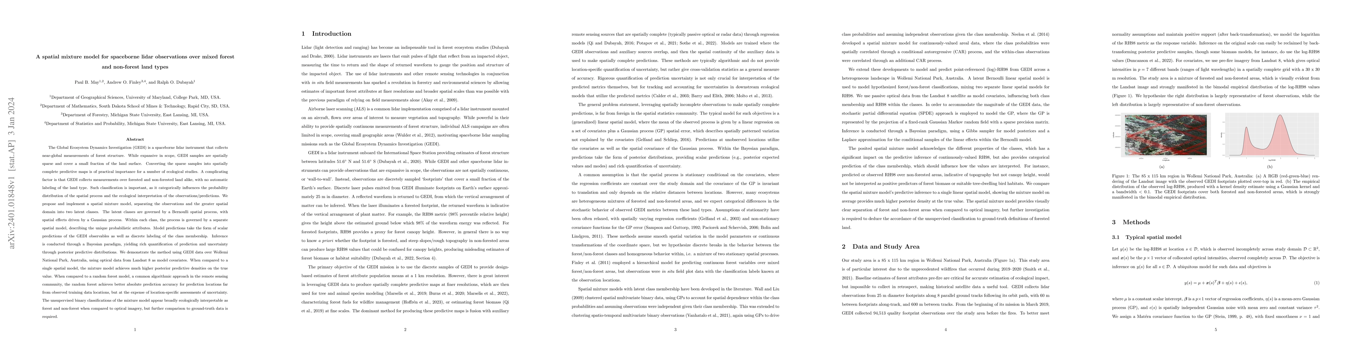
The Global Ecosystem Dynamics Investigation (GEDI) is a spaceborne lidar instrument that collects near-global measurements of forest structure. While expansive in scope, GEDI samples are spatially s...
Incompatible spatial data modeling is a pervasive challenge in remote sensing data analysis that involves field data. Typical approaches to addressing this challenge aggregate information to a coars...
A spatial distributional regression model is presented to predict the forest structural diversity in terms of the distributions of the stem diameter at breast height (DBH) in the protection forests ...
Numerous modeling techniques exist to estimate abundance of plant and wildlife species. These methods seek to estimate abundance while accounting for multiple complexities found in ecological data, ...
Occupancy models are frequently used by ecologists to quantify spatial variation in species distributions while accounting for observational biases in the collection of detection-nondetection data. ...
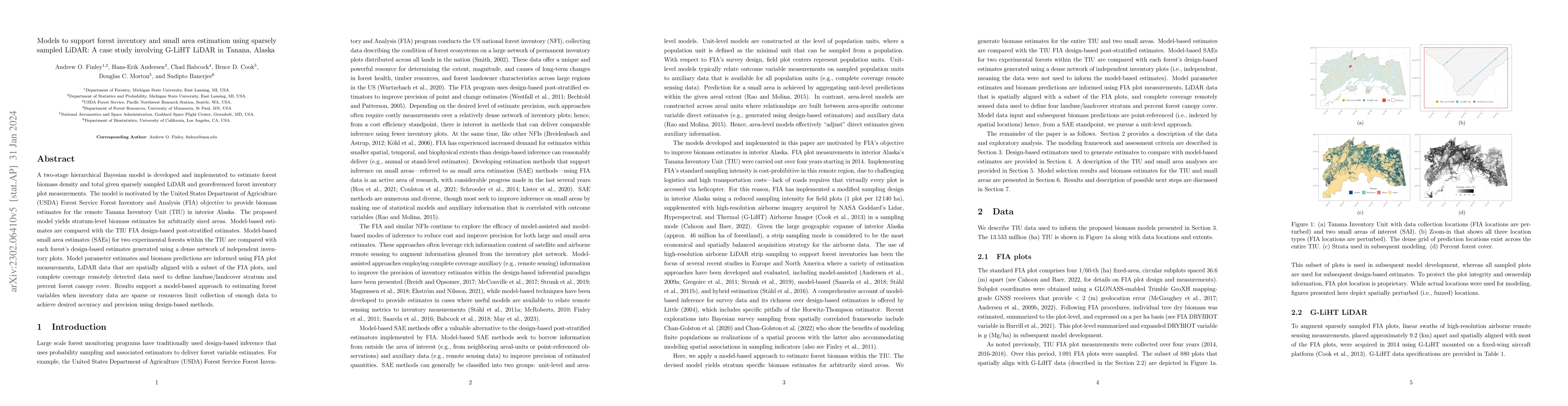
A two-stage hierarchical Bayesian model is developed and implemented to estimate forest biomass density and total given sparsely sampled LiDAR and georeferenced forest inventory plot measurements. T...
Species distribution models (SDMs) are increasingly applied across macroscales. Such models typically assume that a single set of regression coefficients can adequately describe species-environment ...
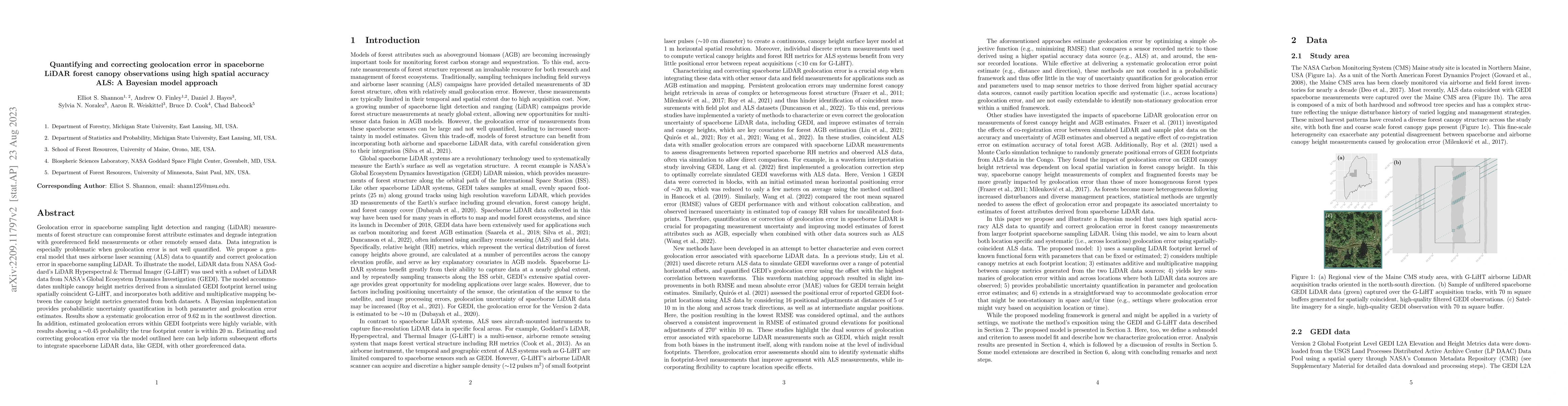
Geolocation error in spaceborne sampling light detection and ranging (LiDAR) measurements of forest structure can compromise forest attribute estimates and degrade integration with georeferenced fie...
Determining spatial distributions of species and communities are key objectives of ecology and conservation. Joint species distribution models use multi-species detection-nondetection data to estima...
Occupancy modeling is a common approach to assess spatial and temporal species distribution patterns, while explicitly accounting for measurement errors common in detection-nondetection data. Numero...
The United States (US) Forest Service Forest Inventory and Analysis (FIA) program operates the national forest inventory of the US. Traditionally, the FIA program has relied on sample-based approach...
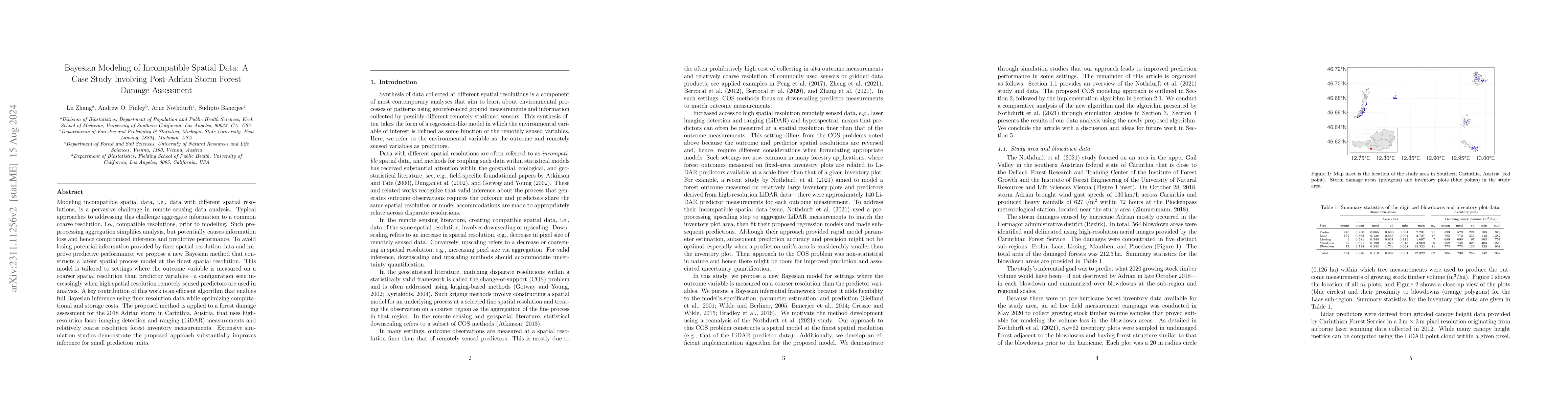
A spatial regression model framework is presented to predict growing stock volume loss due to storm Adrian which caused heavy forest damage in the upper Gail valley in Carinthia, Austria, in October...
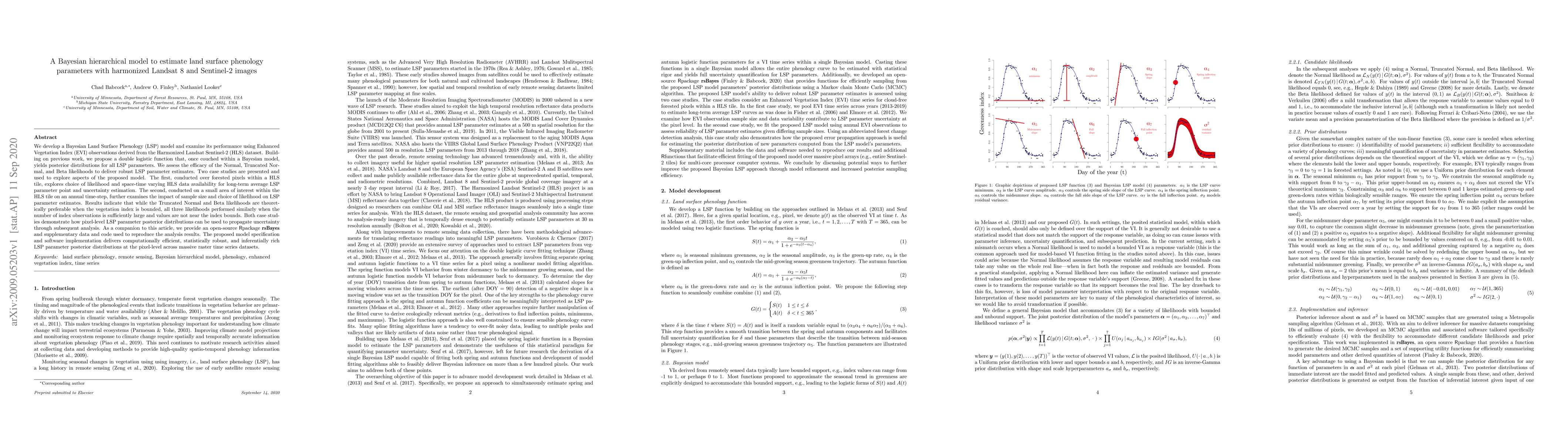
We develop a Bayesian Land Surface Phenology (LSP) model and examine its performance using Enhanced Vegetation Index (EVI) observations derived from the Harmonized Landsat Sentinel-2 (HLS) dataset. ...
This paper describes and illustrates functionality of the spNNGP R package. The package provides a suite of spatial regression models for Gaussian and non-Gaussian point-referenced outcomes that are...
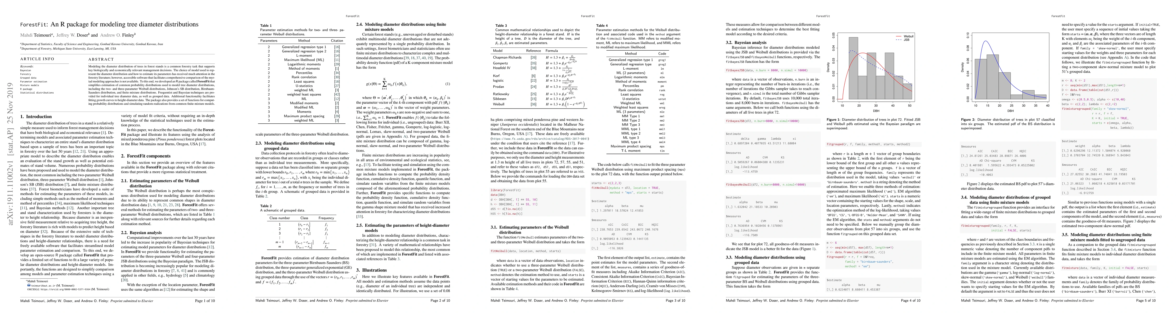
Modeling the diameter distribution of trees in forest stands is a common forestry task that supports key biologically and economically relevant management decisions. The choice of model used to repr...
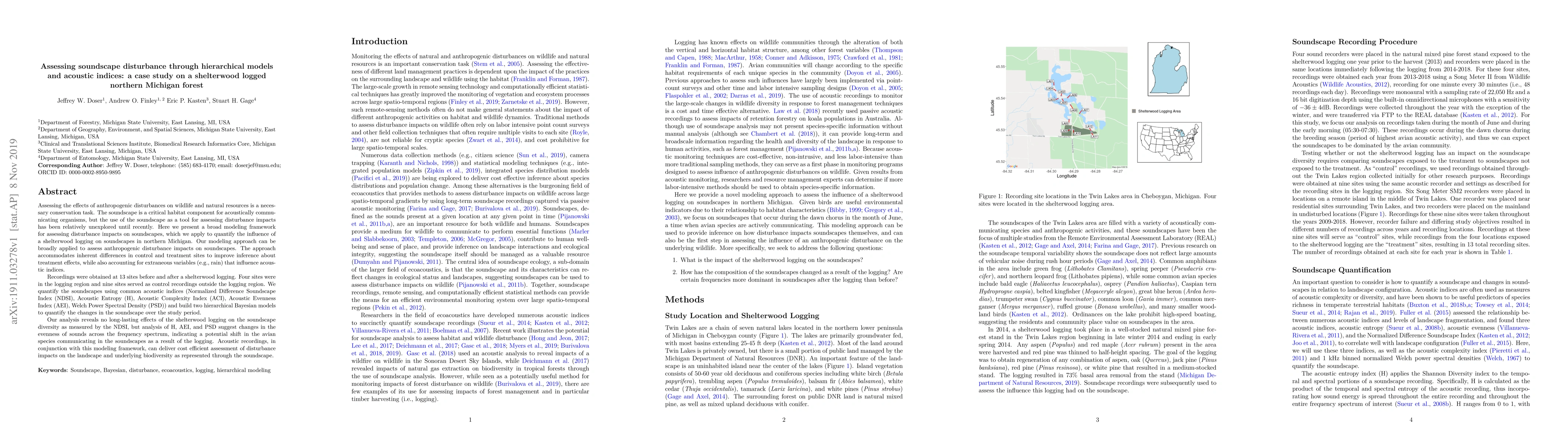
Assessing the effects of anthropogenic disturbances on wildlife is a necessary conservation task. The soundscape is a critical habitat component for acoustically communicating organisms, but the use...
A key challenge in spatial statistics is the analysis for massive spatially-referenced data sets. Such analyses often proceed from Gaussian process specifications that can produce rich and robust in...
This paper describes and illustrates new functionality for fitting spatially varying coefficients models in the spBayes (version 0.4-2) R package. The new spSVC function uses a computationally effic...
Spatially explicit quantification of forest biomass is important for forest-health monitoring and carbon accounting. Direct field measurements of biomass are laborious and expensive, typically limitin...
National Forest Inventory (NFI) programs can provide vital information on the status, trend, and change in forest parameters. These programs are being increasingly asked to provide forest parameter es...
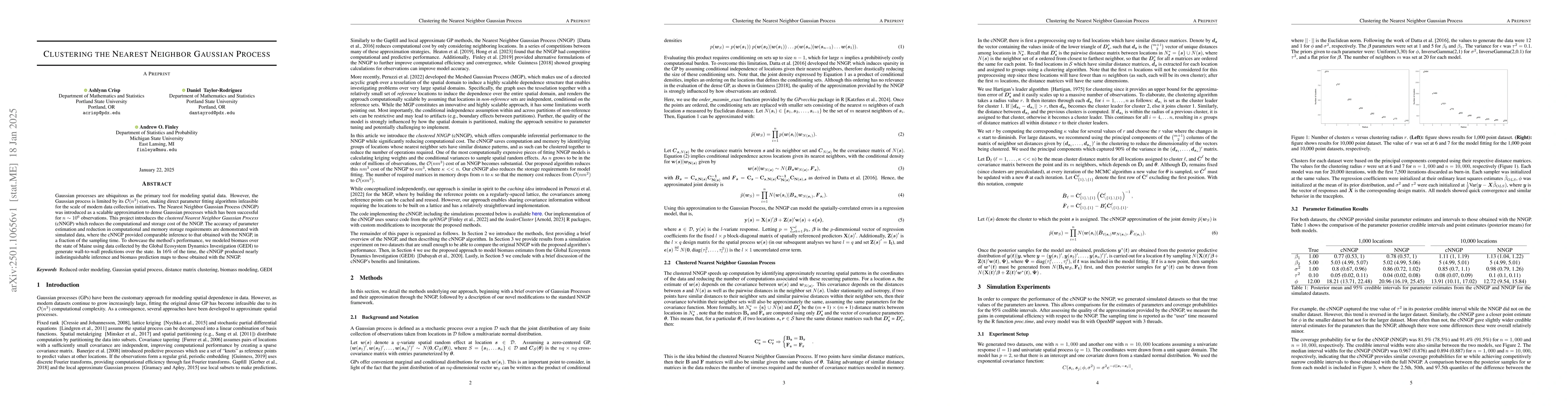
Gaussian processes are ubiquitous as the primary tool for modeling spatial data. However, the Gaussian process is limited by its $\mathcal{O}(n^3)$ cost, making direct parameter fitting algorithms inf...
National Forest Inventories (NFIs) provide statistically reliable information on forest resources at national and other large spatial scales. As forest management and conservation needs become increas...
The USDA Forest Inventory and Analysis (FIA) program conducts a national forest inventory for the United States through a network of permanent field plots. FIA produces estimates of area averages/tota...
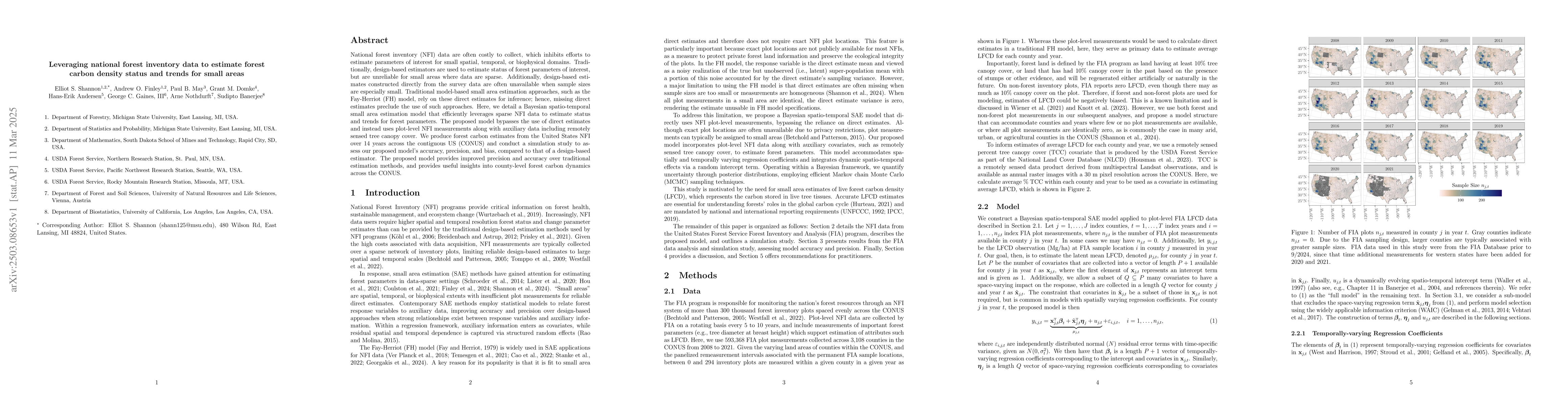
National forest inventory (NFI) data are often costly to collect, which inhibits efforts to estimate parameters of interest for small spatial, temporal, or biophysical domains. Traditionally, design-b...
National Forest Inventory (NFI) data are typically limited to sparse networks of sample locations due to cost constraints. While traditional design-based estimators provide reliable forest parameter e...
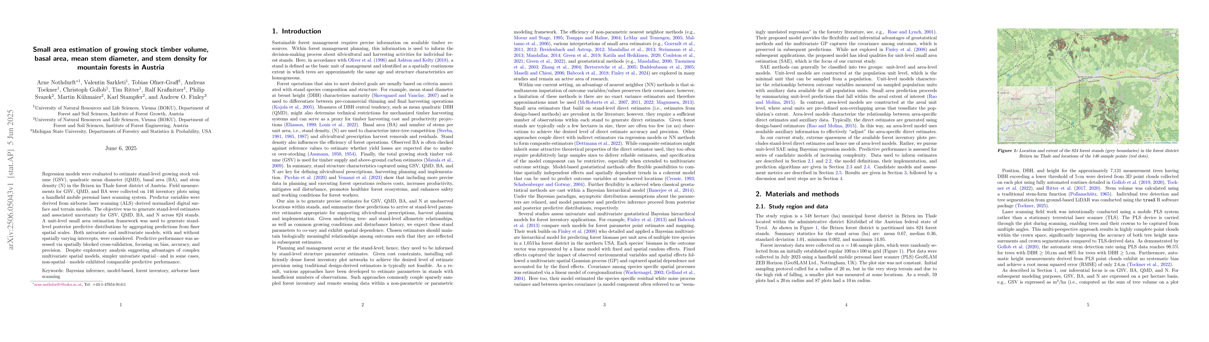
Regression models were evaluated to estimate stand-level growing stock volume (GSV), quadratic mean diameter (QMD), basal area (BA), and stem density (N) in the Brixen im Thale forest district of Aust...
stLMM is an R package for Bayesian linear mixed models with spatial, temporal, and space-time latent effects. It provides a common formula interface for independent and identically distributed (iid) g...