Academic Profile
Statistics
Similar Authors
Papers on arXiv
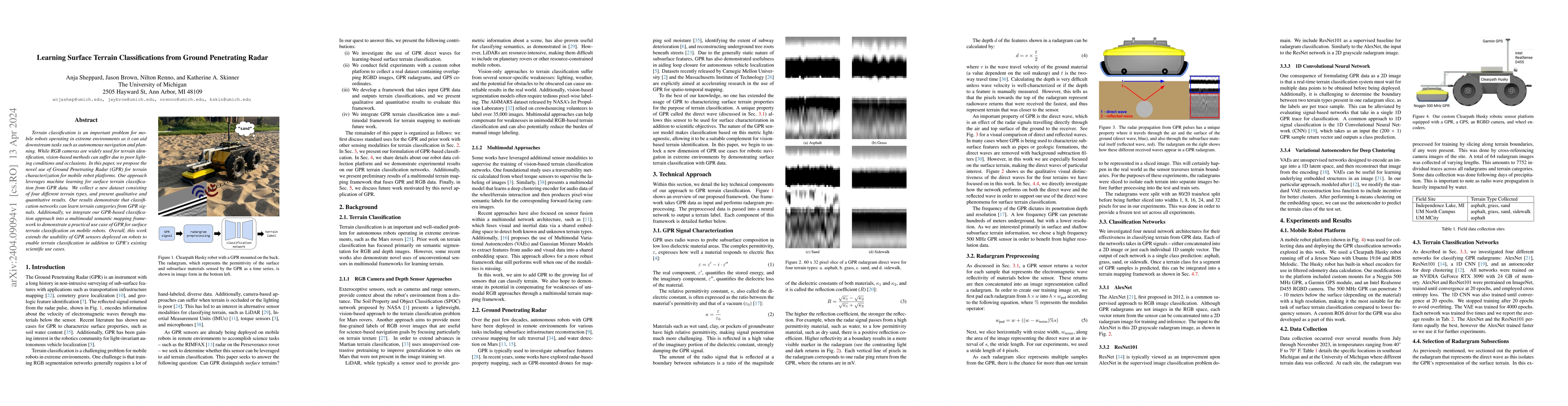
Terrain classification is an important problem for mobile robots operating in extreme environments as it can aid downstream tasks such as autonomous navigation and planning. While RGB cameras are wi...
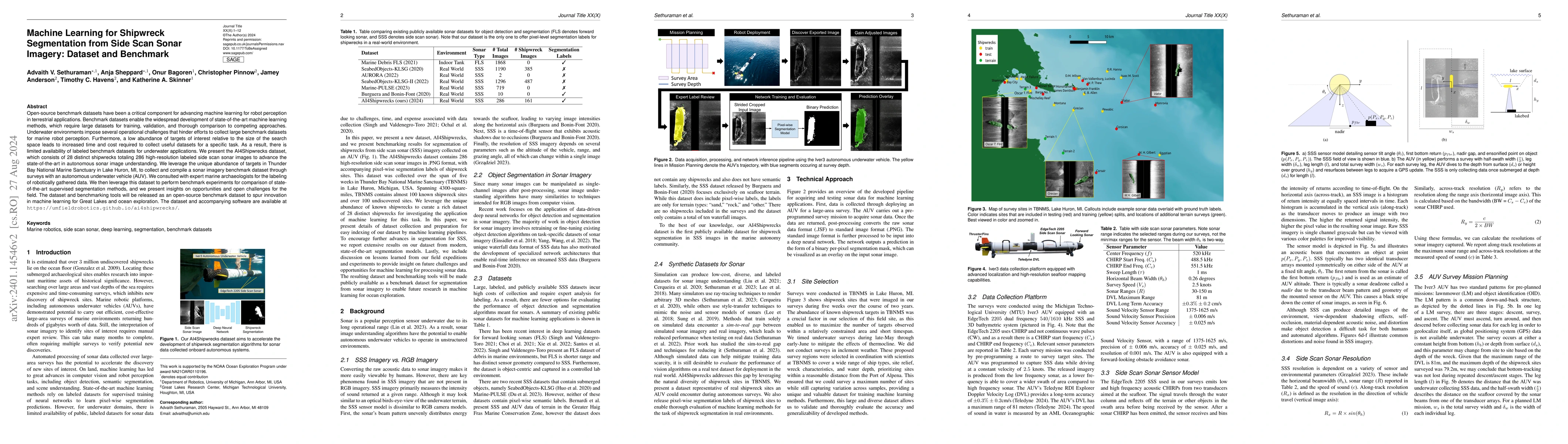
Open-source benchmark datasets have been a critical component for advancing machine learning for robot perception in terrestrial applications. Benchmark datasets enable the widespread development of...
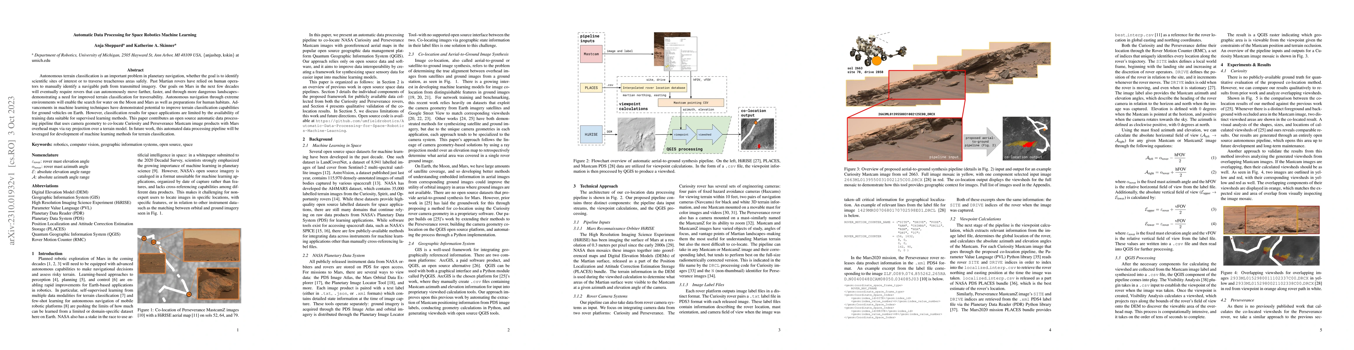
Autonomous terrain classification is an important problem in planetary navigation, whether the goal is to identify scientific sites of interest or to traverse treacherous areas safely. Past Martian ...
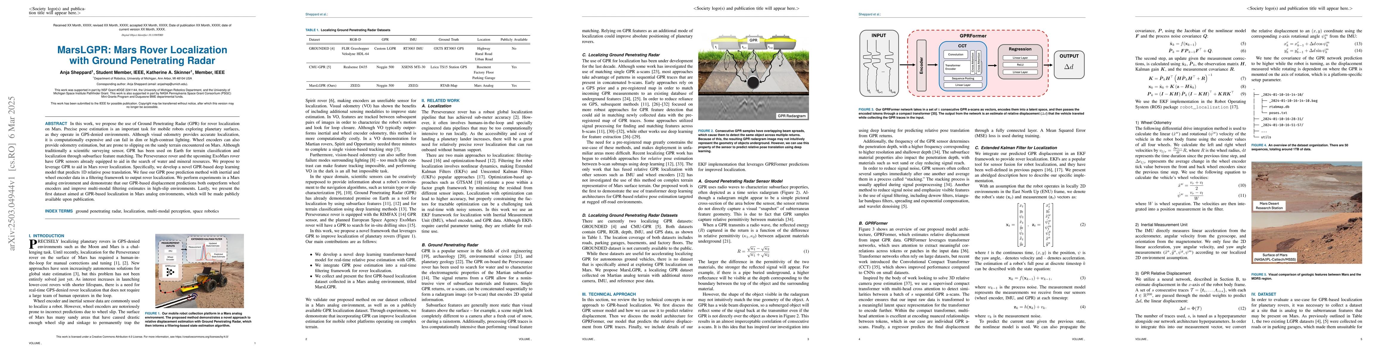
In this work, we propose the use of Ground Penetrating Radar (GPR) for rover localization on Mars. Precise pose estimation is an important task for mobile robots exploring planetary surfaces, as they ...
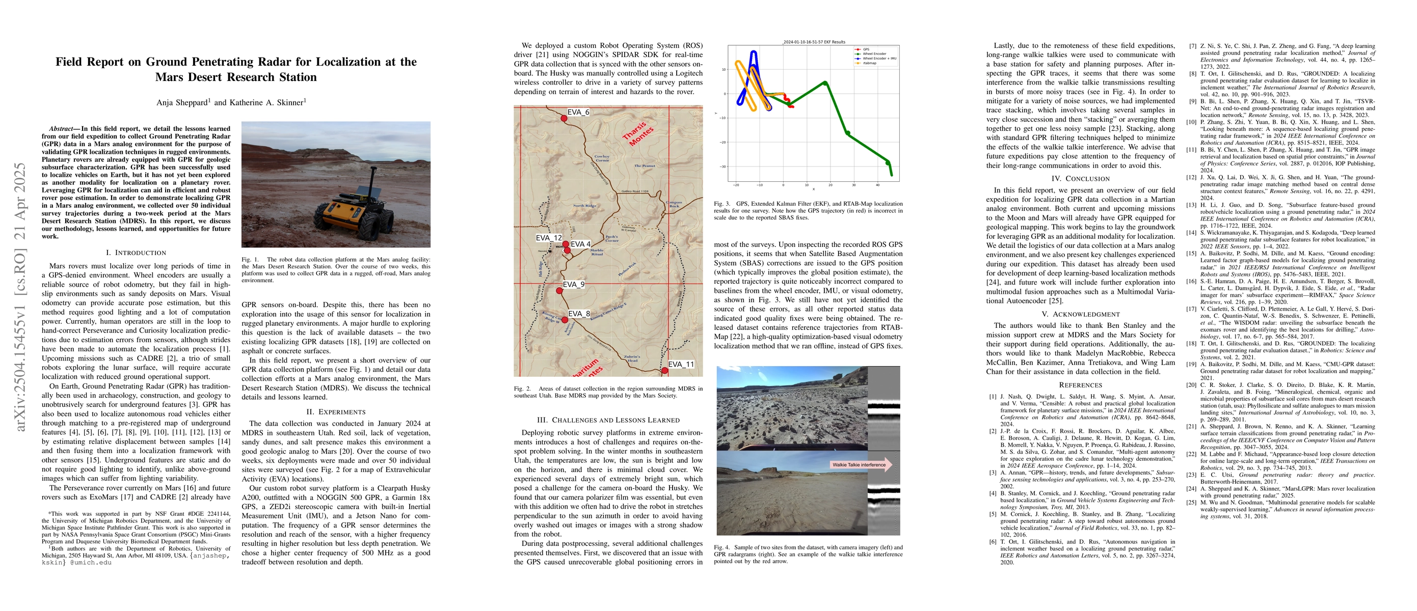
In this field report, we detail the lessons learned from our field expedition to collect Ground Penetrating Radar (GPR) data in a Mars analog environment for the purpose of validating GPR localization...
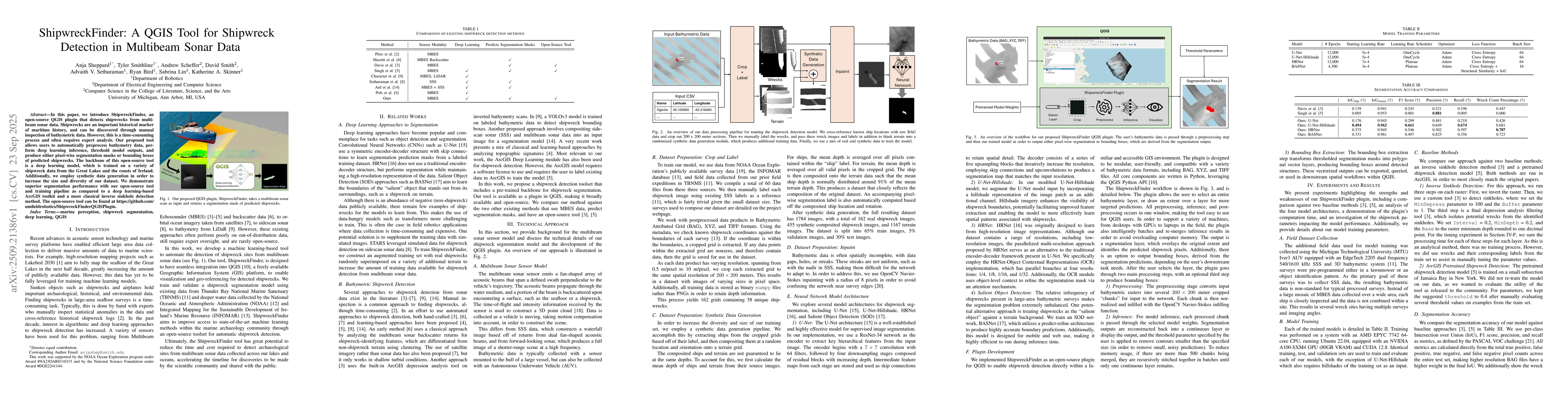
In this paper, we introduce ShipwreckFinder, an open-source QGIS plugin that detects shipwrecks from multibeam sonar data. Shipwrecks are an important historical marker of maritime history, and can be...
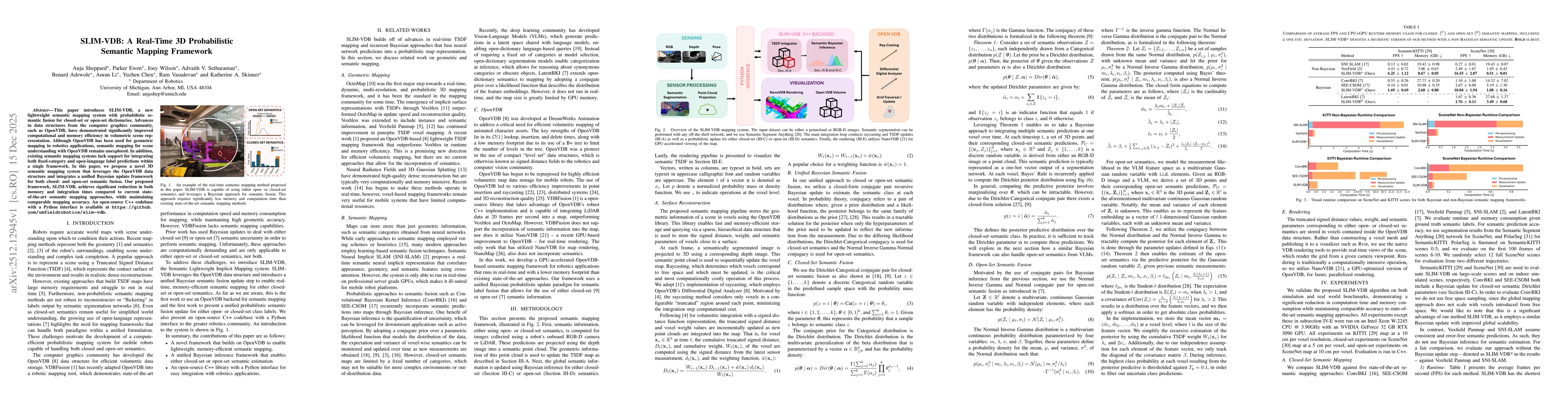
This paper introduces SLIM-VDB, a new lightweight semantic mapping system with probabilistic semantic fusion for closed-set or open-set dictionaries. Advances in data structures from the computer grap...
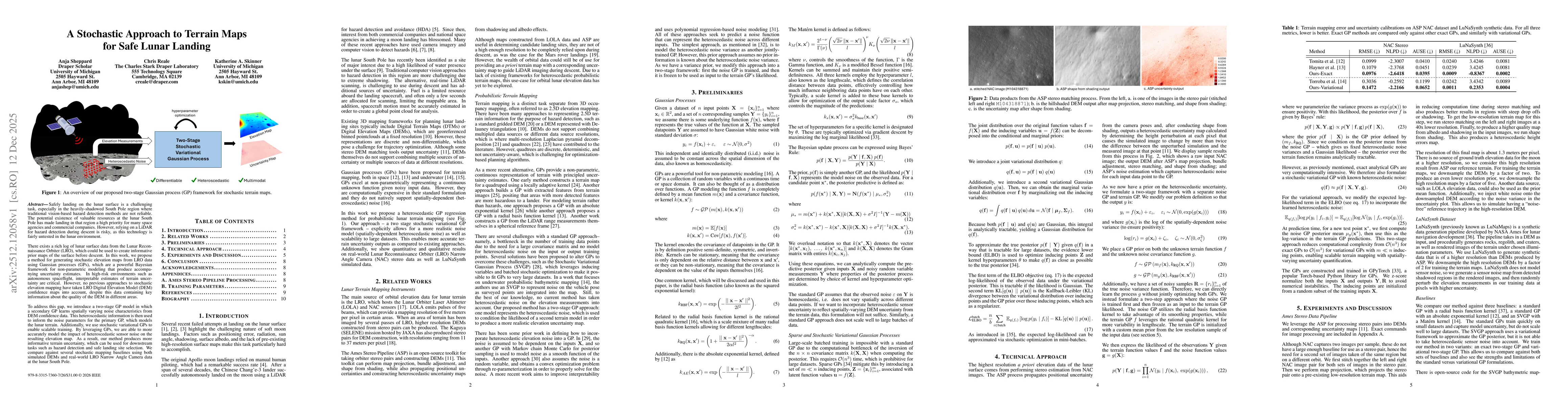
Safely landing on the lunar surface is a challenging task, especially in the heavily-shadowed South Pole region where traditional vision-based hazard detection methods are not reliable. The potential ...
Localization and mapping are core perceptual capabilities for underwater robots. Stereo cameras provide a low-cost means of directly estimating metric depth to support these tasks. However, despite re...