Academic Profile
Statistics
Similar Authors
Papers on arXiv
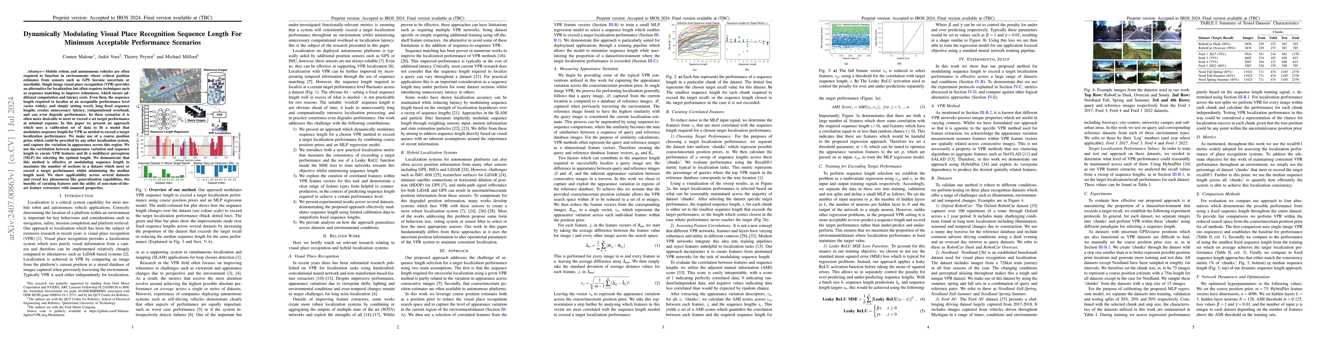
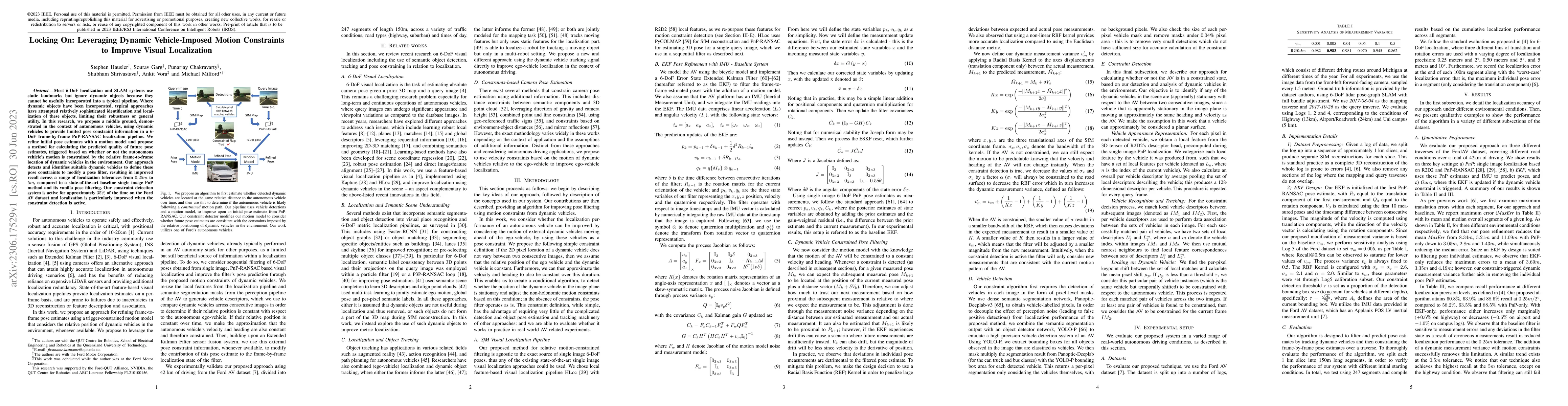
Mobile robots and autonomous vehicles are often required to function in environments where critical position estimates from sensors such as GPS become uncertain or unreliable. Single image visual plac...
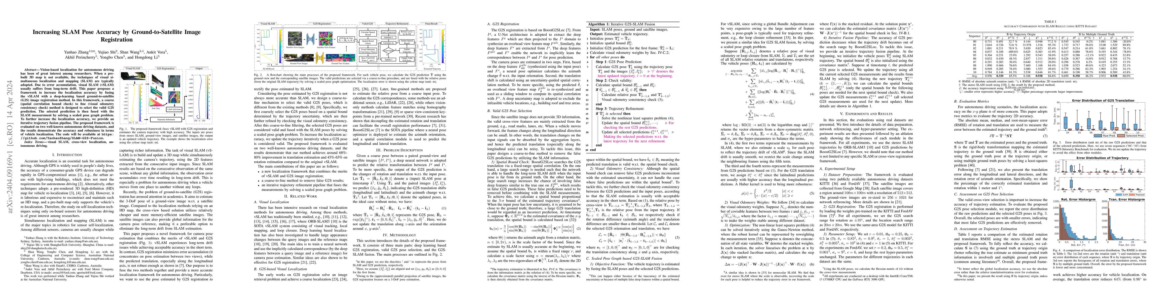
Vision-based localization for autonomous driving has been of great interest among researchers. When a pre-built 3D map is not available, the techniques of visual simultaneous localization and mappin...
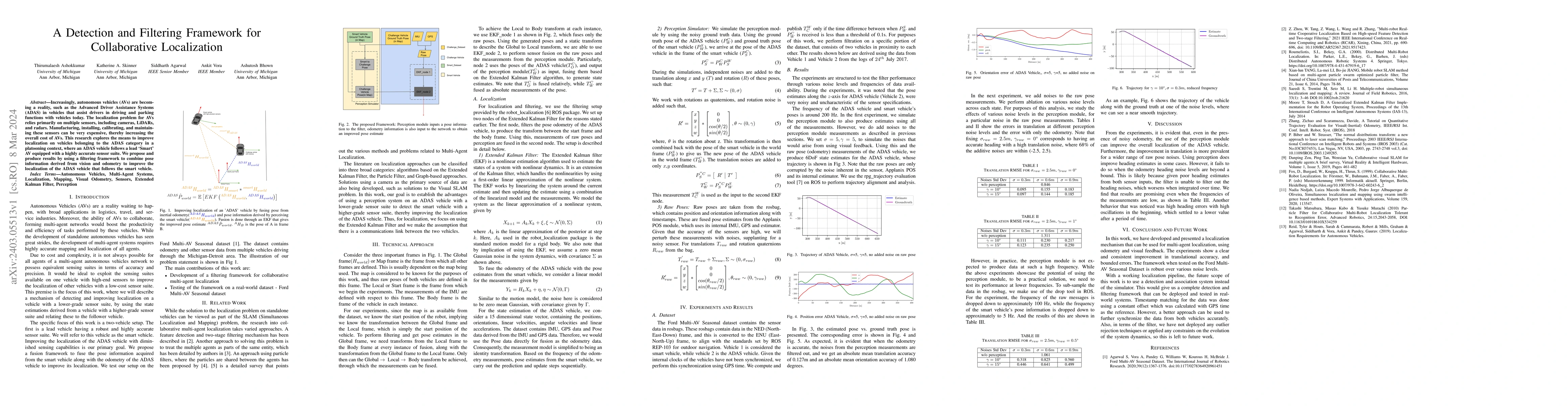
Increasingly, autonomous vehicles (AVs) are becoming a reality, such as the Advanced Driver Assistance Systems (ADAS) in vehicles that assist drivers in driving and parking functions with vehicles t...
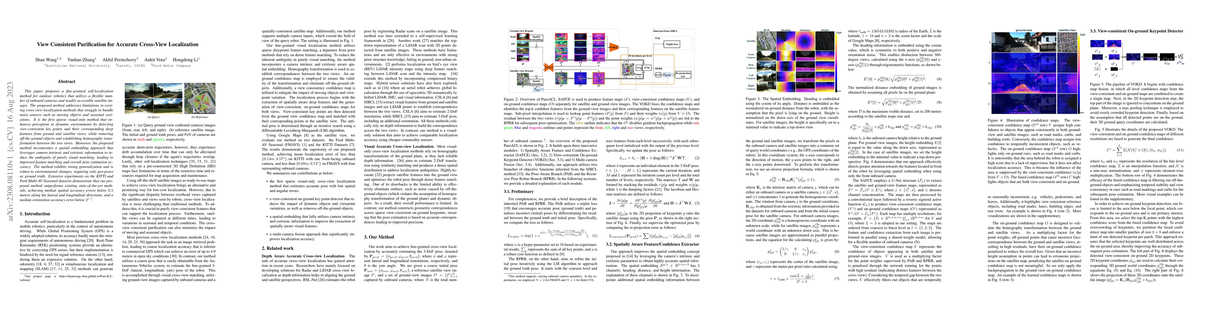
This paper proposes a fine-grained self-localization method for outdoor robotics that utilizes a flexible number of onboard cameras and readily accessible satellite images. The proposed method addre...
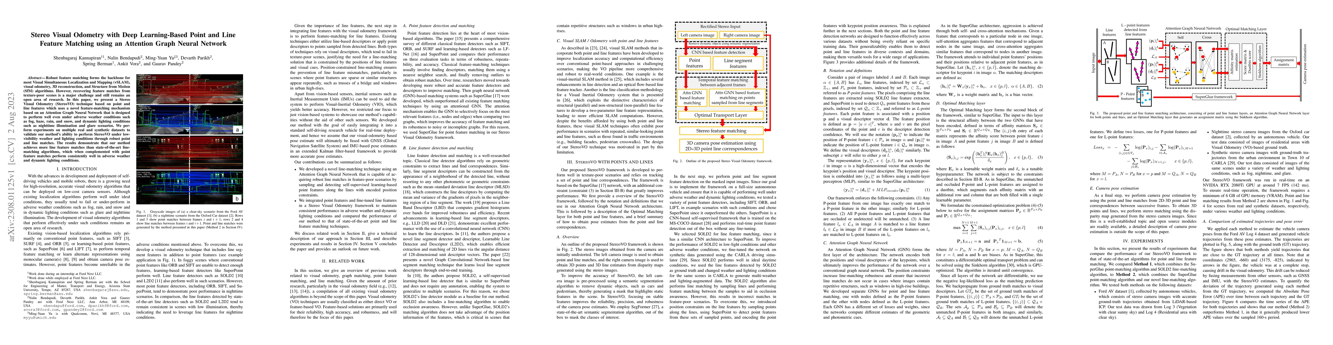
Robust feature matching forms the backbone for most Visual Simultaneous Localization and Mapping (vSLAM), visual odometry, 3D reconstruction, and Structure from Motion (SfM) algorithms. However, rec...
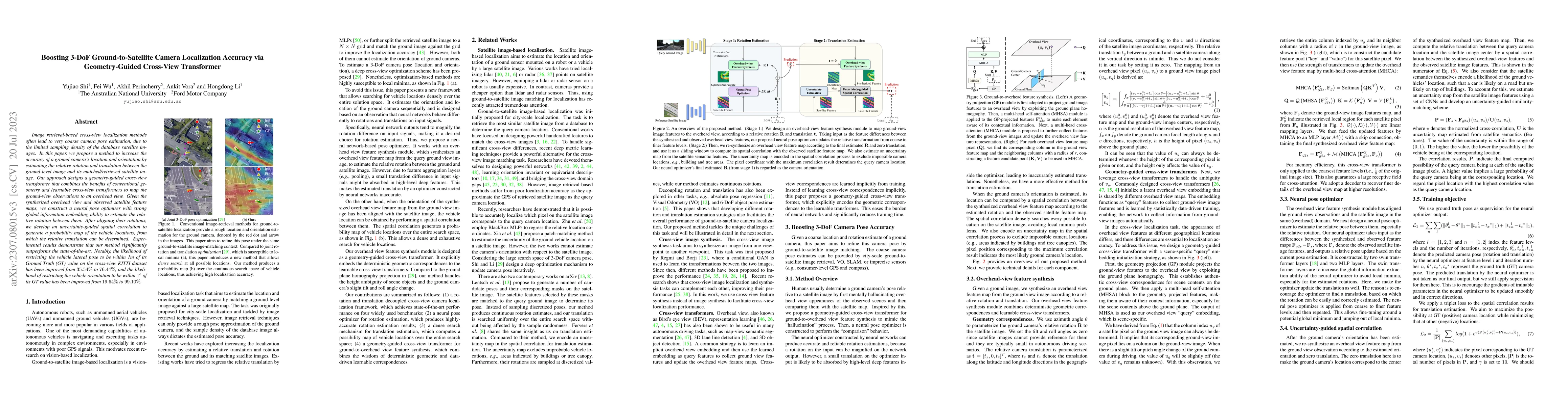
Image retrieval-based cross-view localization methods often lead to very coarse camera pose estimation, due to the limited sampling density of the database satellite images. In this paper, we propos...
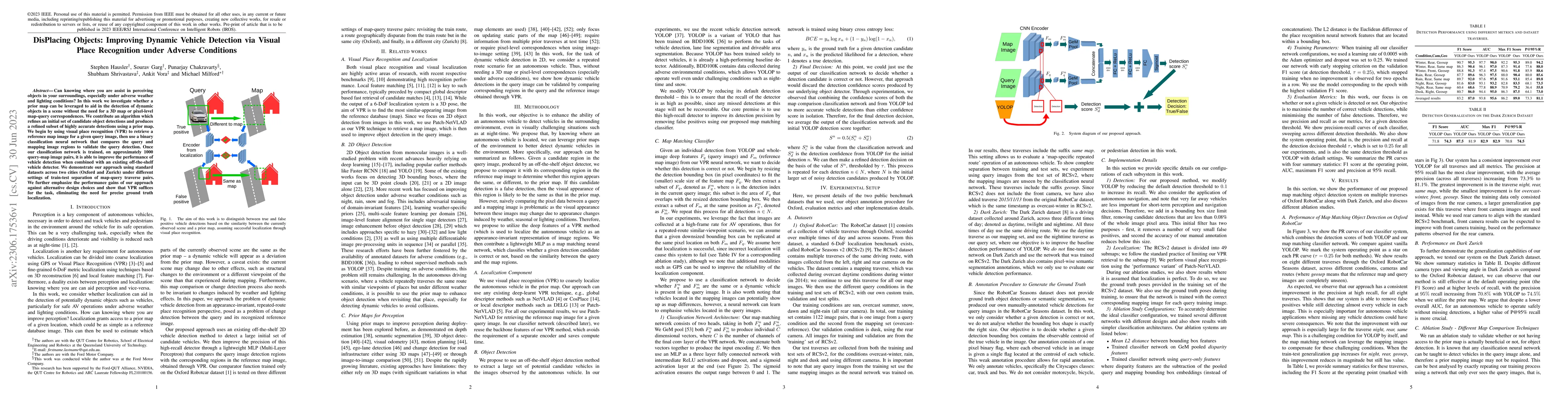
Can knowing where you are assist in perceiving objects in your surroundings, especially under adverse weather and lighting conditions? In this work we investigate whether a prior map can be leverage...
Most 6-DoF localization and SLAM systems use static landmarks but ignore dynamic objects because they cannot be usefully incorporated into a typical pipeline. Where dynamic objects have been incorpo...
Existing spatial localization techniques for autonomous vehicles mostly use a pre-built 3D-HD map, often constructed using a survey-grade 3D mapping vehicle, which is not only expensive but also lab...
6-DoF visual localization systems utilize principled approaches rooted in 3D geometry to perform accurate camera pose estimation of images to a map. Current techniques use hierarchical pipelines and...
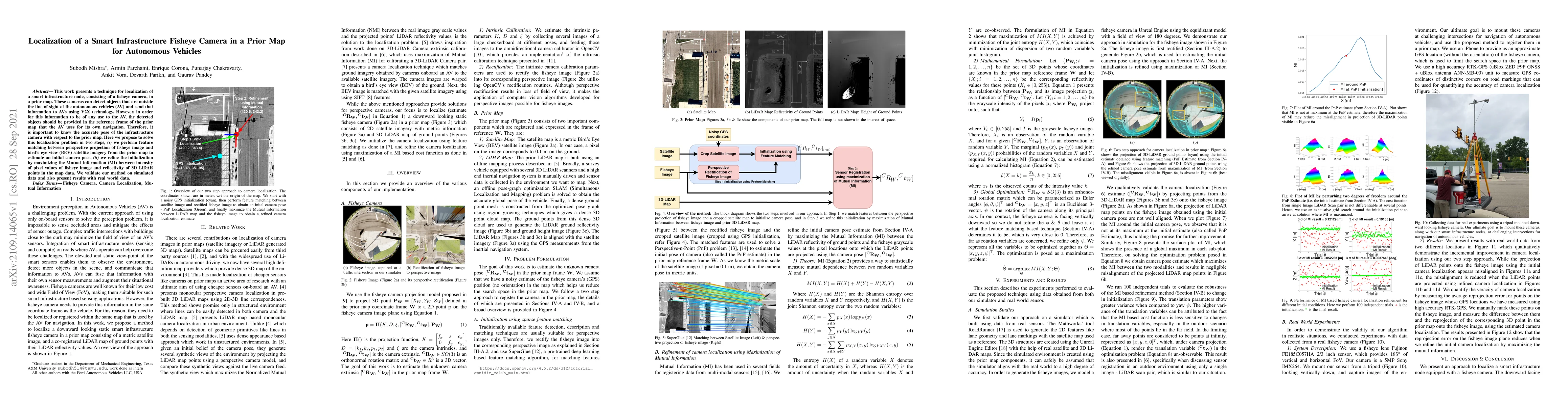
This work presents a technique for localization of a smart infrastructure node, consisting of a fisheye camera, in a prior map. These cameras can detect objects that are outside the line of sight of...
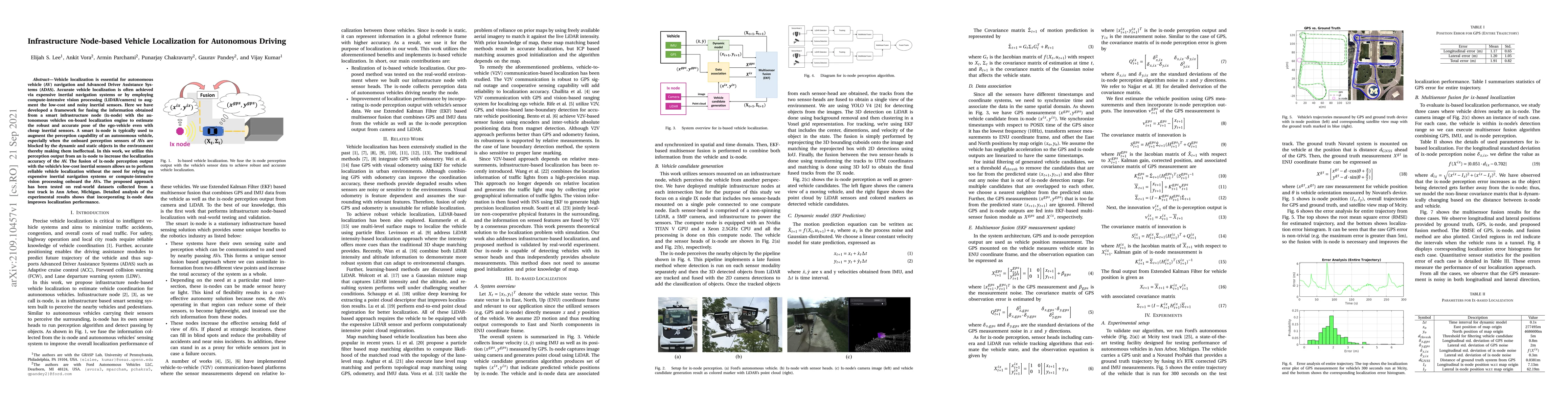
Vehicle localization is essential for autonomous vehicle (AV) navigation and Advanced Driver Assistance Systems (ADAS). Accurate vehicle localization is often achieved via expensive inertial navigat...
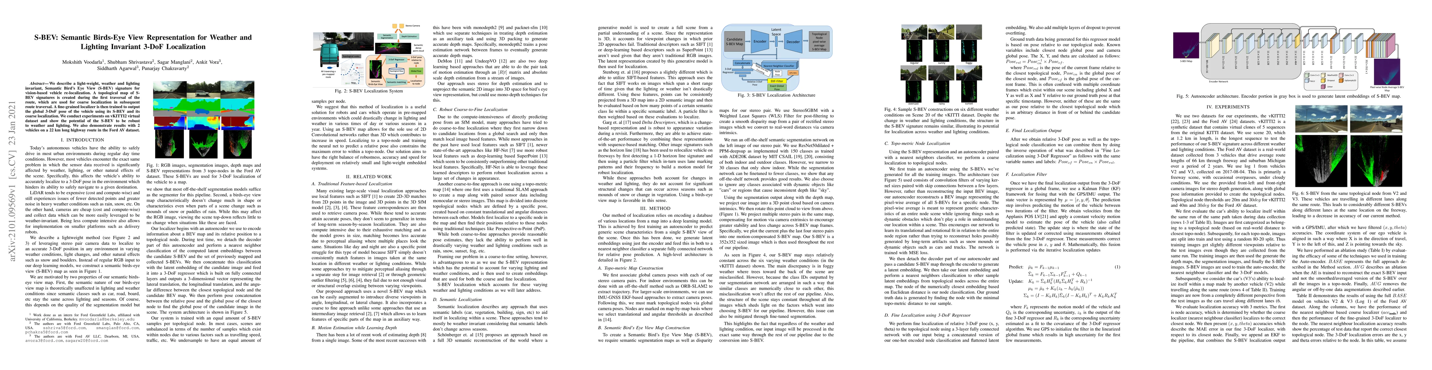
We describe a light-weight, weather and lighting invariant, Semantic Bird's Eye View (S-BEV) signature for vision-based vehicle re-localization. A topological map of S-BEV signatures is created duri...
Fine localization is a crucial task for autonomous vehicles. Although many algorithms have been explored in the literature for this specific task, the goal of getting accurate results from commodity...
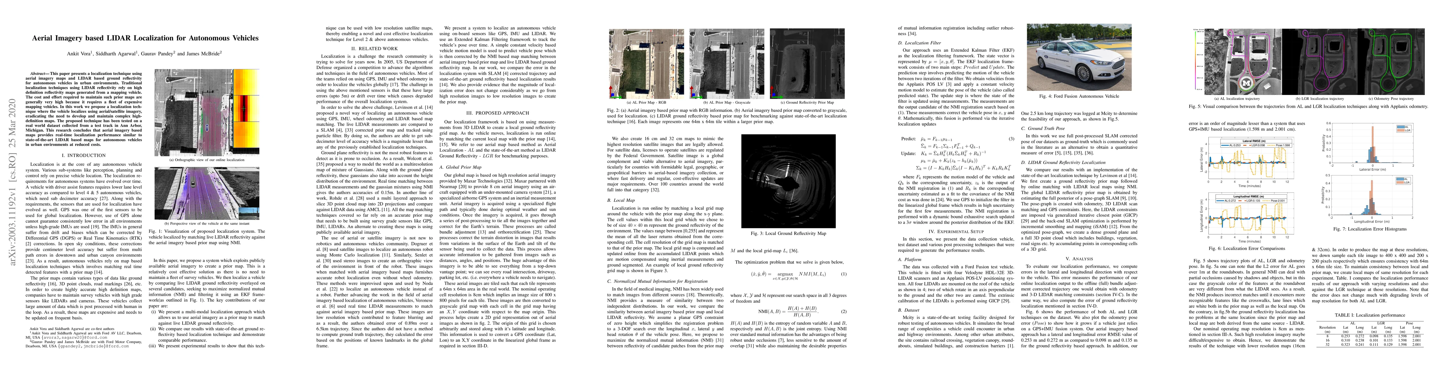
This paper presents a localization technique using aerial imagery maps and LIDAR based ground reflectivity for autonomous vehicles in urban environments. Traditional localization techniques using LI...
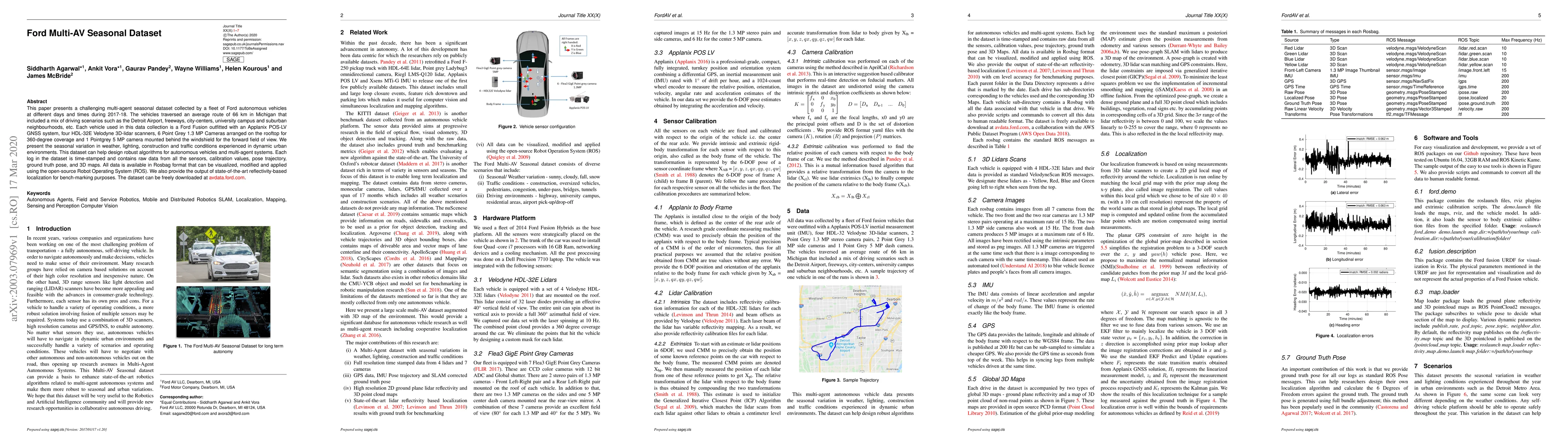
This paper presents a challenging multi-agent seasonal dataset collected by a fleet of Ford autonomous vehicles at different days and times during 2017-18. The vehicles traversed an average route of...
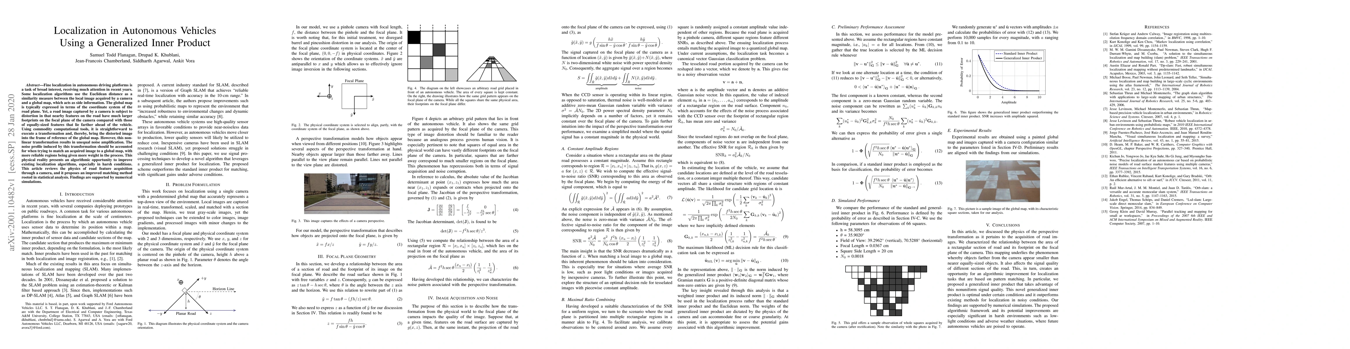
Fine localization in autonomous driving platforms is a task of broad interest, receiving much attention in recent years. Some localization algorithms use the Euclidean distance as a similarity measu...
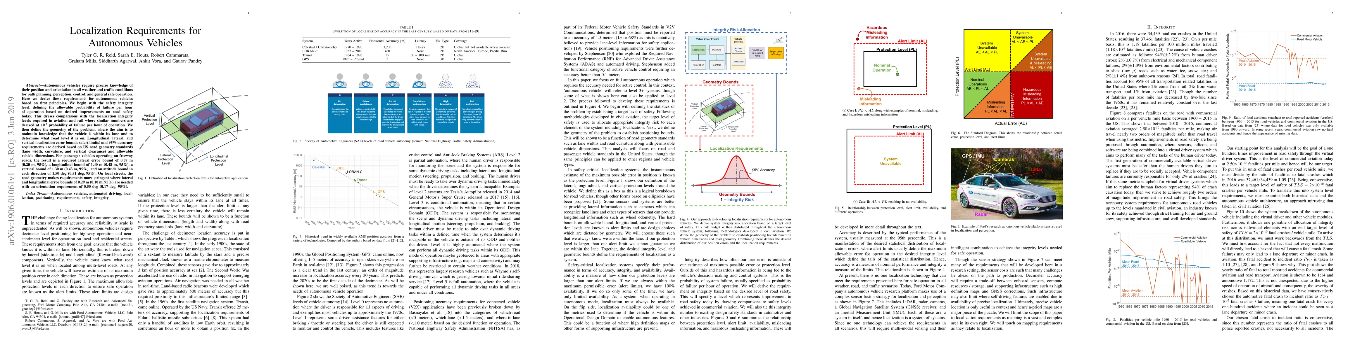
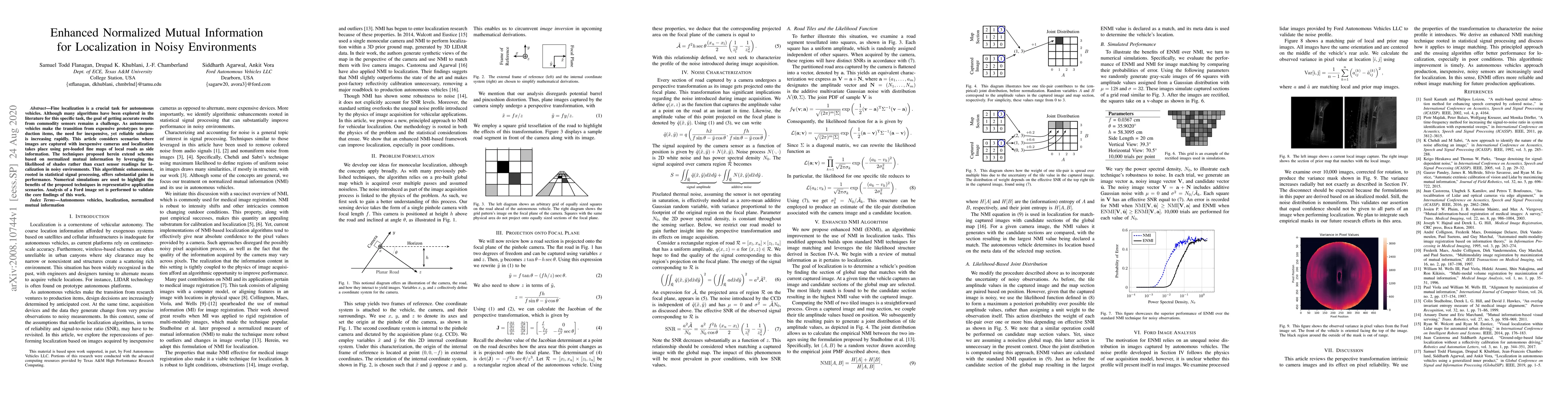
Autonomous vehicles require precise knowledge of their position and orientation in all weather and traffic conditions for path planning, perception, control, and general safe operation. Here we deri...
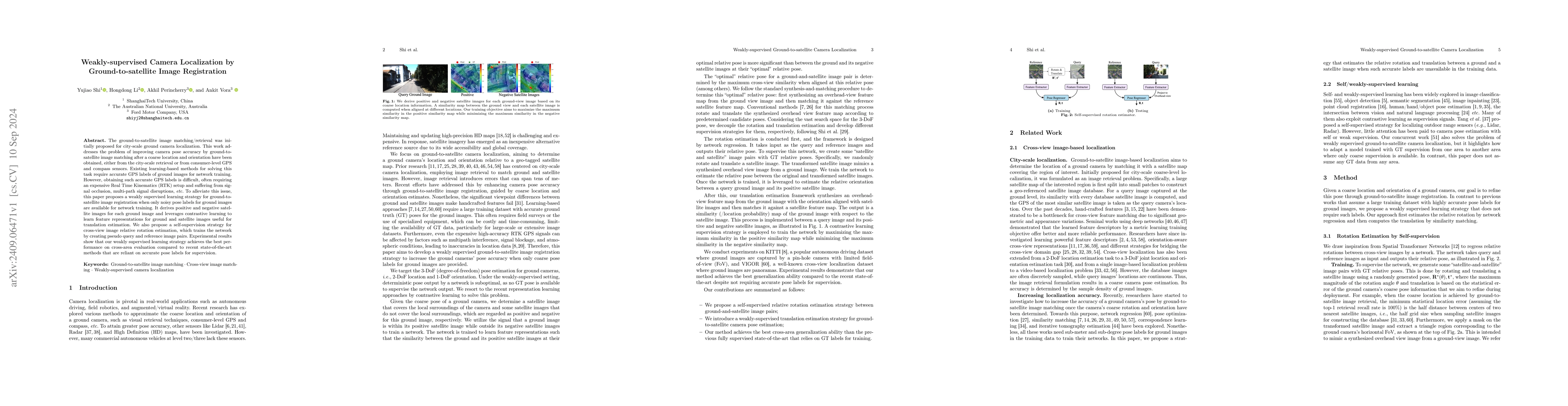
The ground-to-satellite image matching/retrieval was initially proposed for city-scale ground camera localization. This work addresses the problem of improving camera pose accuracy by ground-to-satell...
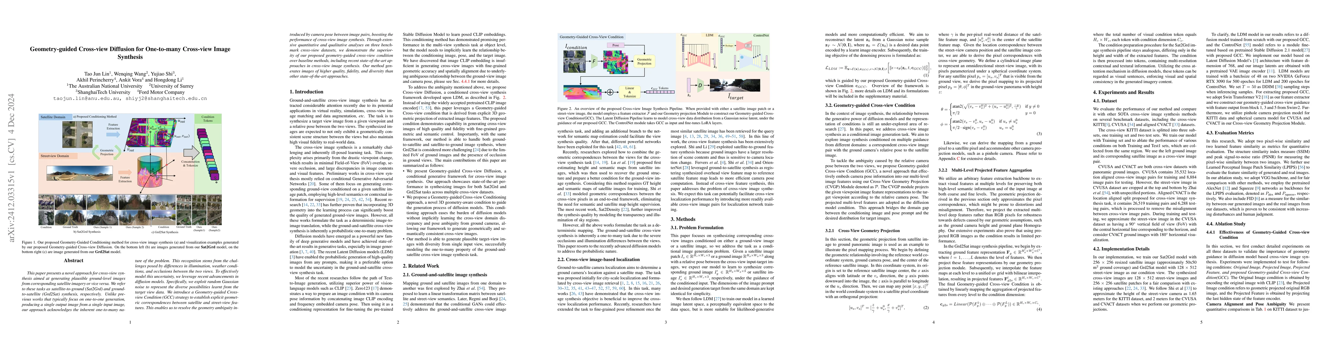
This paper presents a novel approach for cross-view synthesis aimed at generating plausible ground-level images from corresponding satellite imagery or vice versa. We refer to these tasks as satellite...