Academic Profile
Statistics
Similar Authors
Papers on arXiv
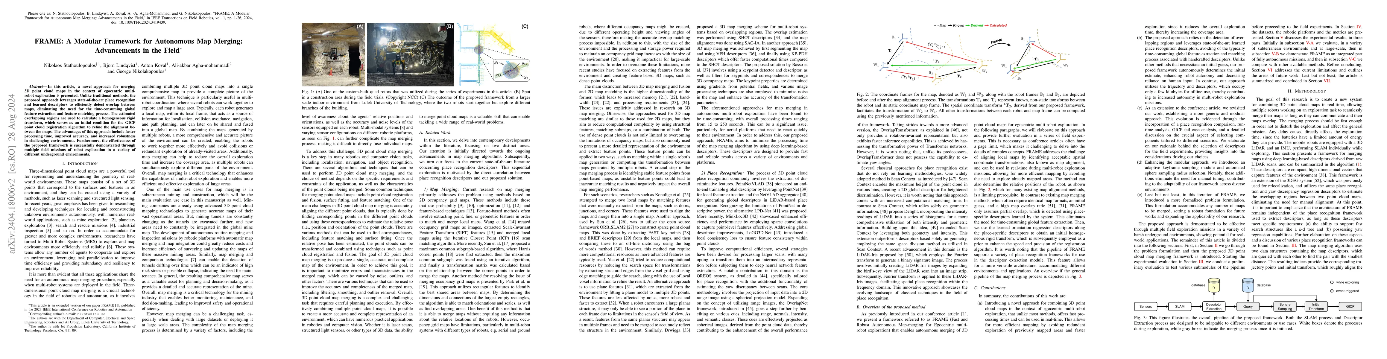
In this article, a novel approach for merging 3D point cloud maps in the context of egocentric multi-robot exploration is presented. Unlike traditional methods, the proposed approach leverages state...
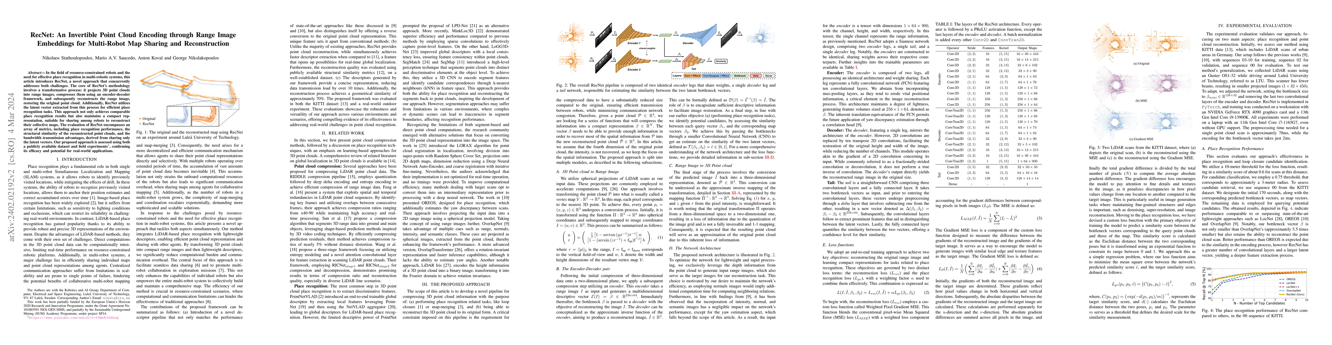
In the field of resource-constrained robots and the need for effective place recognition in multi-robotic systems, this article introduces RecNet, a novel approach that concurrently addresses both c...
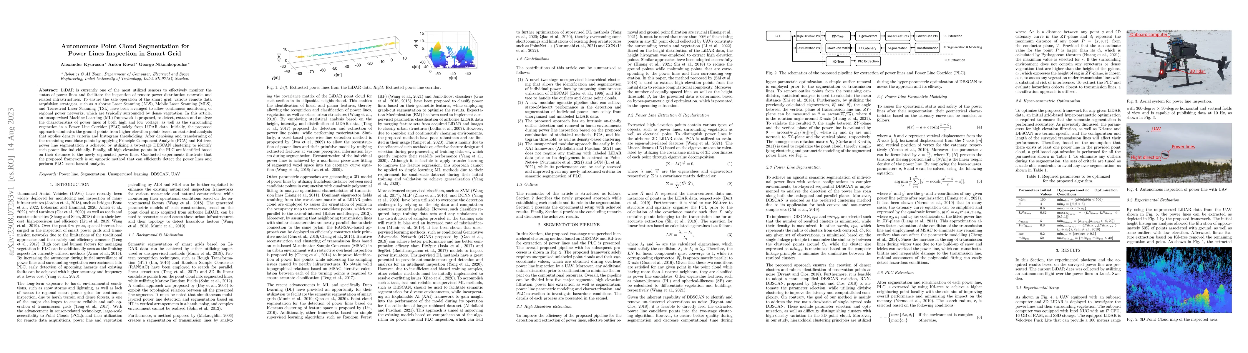
LiDAR is currently one of the most utilized sensors to effectively monitor the status of power lines and facilitate the inspection of remote power distribution networks and related infrastructures. ...
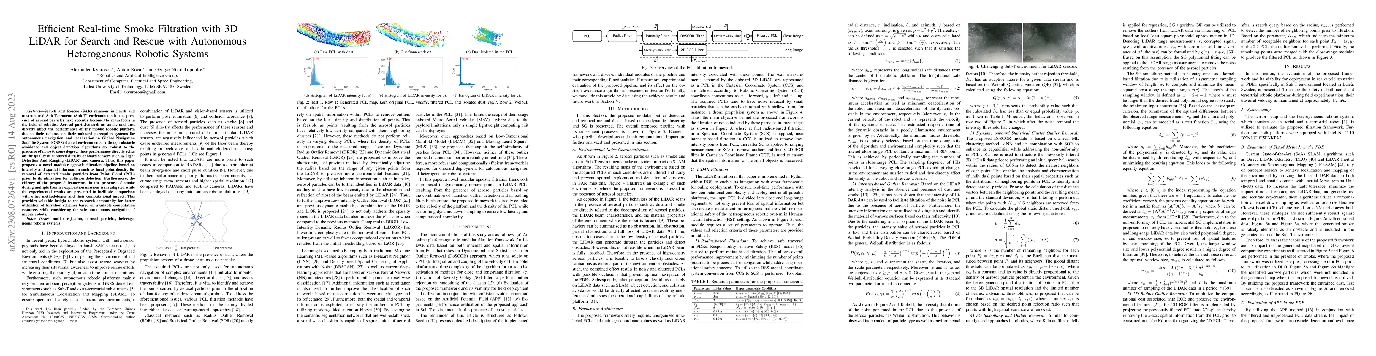
Search and Rescue (SAR) missions in harsh and unstructured Sub-Terranean (Sub-T) environments in the presence of aerosol particles have recently become the main focus in the field of robotics. Aeros...
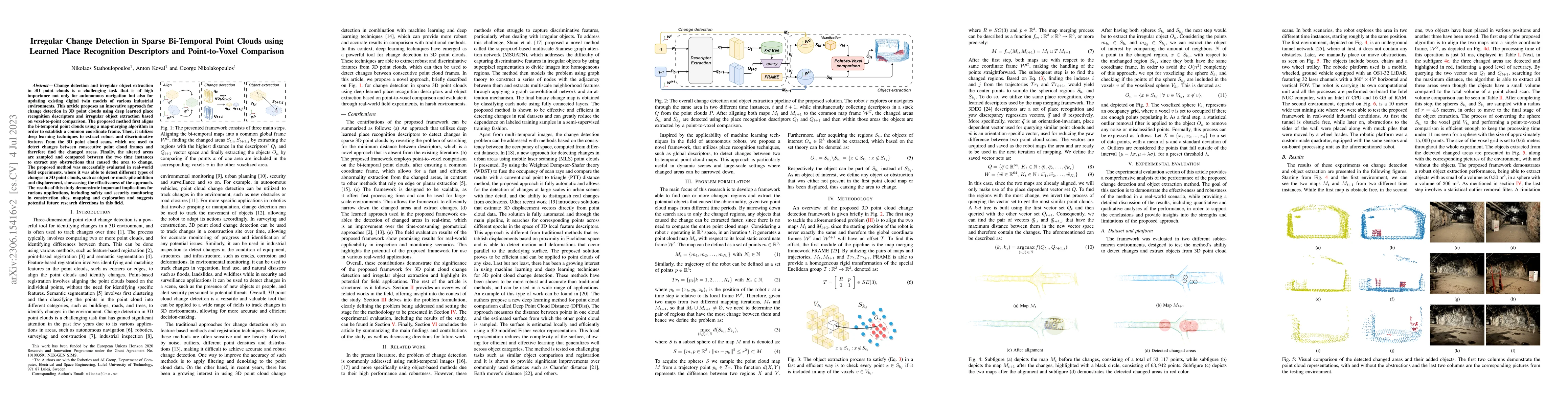
Change detection and irregular object extraction in 3D point clouds is a challenging task that is of high importance not only for autonomous navigation but also for updating existing digital twin mo...
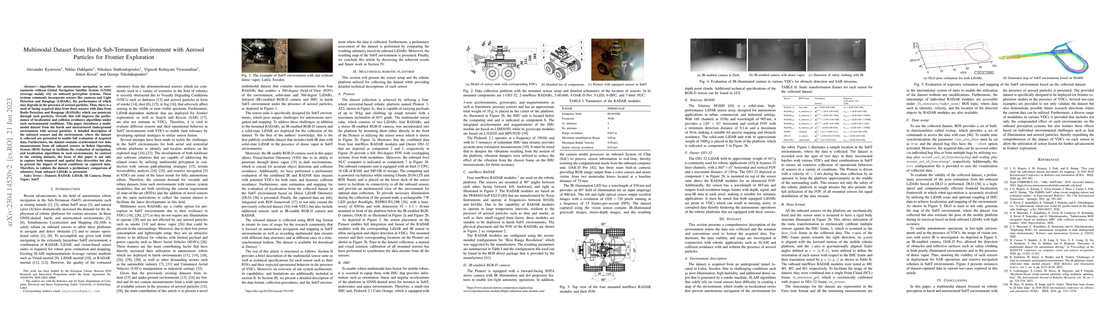
Algorithms for autonomous navigation in environments without Global Navigation Satellite System (GNSS) coverage mainly rely on onboard perception systems. These systems commonly incorporate sensors ...
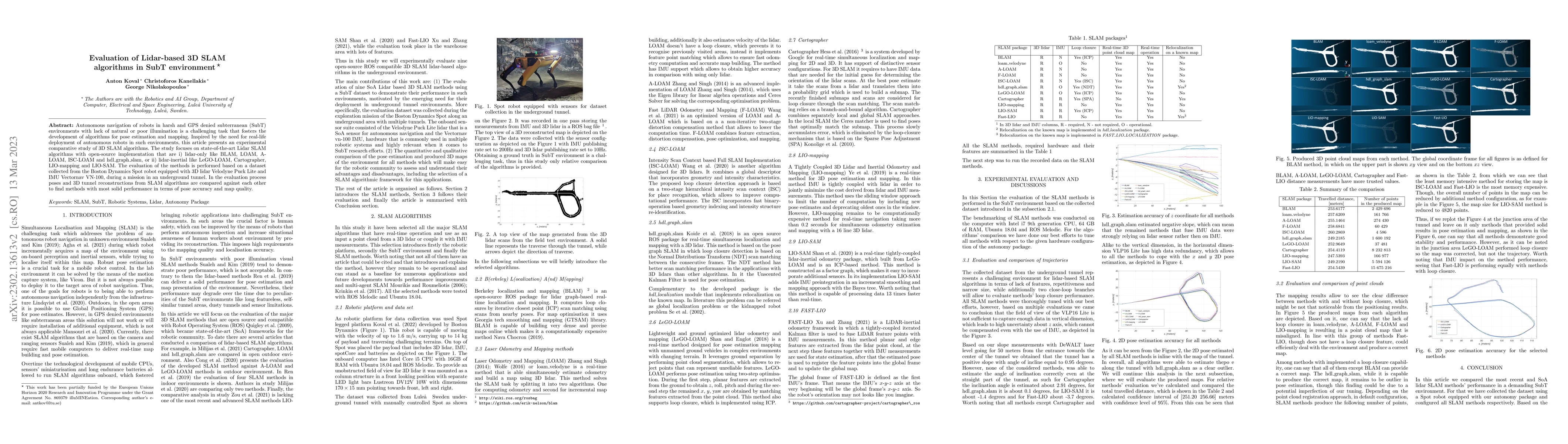
Autonomous navigation of robots in harsh and GPS denied subterranean (SubT) environments with lack of natural or poor illumination is a challenging task that fosters the development of algorithms fo...
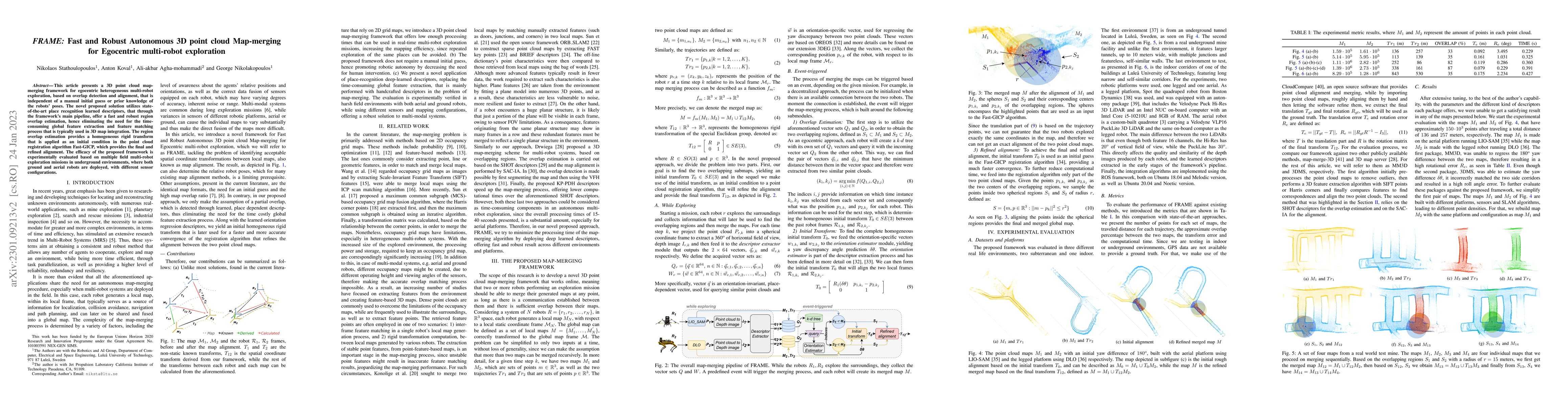
This article presents a 3D point cloud map-merging framework for egocentric heterogeneous multi-robot exploration, based on overlap detection and alignment, that is independent of a manual initial g...
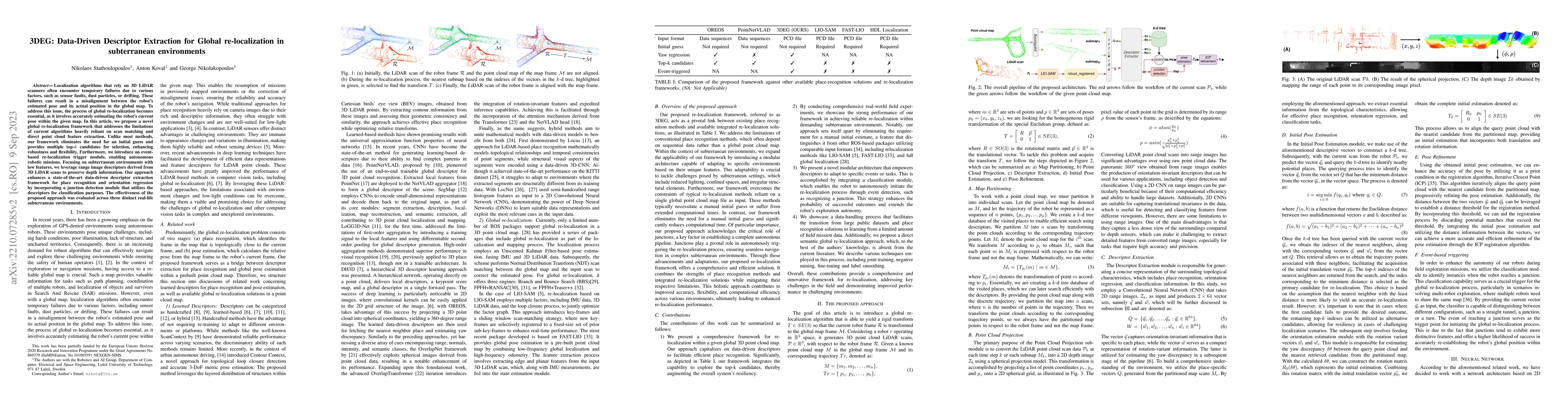
Current global re-localization algorithms are built on top of localization and mapping methods andheavily rely on scan matching and direct point cloud feature extraction and therefore are vulnerable...
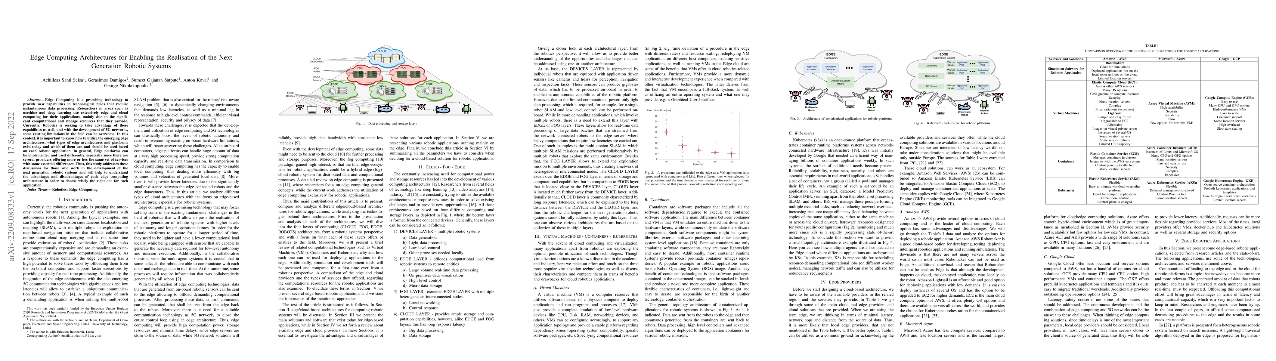
Edge Computing is a promising technology to provide new capabilities in technological fields that require instantaneous data processing. Researchers in areas such as machine and deep learning use ex...
This article establishes the novel D$^*_+$, a risk-aware and platform-agnostic heterogeneous global path planner for robotic navigation in complex environments. The proposed planner addresses a fund...
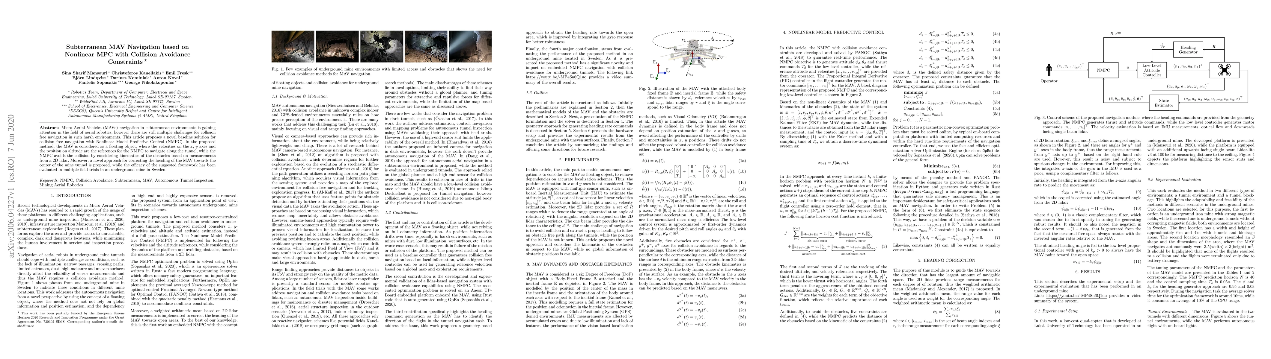
Micro Aerial Vehicles (MAVs) navigation in subterranean environments is gaining attention in the field of aerial robotics, however there are still multiple challenges for collision free navigation i...
Reliable radar inertial odometry (RIO) requires mitigating IMU bias drift, a challenge that intensifies in subterranean environments due to extreme temperatures and gravity-induced accelerations. Cost...
![Thumbnail for [Preprint] Dynamic Modeling, Gait Synthesis, and Control of a Novel Subsurface Bore Propagator](https://nbg1.your-objectstorage.com/arxivlens/thumbnails/2607.00569.webp)
In this article, we present dynamic modeling, gait synthesis, and feedback control design for a modular novel subsurface robot, designed for human-free subsurface exploration and excavation. The subsu...