Academic Profile
Statistics
Similar Authors
Papers on arXiv
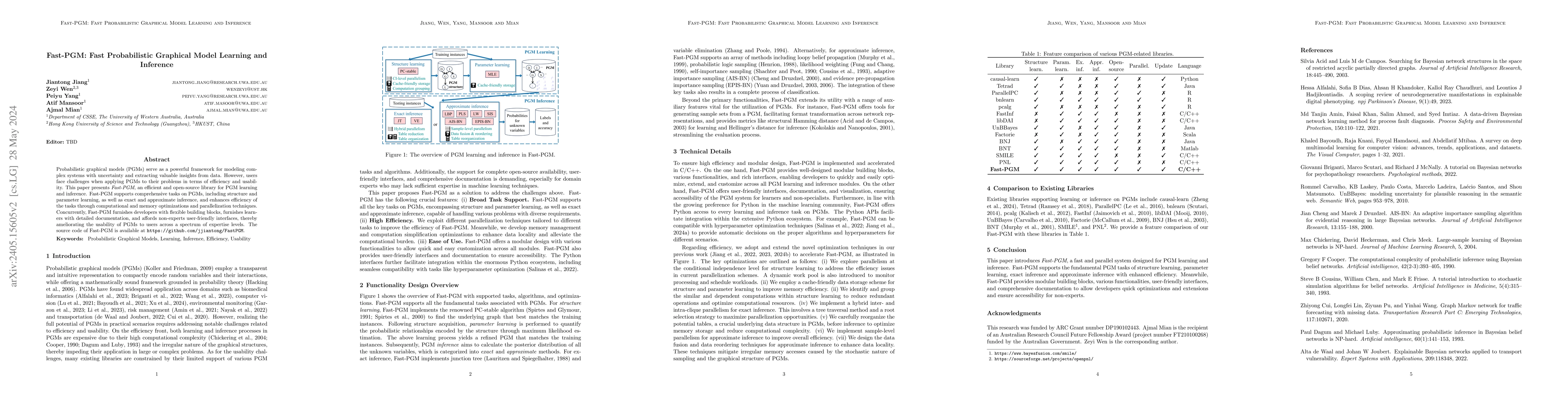
Probabilistic graphical models (PGMs) serve as a powerful framework for modeling complex systems with uncertainty and extracting valuable insights from data. However, users face challenges when appl...
Bayesian networks (BNs) are attractive, because they are graphical and interpretable machine learning models. However, exact inference on BNs is time-consuming, especially for complex problems. To i...
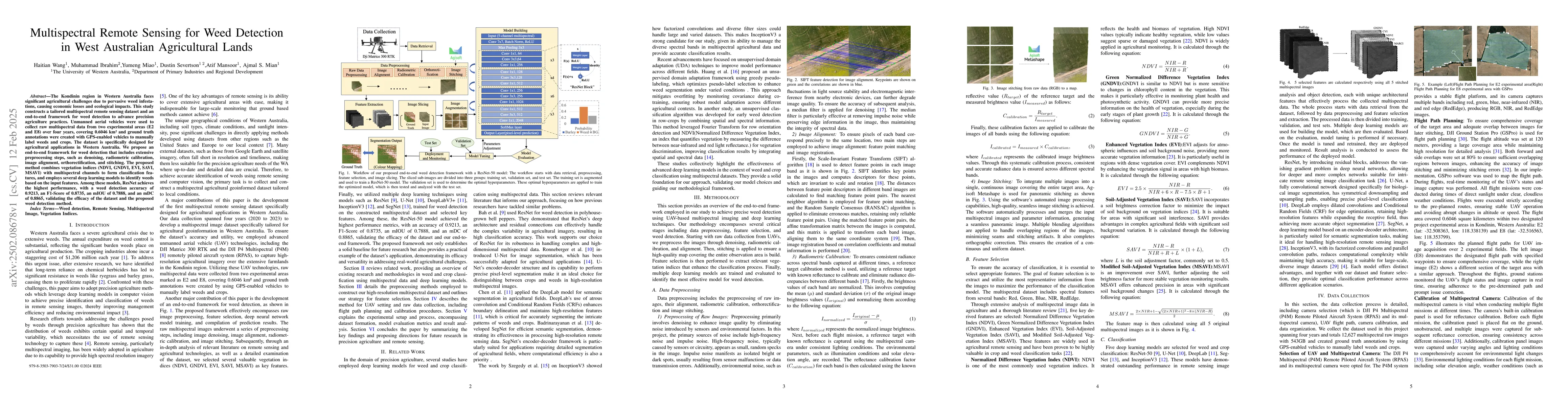
The Kondinin region in Western Australia faces significant agricultural challenges due to pervasive weed infestations, causing economic losses and ecological impacts. This study constructs a tailored ...
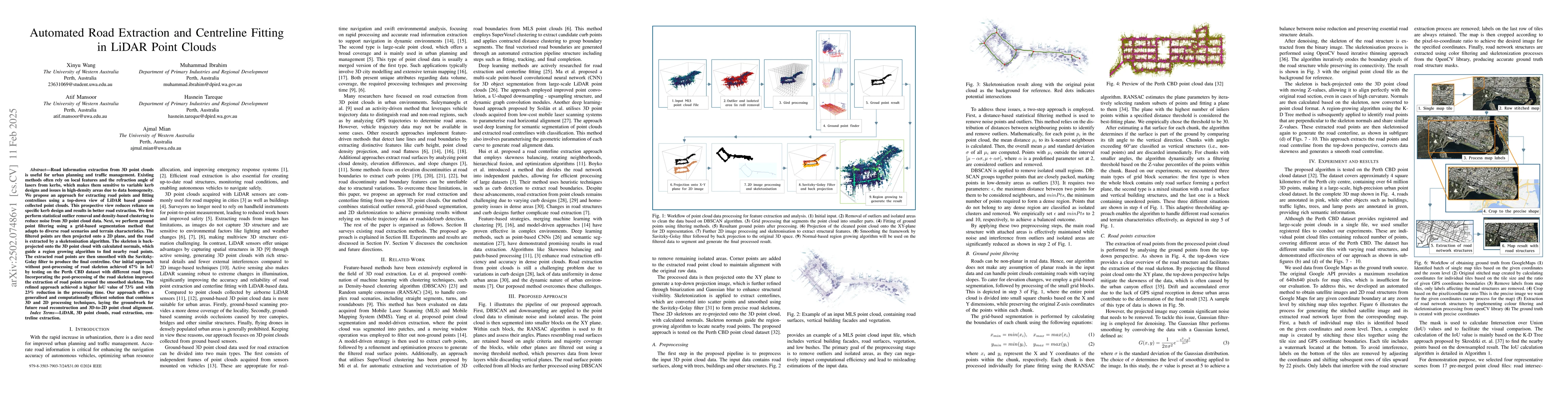
Road information extraction from 3D point clouds is useful for urban planning and traffic management. Existing methods often rely on local features and the refraction angle of lasers from kerbs, which...
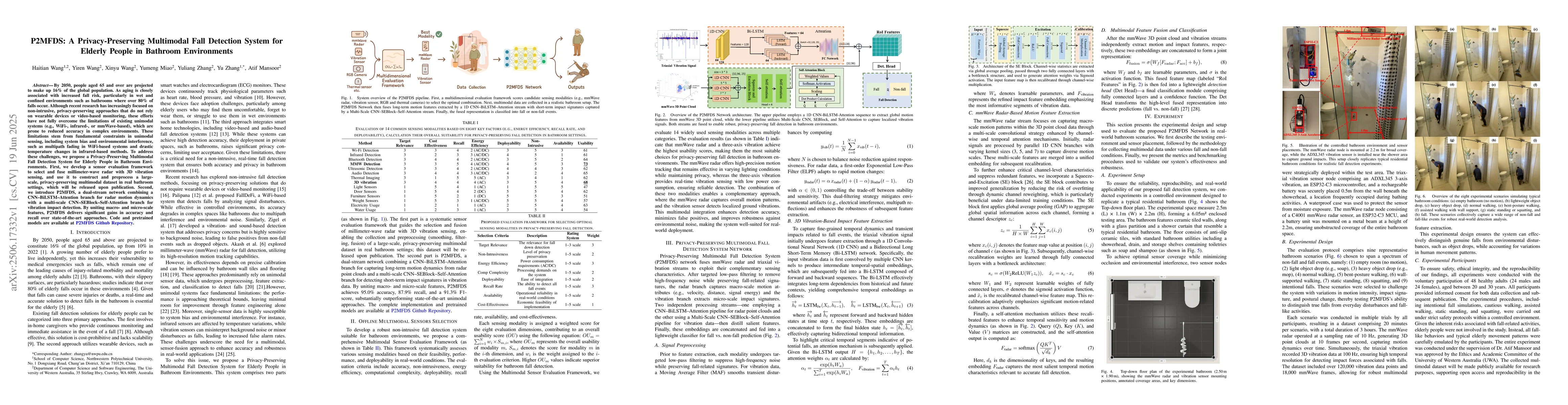
By 2050, people aged 65 and over are projected to make up 16 percent of the global population. As aging is closely associated with increased fall risk, particularly in wet and confined environments su...
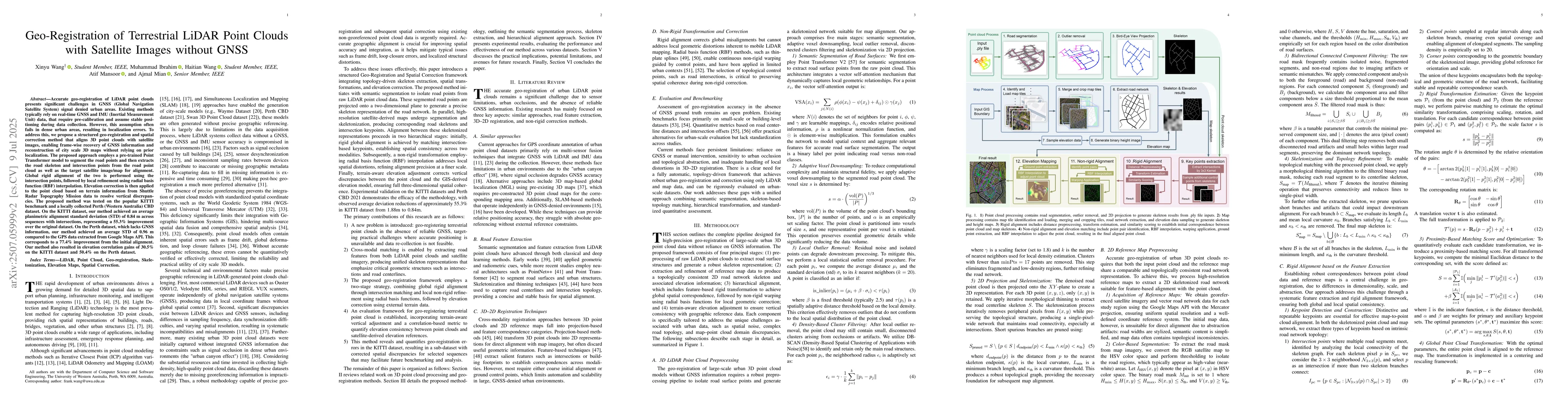
Accurate geo-registration of LiDAR point clouds presents significant challenges in GNSS signal denied urban areas with high-rise buildings and bridges. Existing methods typically rely on real-time GNS...
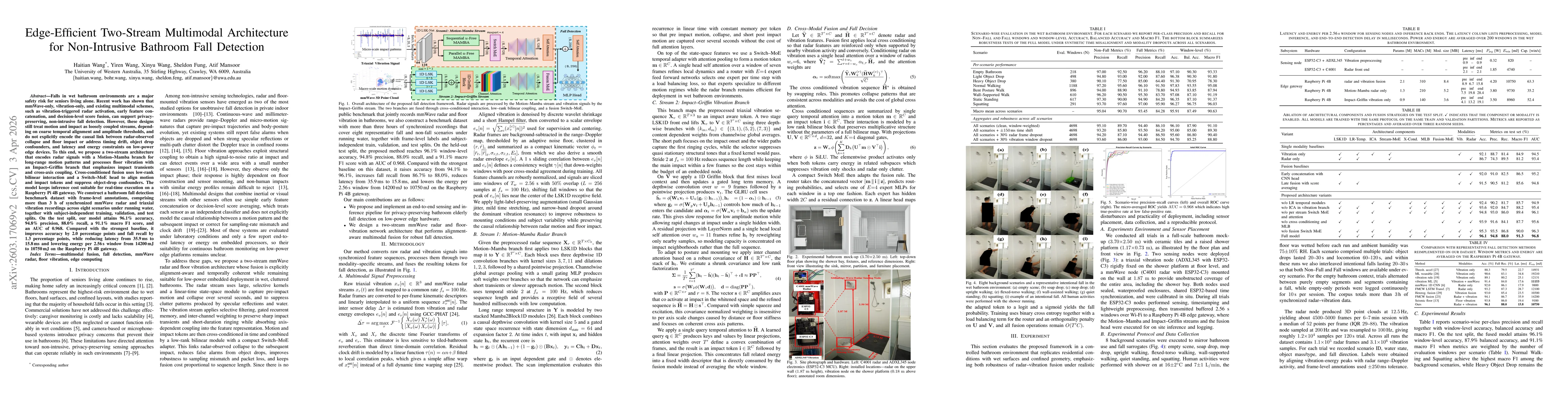
Falls in wet bathroom environments are a major safety risk for seniors living alone. Recent work has shown that mmWave-only, vibration-only, and existing multimodal schemes, such as vibration-triggere...